In brief: In today’s post we look ahead to Houston’s sunny, hot, and largely unchanging forecast. Also, since it’s going to be really sunny outside, we dive a bit deeper into the UV forecast, and why you should protect your skin.
We’ve reached peak sunshine
Sunday marked the summer solstice, the point at which the Sun reaches the highest point in the sky. For Houston this is an altitude of 84 degrees above the horizon (90 degrees is the maximum). The Sun reaches this meridian today at 1:23 pm CT. At this point it does not take long for you to burn because the ultraviolet light from the Sun is very nearly at its maximum point for a sea-level location on Earth.
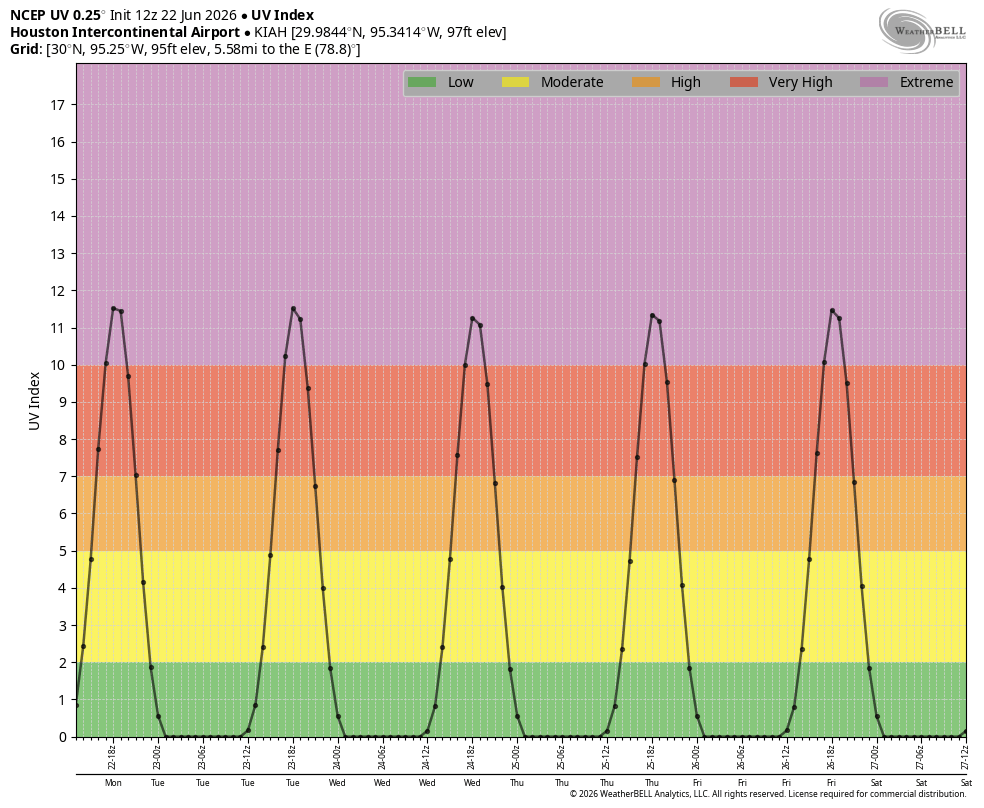
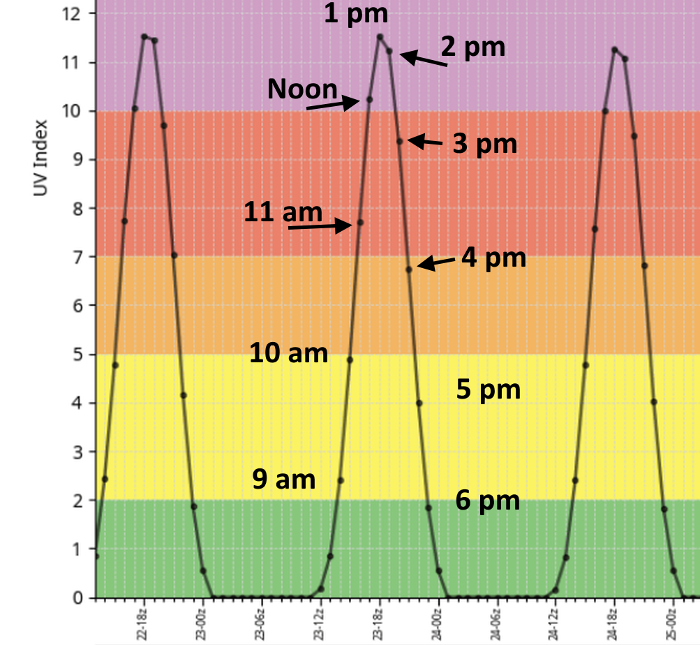
Here’s what the UV forecast for this week actually looks like. If you slide the image, I’ve added some time stamps on a blown up version of the forecast. Essentially, the way to think of this is, from 10 am to 5 pm you’re getting a decent amount of sunshine. From 11 am to 4 pm you’re susceptible to sunburns fairly quickly. And from noon to 2:30 pm your skin will burn quickly without protection, within half an hour or less for many people.
For the remainder of the summer our days will slowly get shorter, and the Sun at a lower angle. But even two months from now in late August, the Sun still reaches a solar angle of 71 percent in the sky, which translates to “noon” on the graphic above in terms of Sun angle. So “extreme” UV is going to be with us for awhile. Protect yourself accordingly!
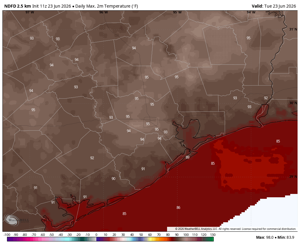
Tuesday through Friday
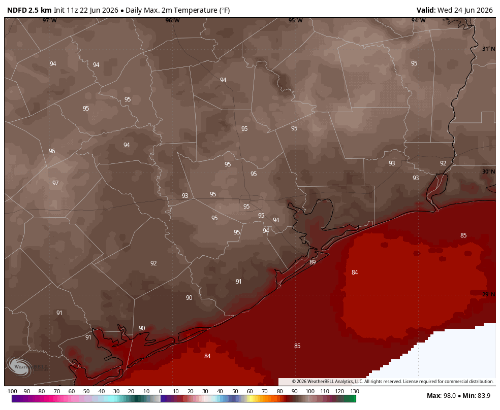
Sunshine will prevail for the rest of the week. We can generally expect highs in the low- to mid-90s in the city of Houston, with slightly cooler conditions closer to the coast, and slightly warmer conditions further inland. Winds will generally be light in the morning, while increasing during the afternoon hours and possibly gusting to about 20 mph. Overnight lows will generally drop into the upper 70s, although Thursday and Friday may get into the mid-70s. But really, this will be a distinction without a difference. Rain chances are essentially zero.
Saturday and Sunday
Does anything change this weekend? Probably not. Oh, maybe there’s a 10 percent chance of showers by Sunday. But really, with high pressure still largely in control our forecast remains more or less the same.
Next week
It is possible, although far from guaranteed, that high pressure will start to relent a little bit at some point next week. I don’t think our temperatures will change much, but this could reintroduce something like a 20 percent chance of showers each afternoon. We shall see.
As I said above, remember your Sun protection!