Houston faces a couple of wetter, and potentially stormy days before our weather clears out sometime on Saturday, and brings us what looks like a fairly nice May weekend. But first we’ve got to get through a round of storms this morning, for the northern half of the region, and then a stormy period on Friday night. We’re not anticipating anything too severe, but we could see some at-times strong thunderstorms.
Thursday
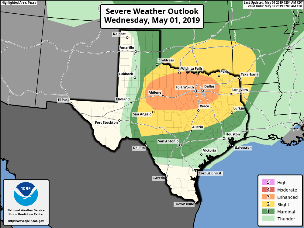
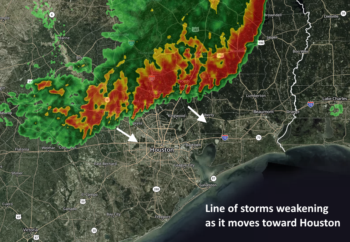
As of 6:15am CT, the northern part of Houston is seeing the remnant line of showers and thunderstorms from a large storm system that moved through North Texas on Wednesday night. This line is slowly weakening as it moves to the south-southeast this morning, but some part of it will likely push through The Woodlands and down at least into central Houston. Closer to the coast, a capping inversion will likely prevent widespread showers and thunderstorms. After this system works through this morning, we can expect a partly sunny day with highs in the mid-to upper-80s.
Friday through Saturday morning
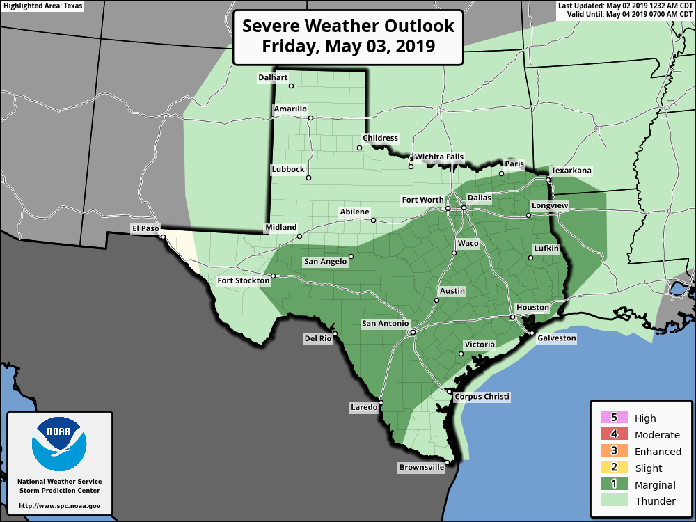
We’ll see another wetter period on Friday through Saturday morning for the region. Most of the action should remain to the west and north of the Houston metro area through the daytime hours on Friday, but sometime that evening we should see a mass of storms move through the area roughly from west to east. This system is part of a weak cold front and an upper level disturbance. Timing is still hazy, but generally we’d expect the worst weather overnight for most of Houston, and probably lingering into Saturday morning for the coast and eastern parts of the region. Most modeling shows the system clearing the area by or before noon on Saturday, but we’re offering no guarantees. Generally, the area will probably see 0.5 to 1.5 inches of rain, but there may be higher localized totals, and we can’t rule out some hail and damaging winds.