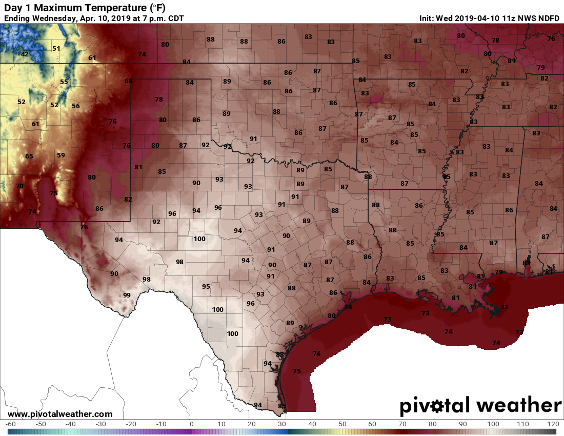
Houston did, in fact, reach 90 degrees on Tuesday for the first time this year. It’s about the right time for this milestone—although last year was nice in that the city didn’t get this warm until May 7. If it didn’t feel that hot outside, the reason is that humidity levels were quite low for Houston. That probably won’t be the case when 90-degree temperatures come rolling around again for us. Anyway, today should be warm again, but then we’ll cool down for the weekend.
Wednesday
Winds have already shifted to come from the south, and this will make for a more humid day. The increased moisture levels should also act as an anchor on warming today, so I’d expect most areas to stay in the mid- or possibly upper-80s beneath mostly sunny skies. Winds will be gusty, perhaps above 20mph, as the onshore flow kicks in. Lows tonight will probably fall into the mid-60s for most.
Thursday
Some clouds will return Thursday, but the day’s high temperatures will largely be determined by the timing of a weak cold front, which probably will push into the city sometime around noon. Depending on how much warming there is before the front, temperatures will either get into the low-80s, or the upper-80s. Most likely this will be a dry front, although we can’t rule out a very few showers as its pushes through the region. Lows should fall to 60 on Thursday night.

Friday
The front seems likely to stall just offshore, and then pull back over the region Friday. It still should be a pretty nice spring day, however, with partly to mostly sunny skies, and highs in the low 80s.
Saturday
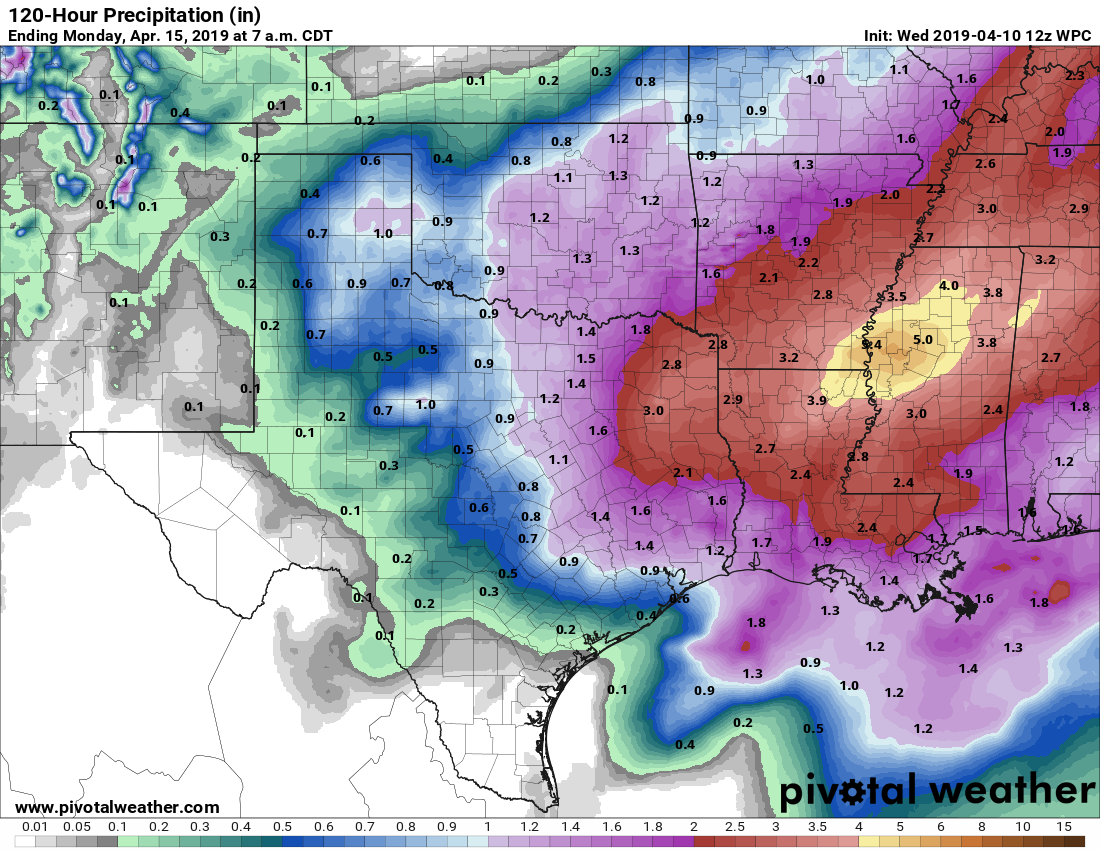
The first half of the weekend still looks fairly messy, although the details remain fuzzy. It seems probable that most of the area will see 0.5 to 1.5 inches of rain ahead of a cold front, but as we noted Monday, the overall dynamics for stronger storms and severe weather will likely set up to the east of the Houston region. So for now, we predict a cloudy day, with highs of around 80 degrees. Showers are likely, with some thunderstorms, and we can’t rule out some severe weather in the form of damaging winds and hail—although there’s no reason to think it will be like the storms last Sunday.
Sunday and beyond
For this Sunday, our weather looks pretty darn nice in the wake of Saturday’s front. Look for highs maybe around 70, with sunny skies, and a cool night in the low 50s. Some far inland areas may even see upper 40s.
We’re likely to remain dry through Tuesday, or so, before some more rain and another front.
Hi Eric, any timing in the rain Saturday up in the Woodlands? I’ll be attending the Chris Tomlin concert at the pavilion at 7pm and I’m trying to prepare.
Thanks !
Hard to have too much confidence in timing yet, but my guess is that the rain showers end sometime during the evening, and hopefully before the show. But can’t offer a firm prediction yet.
Eric,
Is there somewhere I can go to look up wind speeds from Sunday’s storms. Everything I see is current wind speeds.
Ryan’s link is helpful. Also, this preliminary storm report data may prove helpful:
https://forecast.weather.gov/product.php?site=NWS&issuedby=HGX&product=LSR&format=CI&version=1&glossary=0
I’m gonna guess Eric has the best answers for these things, but I’m fascinated by the Ventusky app (and website). It shows wind direction and has an option for wind speeds/gusts. And you can go back (I don’t know how far) to see numbers from previous days.
I’m no Eric, but I usually use the national climatic data site. There are many diff ways to search but I like the data tools by map with the below link. There are several stations around Houston,though not all of them record winds, but just pick the one closest to you on the map to pull up the full details, then view data.
https://www.ncdc.noaa.gov/cdo-web/datatools/findstation
I’d like to put in a request for 2″-2.5″, spread out over the day. Think you can do that? 😉
2-2.5″ of what? Pollen dust? We can do that.