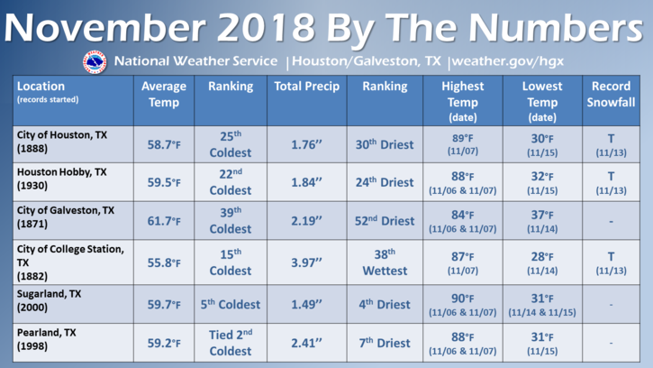
Today’s forecast will look ahead to some winter-like temperatures this week, and the possibility of some heavy rainfall and potential flooding later this week as a storm system moves through the Southern United States. But before we get into December’s weather, here’s a quick look back at November, which for most of Houston was quite cold, and quite dry. Note that the Sugar Land and Pearland temperature rankings, while impressive, only reflect about 20 years of data.
Monday
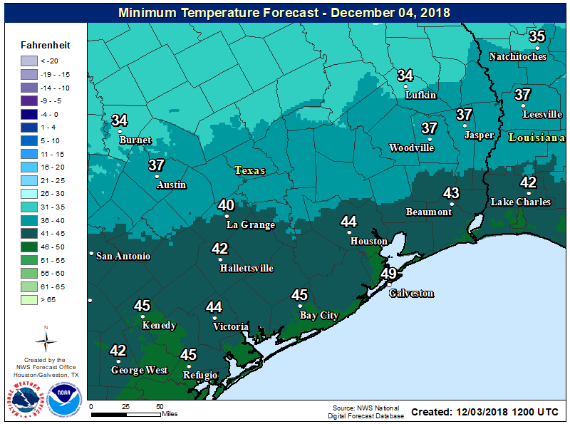
Northerly winds are bringing colder and drier air into Houston this morning, and conditions will remain so as high pressure establishes itself over the region. This will lead to a sunny day, with highs in the mid-60s, with some winds gusting above 20 mph. Temperatures will drop pretty quickly as the Sun goes down, with upper 30s possible for areas north of Houston, and low- to mid-40s for the rest of the metro area.
Tuesday and Wednesday
More of the same. These will be classic, winter-like days for Houston, with partly to mostly sunny skies, highs of around 60 degrees, and lows ranging from the upper-30s for far inland areas to low 50s along the coast. A good time for sweaters and hot cocoa.