Well, we made it through the end of September. And a strange month it was. No tropical storms or hurricanes hit Texas, and yet it has been one of the wettest months in the state’s history. Much of the state received 200 to 400 percent normal levels of rainfall, including all coastal areas of the Houston region (Galveston will record its second wettest September ever, and third wettest month of all time).
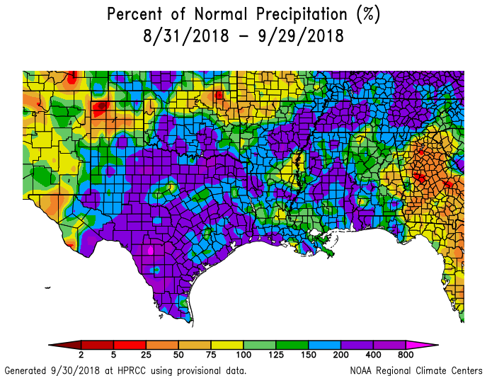
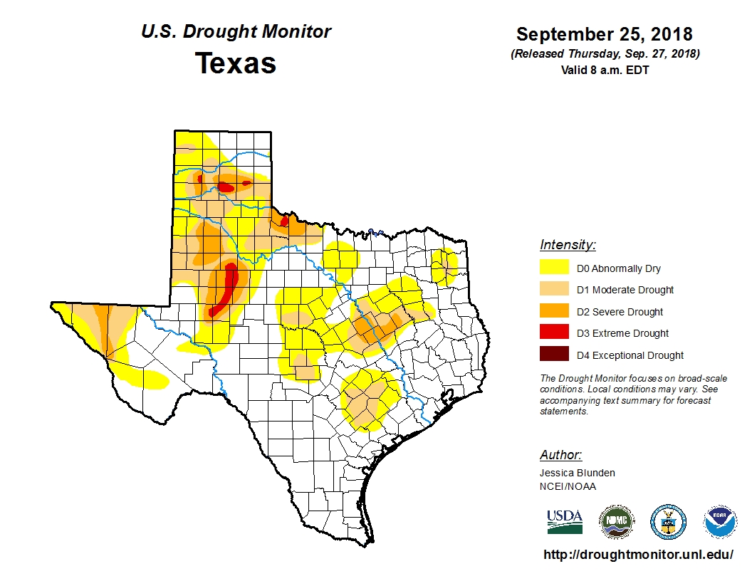
As a result, at the end of a summer in which no tropical storms or hurricanes moved into, or near Texas, the state finishes the hottest part of the year with just eight percent of the state in a “severe” or worse drought. This is a really healthy posture to be in, compared to typical years for Texas at the end of September.
That does not mean September has been particularly fun. Heavy rainfall during the last month has, on at least three occasions, brought significant flooding to Galveston Island and other coastal areas. For much of the region, nearly all of September was a soggy, humid mess with cloudy days and steamy nights. Speaking personally, I am not sorry to see it in the rear view mirror. Now, onto the forecast.