Sunday’s cold front certainly took its sweet time moving through Houston—the city tied a record high with 92 degrees, and Galveston broke its record high of 91 degrees—but cooler and drier air did finally blow through during the afternoon and early evening hours. And it’s everything we’d hoped it would be, strong enough, and lasting long enough, that we’re declaring this Fall Day for 2017 in Houston.
Monday
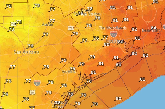
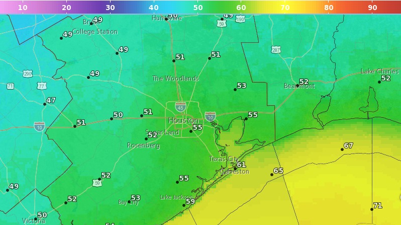
It’s been a breezy night, especially along the coast, as the front has pushed deep into the Gulf of Mexico. These winds should die down later this morning, although some gusts in the low 20s are possible throughout the day. Look for highs in the upper 70s this afternoon under sunny skies. Temperatures tonight will be pleasant for fall, ranging from around 50 degrees well north in Houston, into the mid-50s for much of Houston, and upper 50s closer to the coast. It’s going to feel, dare I say it, almost cold?
Tuesday
Another day a lot like Monday, with less wind. Look for highs in the upper 70s, sunshine, and another cool night heading into Wednesday.