As of about sunrise, Houston’s radar is fairly quiet, with just a few showers streaming in from the Gulf of Mexico. However, we expect that to change later this morning, with the potential for widespread showers, and some locally heavy rainfall. After this, we can expect drier weather through the weekend.
Tuesday
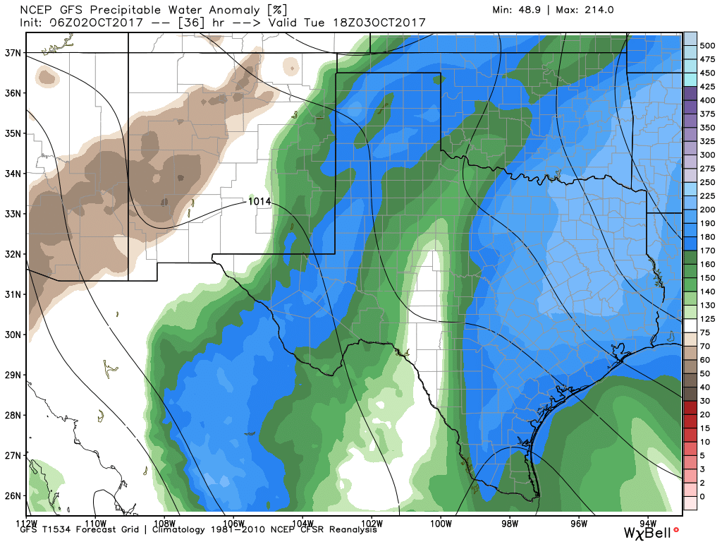
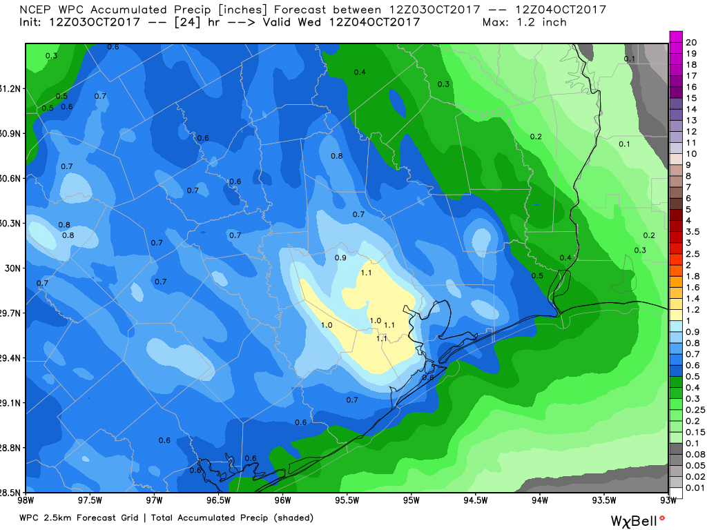
There are a few indicators of the easterly flow that’s been piling moisture into Houston during the last few days. The first one is that, if you’ve been anywhere near the coast or bays, you’ve seen water levels a couple of feet above normal. This is just the easterly winds piling water on top of high tide. The second factor is the increased humidity levels of the Gulf of flow. This increased moisture from the Gulf is likely to culminate later today in showers and thunderstorms. We are not too concerned about flooding, but much of the Houston area may well see about 1 inch of rain, give or take. Some isolated areas will almost certainly see more. If there are any concerns later today, rain wise, we’ll be on top of them for you.
Wednesday
A transition day, as showers end Tuesday night or Wednesday morning. Skies should clear out in the morning or early afternoon, with highs in the mid- to upper-80s.