Unfortunately, as expected, the ingredients have come together this afternoon and evening to focus development of strong thunderstorms across much of the Houston metro area. As much as 3 inches of rain have fallen across southern and southwest parts of Harris County, including the NRG Stadium area, causing minor to major street flooding.
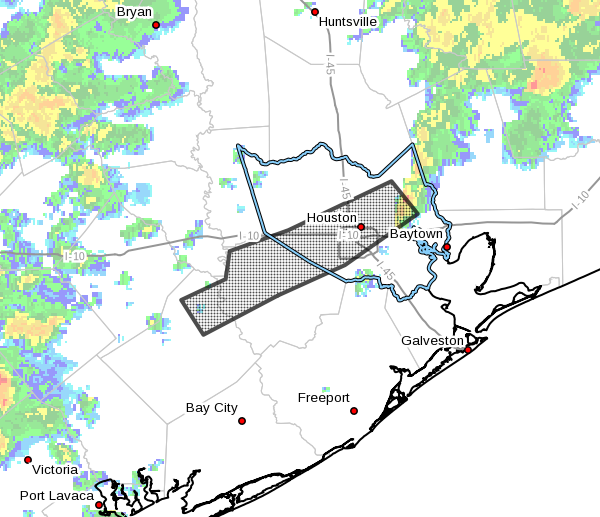
These areas are now under a flash flood warning until 8:15pm CT.
A flash flood warning is in effect for this area until 8:15pm CT. (National Weather Service)
Good morning. Unfortunately the greater Houston region remains in an unsettled pattern, and the kinds of storms we’ve seen on Thursday and Friday afternoon and evening are likely again today—and possibly in even greater abundance.
There are two factors at play with our weather today. To start with we’re going to see a mostly sunny morning. This will lead to daytime heating, which in turn will help set up a sea breeze. This flow from the Gulf of Mexico should lead to the development of coastal showers early this afternoon, and we should see them move steadily inland. At the same time a weak, late-spring cool front will be moving down though Texas, southward toward Houston, bringing some additional instability with it. The weather concern is that the sea breeze and front essentially collide, in which case we’ll have a big party in the atmosphere for instability.
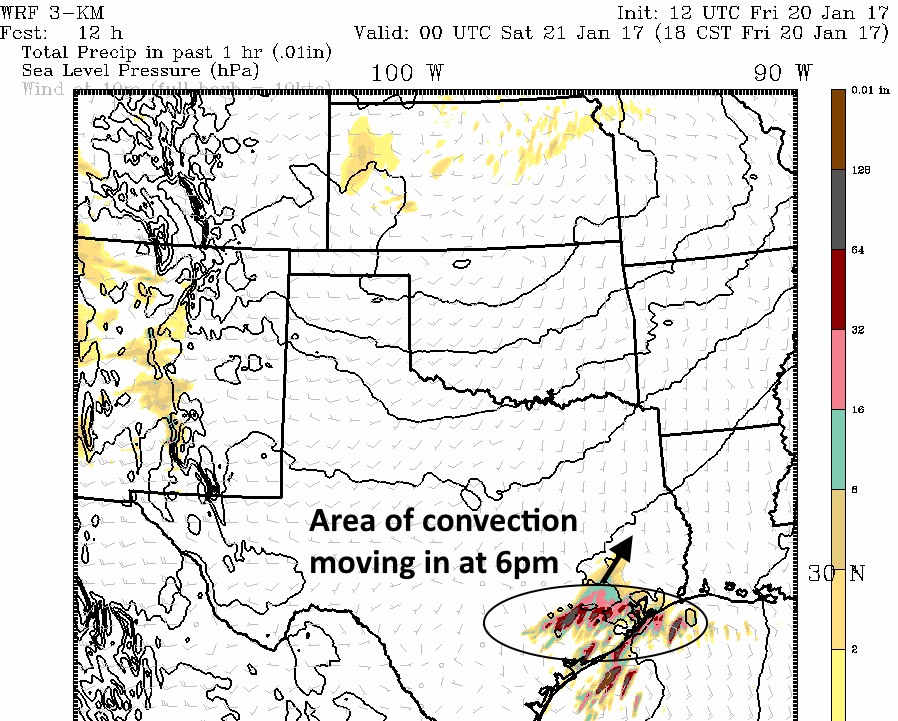
This means the potential for locally heavy rain, hail and possible severe thunderstorms, like we’ve seen the last couple of afternoons. Only potentially more widespread. Here’s how one model, the HRRR, suggests conditions will look at 6pm today.
HRRR model forecast for 6pm CT on Saturday. (Weather Bell)
Good afternoon. Matt’s forecast from this morning still holds up pretty well, but I wanted to provide a quick update on storm possibilities looking ahead.
FRIDAY EVENING
We’ve seen some strong thunderstorms fire up from the Lake Jackson area to Alvin this afternoon, and we’ll continue to see at least some scattered development through the evening hours as temperatures remain in the upper 80s helping to fuel these storms. Much of Houston will not see rain, but where these storms do fire up this evening they have the potential to be intense and flood streets. Small hail is also a possibility. I do not expect coverage to be quite as widespread at Thursday evening, but these things are hard to predict. Storms end by 9 or 10pm with the loss of heating.
Storms mainly have developed to the south of Houston this afternoon, but they may migrate further inland this evening. (Intellicast)
A line fairly strong thunderstorms has developed this evening to the west and southwest of Houston, bringing locally heavy rains, intense winds and dime-sized hail. These storms are moving slowly to the east-southeast.
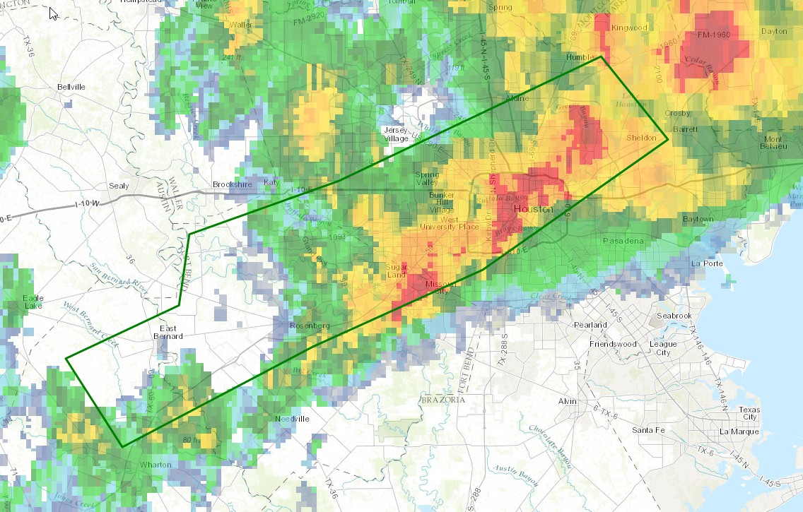
The area of heaviest storms as of 9pm is indicated below:
Area of heaviest storms through 9:30pm CT. (National Weather Service)
So far bayous are holding up fine, but there is some localized street flooding beneath the heaviest rains.
Some of the latest modeling suggests these storms may intensify for the next couple of hours, before weakening later tonight. If they’re going to present an ongoing threat we’ll update the site later.