We’re almost to the weekend! Houston may experience some potentially dynamic weather this afternoon. But after that the region should see a mostly pleasant weekend.
Friday
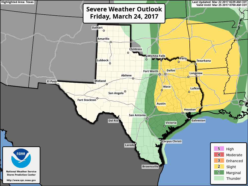
The much talked about upper-level system has now moved out of the Rocky Mountains, and is pushing a line of showers and thunderstorms to the east. As of 6:30am CT these storms were still well west of Interstate 35, so they won’t reach the Houston area until this afternoon.

My thoughts remain much the same as they’ve been this week—this should be a fairly fast moving line of storms, and while there is the potential for some thunderstorms, I think the bulk of the severe weather should remain to the north-northeast of the Houston metro area. In terms of rainfall, accumulations for most areas should be around 0.5 inch, or less, as the storms continue to move at a good clip through the region. They’ll probably reach the region at some point after about 1pm and then exit this evening. Some rain, frankly, would be helpful in dissipating the heavy pollen.
(Space City Weather is sponsored by an anonymous donor this month)
