Good morning. After another day or so of quiet weather we’re going to have to face another period of potentially heavy rain on Friday night and Saturday.
TODAY
Houston will see warm temperatures on Thursday, but how warm depends up the extent of cloud cover. If we’re mostly sunny temperatures could rise into the upper 80s, to near 90 degrees. If there are some clouds, or a scattered shower near where you live, temperatures will probably remain in the mid-80s. In either case, it will be a warm, almost-summer-like day.
FRIDAY
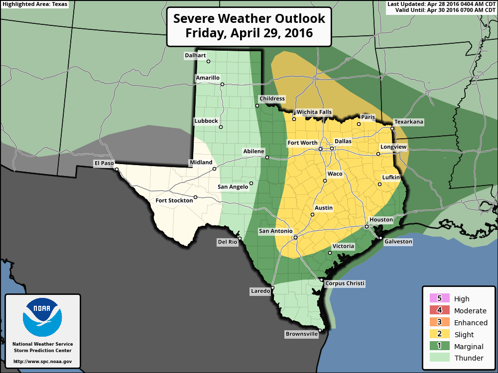
After a slight chance of showers and thunderstorms developing to the north of Houston on Thursday night and Friday morning, we’ll see better rain chances later in the day. It is possible we’ll see some thunderstorms move in from the west later on Friday, during the evening hours. For now the west-northwest part of the metro area lies under a “slight” chance of severe weather (damaging winds, hail and possibly a tornado) on Friday and Friday night.