In brief: Houston should strap in for a stretch of ups and downs in the temperature department culminating in a return to winter-like cold next week. In between, a slight chance of strong storms east of Houston Saturday, and another round of rain Tuesday into Wednesday. Our biggest question mark is exactly how cold it gets next week.
Happy Valentine’s Day to all! Of course, we don’t need a singular day out of the year to know you love us. We love you too. (No, but seriously, we always want to share our appreciation of your support, so thank you). If you love warm weather or you love cold weather or loathe either, we have something in the forecast for you.
Today & tonight
There are some lower and mid-level clouds moving across the region this morning, as warmer, more humid air is trying to begin returning to the region. While the sun may poke out here and there, look for mostly a cloudy-ish day. A few showers or a very isolated thunderstorm may move through later this afternoon. The vast majority of the day should be dry, however. Highs will eventually reach the upper-50s, though it may not occur until later in the evening due to the clouds. In fact, temperatures should actually keep rising tonight until they reach the mid-60s on Saturday morning.
Saturday
The main concern for Saturday will be severe weather potential. We are fairly confident that the bulk, if not all severe weather will remain to our east tomorrow. If you are traveling into Louisiana or Mississippi, there could be a fairly noteworthy severe weather outbreak, however.
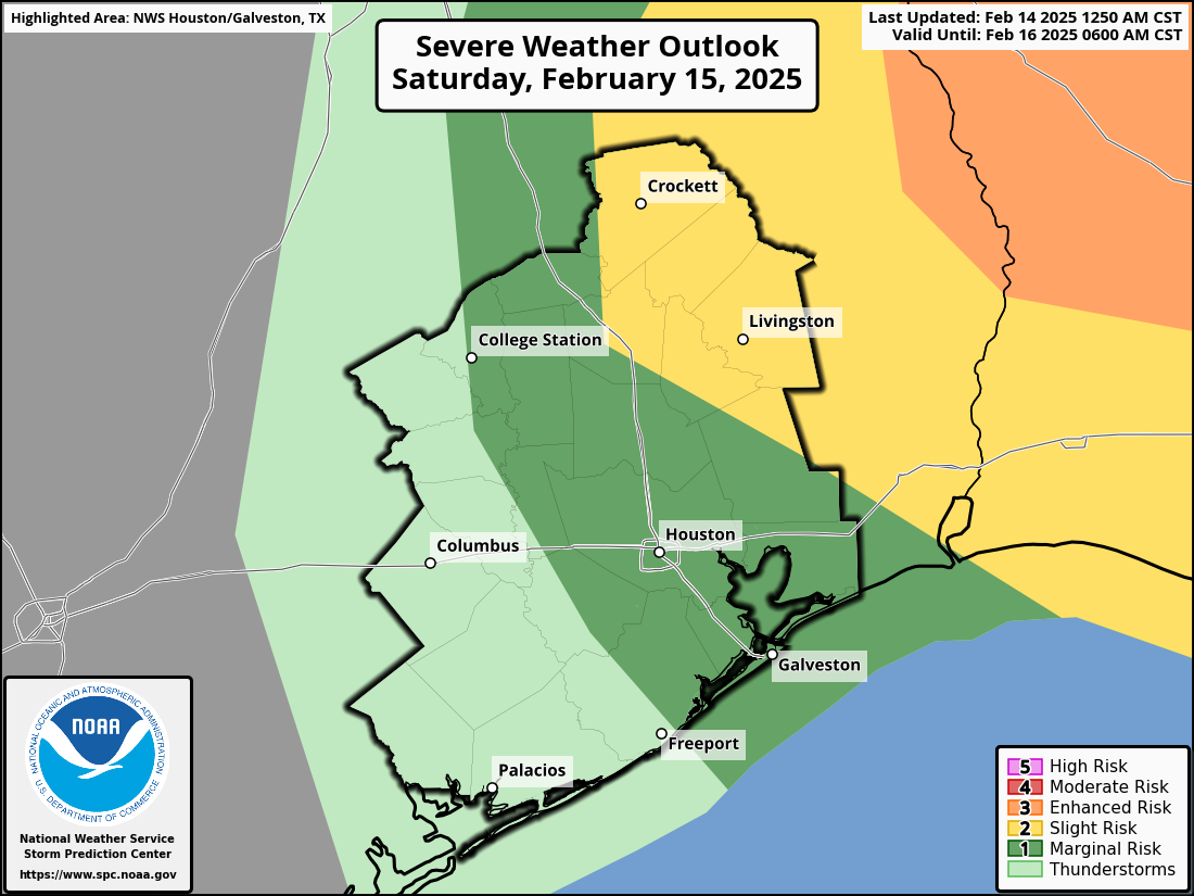
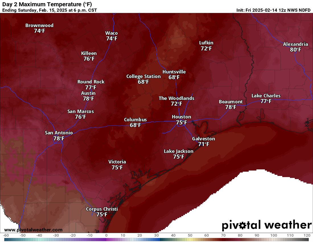
That said, we will likely still see showers and storms around the Houston area throughout the day but in a bit of a disjointed, improv, hit and miss type fashion. Look for that throughout the day, likely ending as perhaps a narrow line of developing thunderstorms when a cold front exits the area after 3 or 4 PM. Temperatures will push well into the 70s on Saturday, possibly even near 80 degrees in spots south of I-10 or to our east.
Sunday
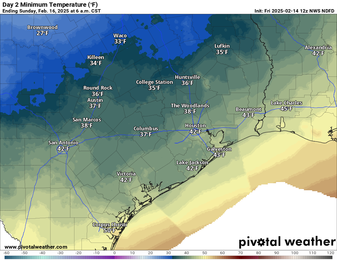
Oh, you’ll be greeted by a casual 35 degree drop in temperatures on Sunday morning, from just shy of 80 to near 40 degrees. Some areas will likely dip into the 30s too. It will also be on the breezy side, especially near the coast with Galveston likely seeing some wind gusts of 30 to 35 mph. So expect Sunday to feel a lot more like winter. The winds will lighten up and temps should warm into the 50s or even near 60 though, so it won’t be too bad of an afternoon.
Monday & Tuesday
Monday, we rise to near 60 degrees, while Tuesday should push into the mid-60s. Watch for showers by Tuesday afternoon.
Back to winter
A much more aggressive return to winter is in the cards for later next week. The showers on Tuesday afternoon will precede a storm system that passes by on Wednesday morning. To be frank, the model handling of this storm has left a lot to be desired, as there have been a lot of run to run shifts, with even some model runs implying rain ends as sleet or snow north of Houston. That’s not what we’d call the “base case” outcome, but it’s out there as a minor possibility at least. Whatever the case, we have a couple more days to pin this down, so I’d just ask you to bear with us.
Because of the uncertainty we know that while it will likely get quite cold later next week, we aren’t quite entirely sure of the amplitude yet. I would suspect that Houston proper sees upper-20s for low temperatures, while outlying areas would be somewhat colder. But there is a wide variety of possible outcomes to the point where realistically Houston could be as cold as 20 degrees or as “mild” as 35 degrees by Thursday morning. We are fairly confident that Thursday morning would be the coldest morning.
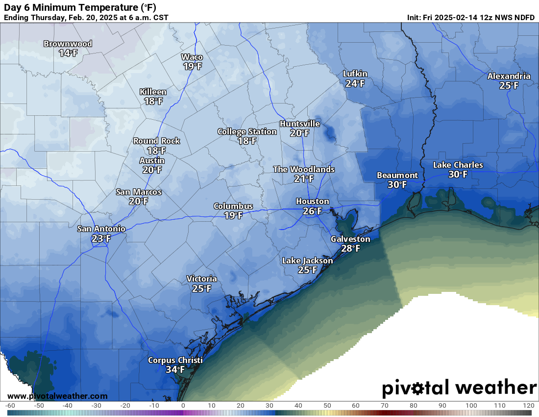
If you live north of Houston, get your plant coverings prepared once again. In Houston and points south, just keep watching and waiting. More to come on this.