Summary: A mostly gentle rain is expected for most of the Houston area today, with the steadiest falling near the coast or down toward Matagorda Bay. A cold front will usher in a blustery overnight and Saturday with temperatures dropping into the 40s, before a spectacular Sunday and Monday. We’ll likely be talking 80s by midweek next week.
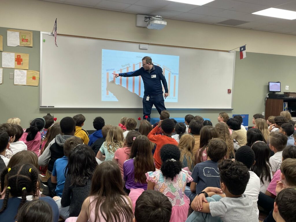
Before we get into things today, I want to give a shoutout to the second graders at Creekview Elementary up in Tomball. I got to visit them yesterday and answer all their weather questions, most of which happened to be about tornadoes! Some bright kiddos, and a thank you to Kristin Pesz, Tiffany Major, and the rest of the second grade teachers for having me out and for a couple special gifts!
Alright, let’s jump into the forecast.
Today
We’ll end the week on a wet note. This looks like the rare Houston steady rain that doesn’t dump all at once. This should be a rather gentle light to perhaps moderate rain most of the time in our area. Most of the area should see at least some rain, but the odds drop off, ahem, precipitously north of Highway 105.
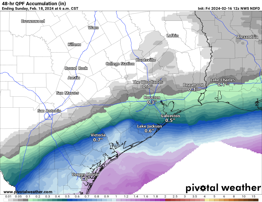
Areas south of Houston will see the most rain, which is to say a half-inch to inch perhaps, with the highest amounts down near Matagorda Bay. For Houston, totals will probably range from a few hundredths of an inch up near Conroe to a quarter to half inch south of I-10. Temperatures won’t move much today, with 60s this morning, increasing just a few degrees this afternoon.
Late tonight & Saturday
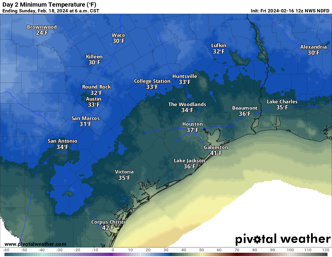
It will not be until about midnight or so, give or take an hour or two that we notice a big time change. A cold front will hit, which should taper any rain off to drizzle mostly. But behind it, fairly potent north winds will usher in cold air. Look for gusts of 20 to 30mph, stronger on the coast or near the Bay. And temperatures will probably hold steady in the mid to upper 40s at best. It will remain mostly cloudy with a few showers or some light rain around through the day, particularly south or east of Houston.
Sunday
Winds calm down Saturday night, and Sunday will dawn calm and chilly. Look for lows in the 30s over a good chunk of the region. But Sunday’s daytime looks absolutely stellar, with temperatures rebounding well into the 50s to perhaps near 60 in spots. Oh, and it’ll be sunny. Definitely one to enjoy!
Presidents’ Day
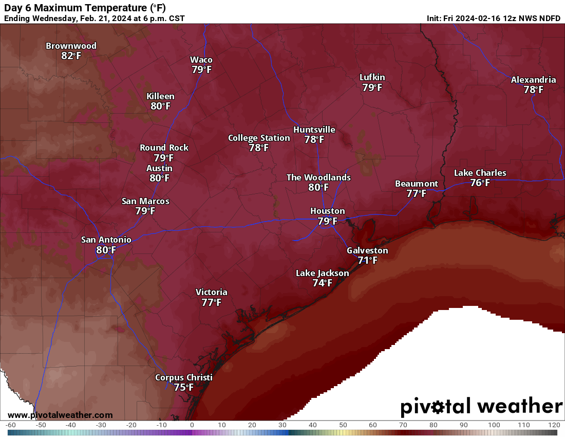
Monday looks fantastic, with sunshine, morning lows in the 40s, and daytime highs near 70 degrees. Another stellar day.
Rest of next week
The warm up does not stop there. We will continue to add a little humidity and warmer temperatures Tuesday, Wednesday, and Thursday. I expect highs to hit the upper 70s Tuesday, and 80 or better Wednesday and Thursday. Current model guidance from the National Blend of Models (NBM) suggests at least a 50 to 60 percent chance of 80 or better on both Wednesday and Thursday. Lows will bump up into the 50s to near 60 degrees perhaps by Thursday.
No real meaningful shower chances are expected right now, but this warm pattern may allow for some sea fog in Galveston or along the bayshore. A cold front should nudge through the area Friday, allowing for cooler, dry weather next weekend but nothing too excessive. We’re probably looking at 40s and 50s for lows and 60s or 70s for highs. More on that next week.

I guess I’ll have to savor this last cold front. The #$%$ 90s await……………
So glad to see you visiting schools! Kids were very lucky.
After this chilly burst, next week looks mighty fine. If only we could push “pause” at that point, it would be great.
Like the political season, our months of hot and humid weather goes on too long. Both can be shortened by three months and everyone will be just fine. On the bright side, the rain will be gentle as Matt said.
I have a great memory of my local meteorologist visiting our class in elementary school! I specifically remember him warning us not to be on the landline during a thunder/lightning storm because of the risk of getting shocked through the phone haha. Anyway, kudos to you! Those kids might remember you forever.
Hey Matt and Eric, don’t forget to mention our trail riders coming through town next week – they start Sunday from 11 different locations and converge on Memorial Park on Friday and they are SURE going to be thankful for this positive forecast! Readers can see all the ride routes here, and they absolutely love waving to kids on the route! https://www.rodeohouston.com/trail-rides/
I have wondered for a long time about the are there any atmospheric hints to tell us what kind of summer we would have be it a normal one, seasonably hot and humid with your daytime thunderstorms or the blast furnace that we have suffered through the last back-to-back summers. To me it seems the state of the ENSO is not much of an indicator of what will happen. Or is just wait and see if regional atmospheric patterns favor lack of a high pressure or the death ridge like we’ve had in recent years.
If Eric n Matt could weigh in, I’d be all eyes and ears. Thanks a million.
Thank for your presentation to school children!!
Matt, Backing up a bit to last Sunday’s tornadoes, did the weather folks overdo it? Did anything actually touch down? Maybe the fact that the Doppler in League City was so far away from the action impacted the less than accurate information. Thanks.
I guess the capping inversion is back over Houston repelling rain and storms away. So strange
Can you guys tell me if it’s safe to plant young citrus trees now. Is SE Texas done with the freezing temps?