In brief: Very nice spring weather, albeit more typical for May will continue in Houston through the weekend. A slight change toward better rain chances remains in the cards next week, but there are reasons to have some healthy skepticism.
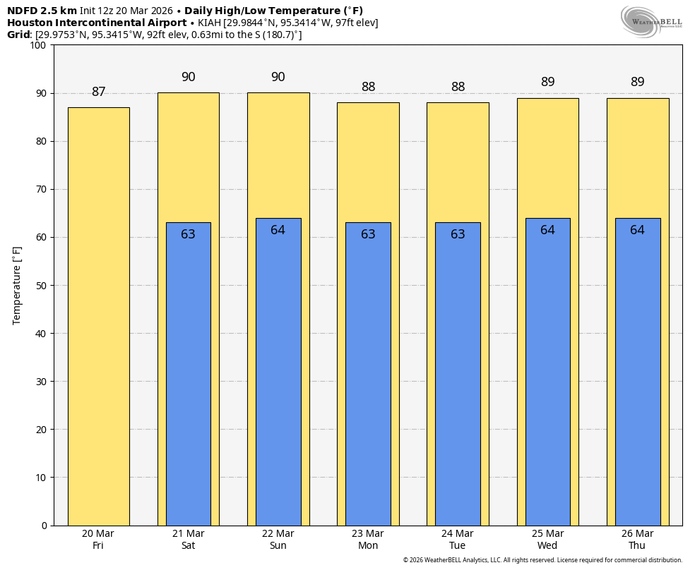
Despite somewhat underwhelming maximum temperatures so far in this period of warm weather, Houston remains on track to basically lock in a top 5 warmest March on record and the warmest March since 2020, if not longer. Yesterday, Bush only hit 84°, while Hobby managed 82°. Let’s take a run at the forecast.
Today and Thursday
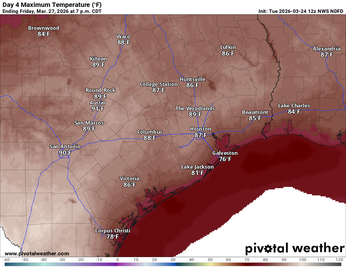
It would appear that we’ll be seeing more of the same today and tomorrow. It should be a touch hotter on both days, with highs likely topping off somewhere in the 85-to-87-degree range. Originally, it looked like Thursday could be perhaps a skosh cooler but that appears to be an imperceptible difference at this point. Other than that, expect sun and a few fair weather clouds after some patchy morning fog or low clouds. *Roofcast:* Based on this forecast, the roof will probably be closed for a 3 PM game on Opening Day at Daikin Park. Odds will be higher that it will open for night games through the weekend.
Friday
Our best chance at approaching 90 degrees continues to look as if it will come on Friday. I still think we’ll come up just short. Yesterday I said to put 8 bucks on 89° and a dollar each on 88 and 90+. Today, I might say to put 7 dollars on 89°, 2 dollars on 88°, and a buck on 90+. Once again it should be sunny.
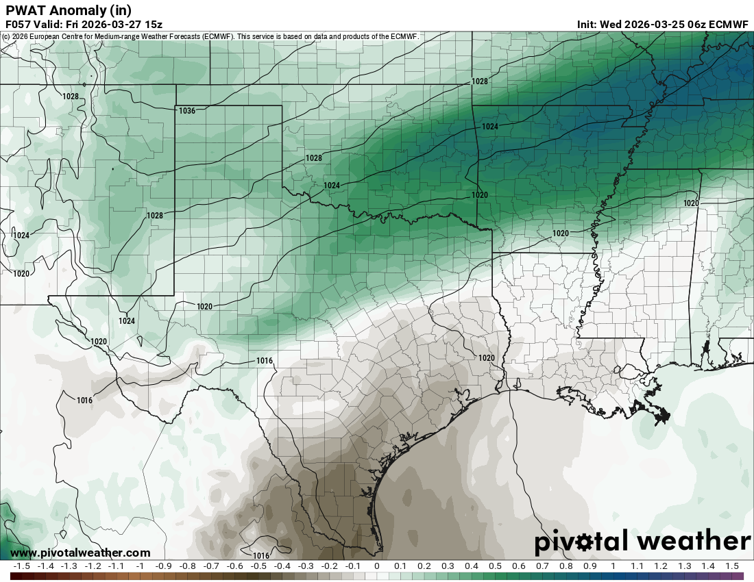
Overnight lows will remain fairly comfortable, generally in the 60s with humidity that isn’t too terribly high. In fact, as you can see from the precipitable water anomaly map above, the air mass is actually running a bit drier than normal on Friday morning, meaning humidity should be kept in check. Overall, conditions in our neck of the woods have not been too uncomfortable or exceptionally dry either over the last week or so, which feels like a bit of a rarity. But it’s what sometimes makes early spring the best season here in Houston, even when it’s hotter than normal.
The weekend
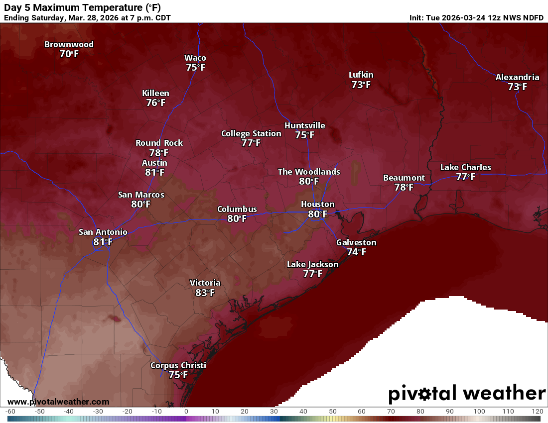
Saturday will be something of an interesting temperature forecast. I would still say much of the area sees upper-70s for highs, but if the air is just dry enough, we may bust hotter, with highs in the low-80s in spots.
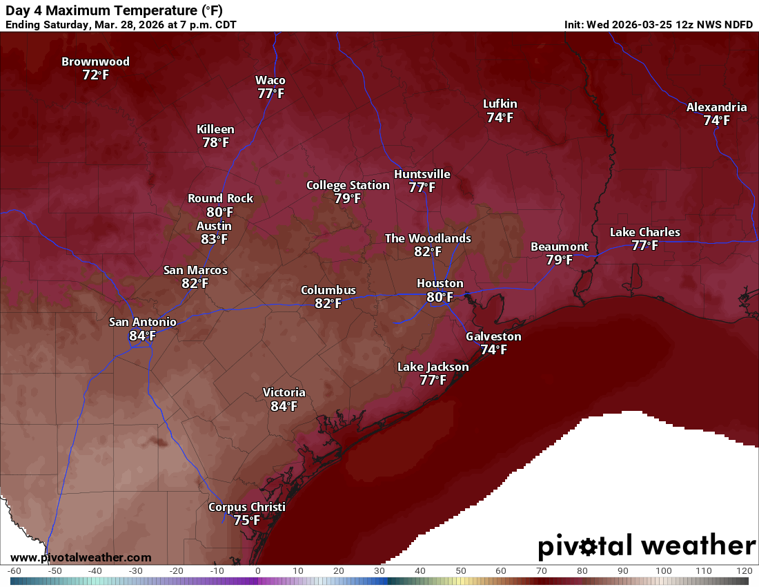
Either way, it looks like a lovely day. Sunday should be much the same with morning lows in the 50s or low-60s and highs in the low-80s and sunshine.
Next week
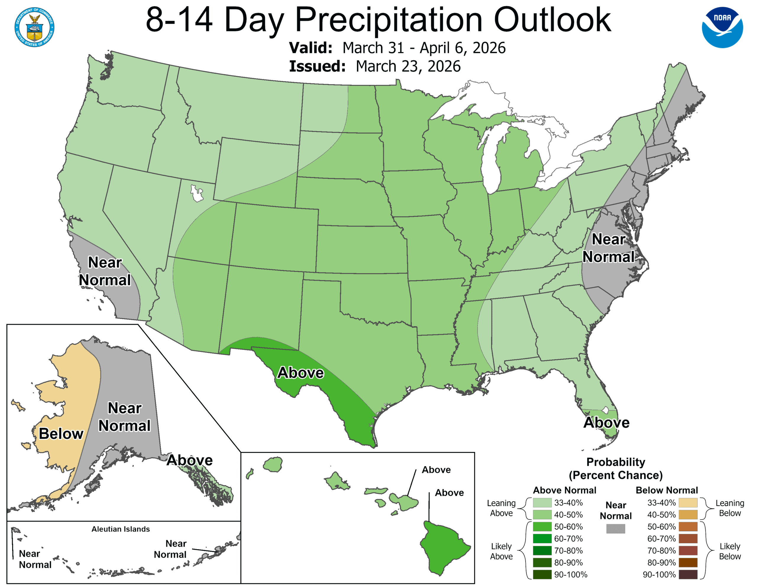
We continue to see modeling suggest we go to a slightly more active, wetter weather pattern across Texas. Whether or not that actually translates to significant rain for the Houston area remains to be seen. But if you look at what the upper-level weather pattern is expected to do next week, this big ridge that has been anchored in either the West or Plains since last week will finally shoot eastward, leaving Texas in a weaker transition zone between ridge and trough.
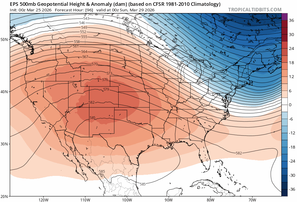
This should allow for some Pacific moisture to infiltrate Mexico and Texas. And if we don’t see organized thunderstorms per se, we will probably see a scattering of typical spring storms across the state. Hopefully that nets us a couple inches of much-needed rain, but time will tell. One thing that could wreck that is if the high pressure in the East flexes too much, meaning we just end up on the western edge of it rather than on the outside of it. Also, as noted yesterday, in long-term droughts, these things have a habit of going “poof” so I’m keeping my expectations low for now.