In brief: This is the first in a series of World Cup-related posts for Houston and our visitors. In this one, we tackle typical June weather in Houston and introduce folks to some insider knowledge to help manage the weather in the Bayou City.
For our regular Space City Weather readers, you’ll already know a lot of this, but perhaps a nice refresher can’t hurt! And for those of you visiting Houston for the World Cup or coming to our fair city for the first time, here are some weather and community things to know! We’ll have some additional World Cup themed posts in the coming days.
Pick your outdoor time carefully
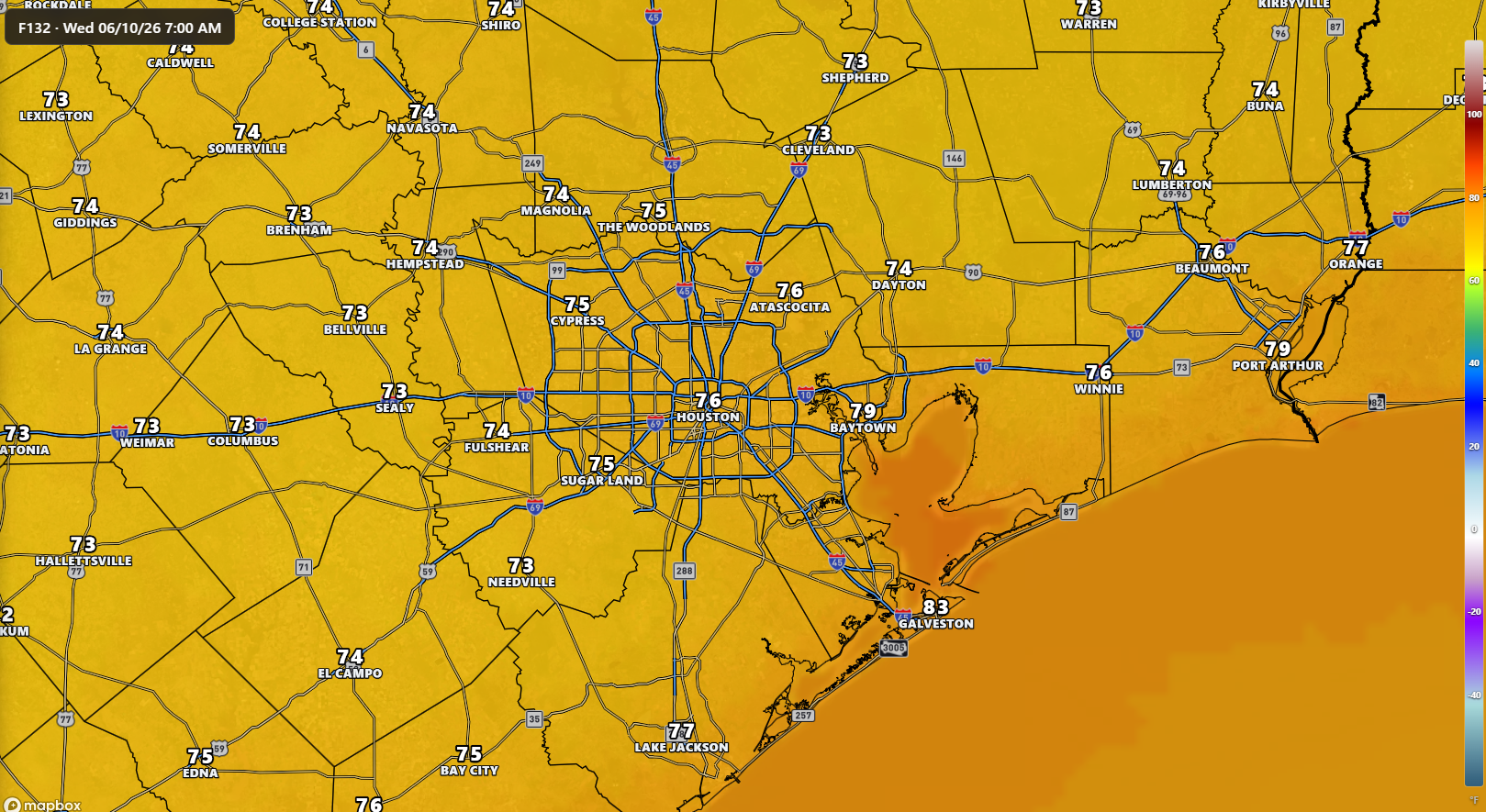
Houston’s all about the heat in summer. I’ve been a meteorologist in Houston for 14 years now, and while August is by far our most oppressive month, June begins the process of testing you. Average highs through June increase to about 93 degrees by the time Germany and Curaçao take the pitch this weekend. Morning lows aren’t much better. While they average about 75 degrees, that usually comes with a good bit of humidity.
The first piece of advice: Utilize the evening hours for outdoor exercise. Houston usually gets a nice sea breeze off the Gulf that arrives in the city around 5 or 6 PM. That can come with increased humidity, but once temperatures begin to level off during the evening hours, the breeze offsets it a good bit. Conversely, the mornings can be still, thick, and rather gross.
If you do need to get out for a run or walk, Houston has a wonderful and underrated park system. Hermann Park is a particular jewel in the middle of the Museum District north of Reliant Stadium and the Texas Medical Center, with trails, a delightful Japanese garden, a golf course, the Houston Zoo, and much more. Hermann Park is also adjacent to or a short walk from the Museum of Natural Science, Museum of Fine Arts, Children’s Museum, and Health Museum, among others.
Some Houston June temperature superlatives: The hottest recorded temperature during the period of the World Cup in Houston was 107 degrees back on June 29, 2013. 100 degrees or better has been achieved 67 times through the June 14 to July 4 period. So, brace yourself, you wild Oranjefans and stay hydrated!
Move that water
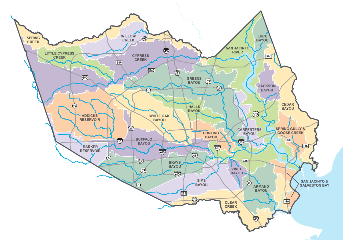
To the outside, Houston is known as Space City because of its prominent place in U.S. space history, but the official nickname is the Bayou City. Houston is divided up by a network of bayous, each with its own character and watershed. The bayous serve a natural purpose by conveying water from the frequent downpours the areas receives through the region and out into Galveston Bay and eventually the Gulf. Despite dividing up the city, they will also connect many neighborhoods through a complex and massive trail system known as the Bayou Greenways. The intent is that people will be able to get across much of the city via the trail network in the future.
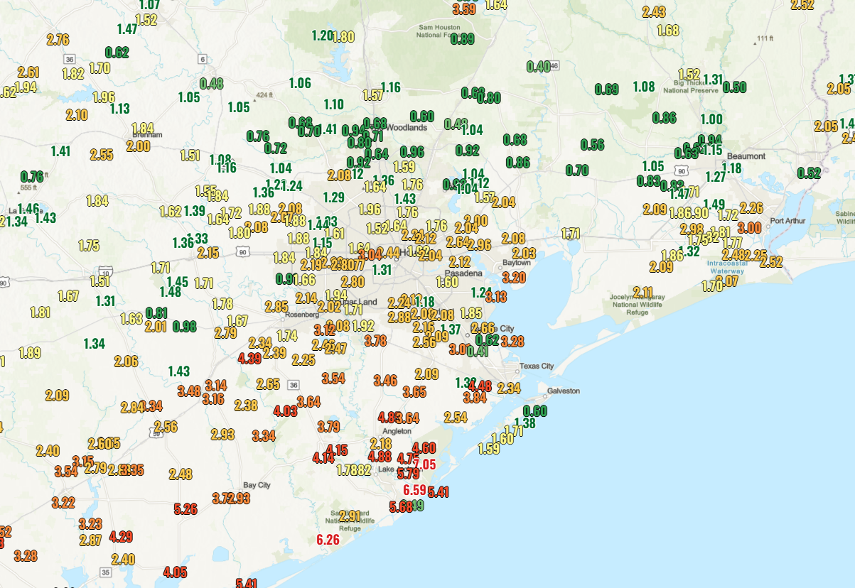
But the bayous are ultimately the freeway network for water here in Houston, and we get a lot of it. Houston averages about 52 inches of rain per year, which is about 13 inches more than Seattle. The difference is that in Houston, when it rains, it rains. Our wettest month of the year on average is June, when the city normally receives about 6 inches of rain. However, that can vary. In June of 2004, we received over 18 inches of rain here in Houston, with no tropical storms and eight days of an inch or more. The following June, we received less than one-tenth of an inch of rain over the entire month. So far this month, we’re tracking wetter, with some places seeing -a lot- of rain.
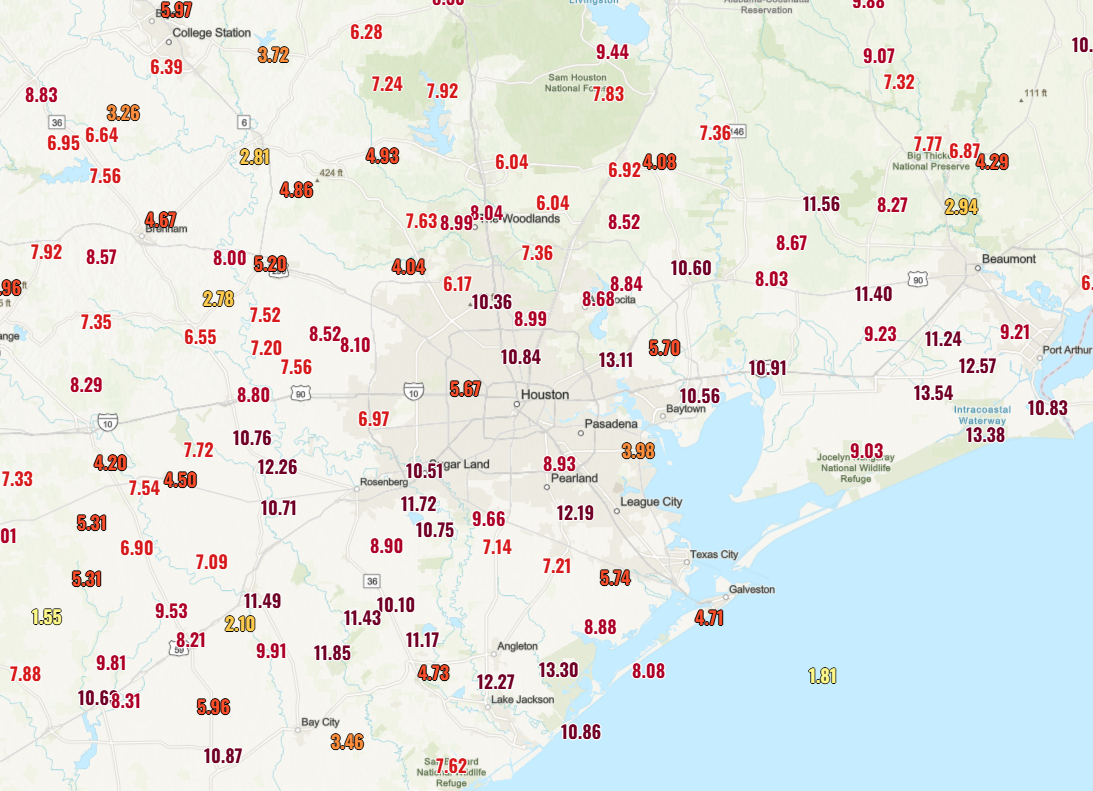
And this after a wet May.
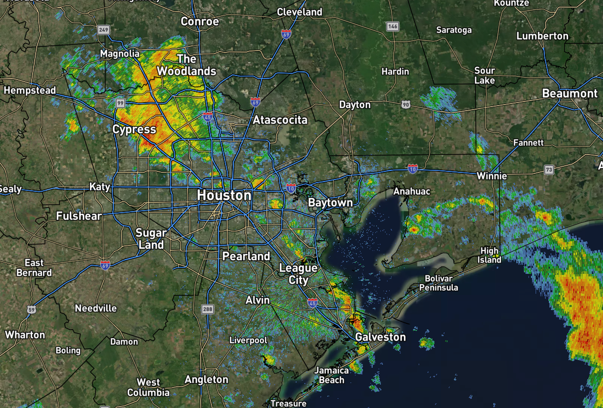
Much like it does season to season, summertime thunderstorms in Houston will vary from place to place. A typical summer day features thunderstorms developing near the coast or just inland in the morning hours, moving into the city and north and west during the afternoon hours. But many areas will hear thunder or see nothing at all, while a few places pick up an inch or two of rain. The dividing line between “rain o’clock” and nothing at all can be razor thin all summer long. We seem to have this pattern already well established this month, so as long as there remains available atmospheric moisture, we should expect daily thunder chances in the Houston area. Thankfully, the matches will be played indoors.
For folks visiting Houston, it’s important to understand that the rain here is probably not what you’re used to unless you live in the tropics. It falls hard, sometimes at a rate of 3 to 5 inches an hour. Flooding of streets happens frequently during the worst rain events. More serious flooding is rarer, but it does occasionally happen, and as a visitor to Houston, you should know two key things. First, Houston’s streets are a part of the drainage system. That’s not a typo. While the bayous serve as the first defense against flooding, the fact of the matter is that even the best drainage systems struggle to keep up with rain rates as intense as we see here in Houston. Thus, the street network sort of acts as a retention network for water. You’d rather have streets flood than buildings. Houston can’t engineer flooding away but this solution does mitigate it to a certain extent.
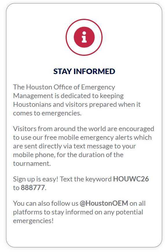
The second thing you should know is how to receive weather warnings. In most cases, your phone can prompt you about flash flood or tornado warnings. Brian Mason, the director of the Houston Office of Emergency Management recommends their AlertHouston mobile alert system. “We have created a special keyword for messaging during World Cup. Text HOUWC26 to 888777 to receive weather-related and other local emergency alerts from Houston Office of Emergency Management.” Some people may be wary of another push notification, but I would strongly encourage folks visiting to opt-in to these alerts during your time here.
Flooding can also be linked to tropical storms and hurricanes. Houston has not been directly impacted by a hurricane in June since 1921, but there have been numerous tropical storms including the infamous Allison in 2001, which deposited nearly 40 inches of rain on a portion of the city. The most recent early season hurricane was Beryl in early July of 2024, an intense category 1, almost category 2 storm that caused severe tree damage to the Houston area resulting in massive power disruptions. But cases like this are rare, and Houston’s more serious hurricane impacts typically don’t occur until August or September. As of right now, we are not expecting tropical activity in the Houston area this month.