In brief: While rain totals across the Houston area have been rather variable (ranging from less than an inch in some spots to over 8 inches in far southern Brazoria County), we expect everyone to participate in rain and storm chances this weekend, especially from Saturday night into Monday. Flash flooding remains a distinct possibility, and our Stage 2 flood alert will remain up through at least Monday.
Rainy pattern check-up
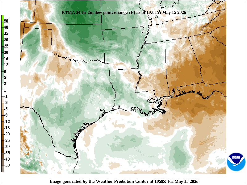
We’re a few days into this relatively significant change to a rainy pattern, and so far, so good for the most part. We’re going to maintain the Stage 2 flood alert through the holiday weekend. I think the rains we saw Wednesday down in Brazoria County (7 inches) exemplify what this setup is capable of.
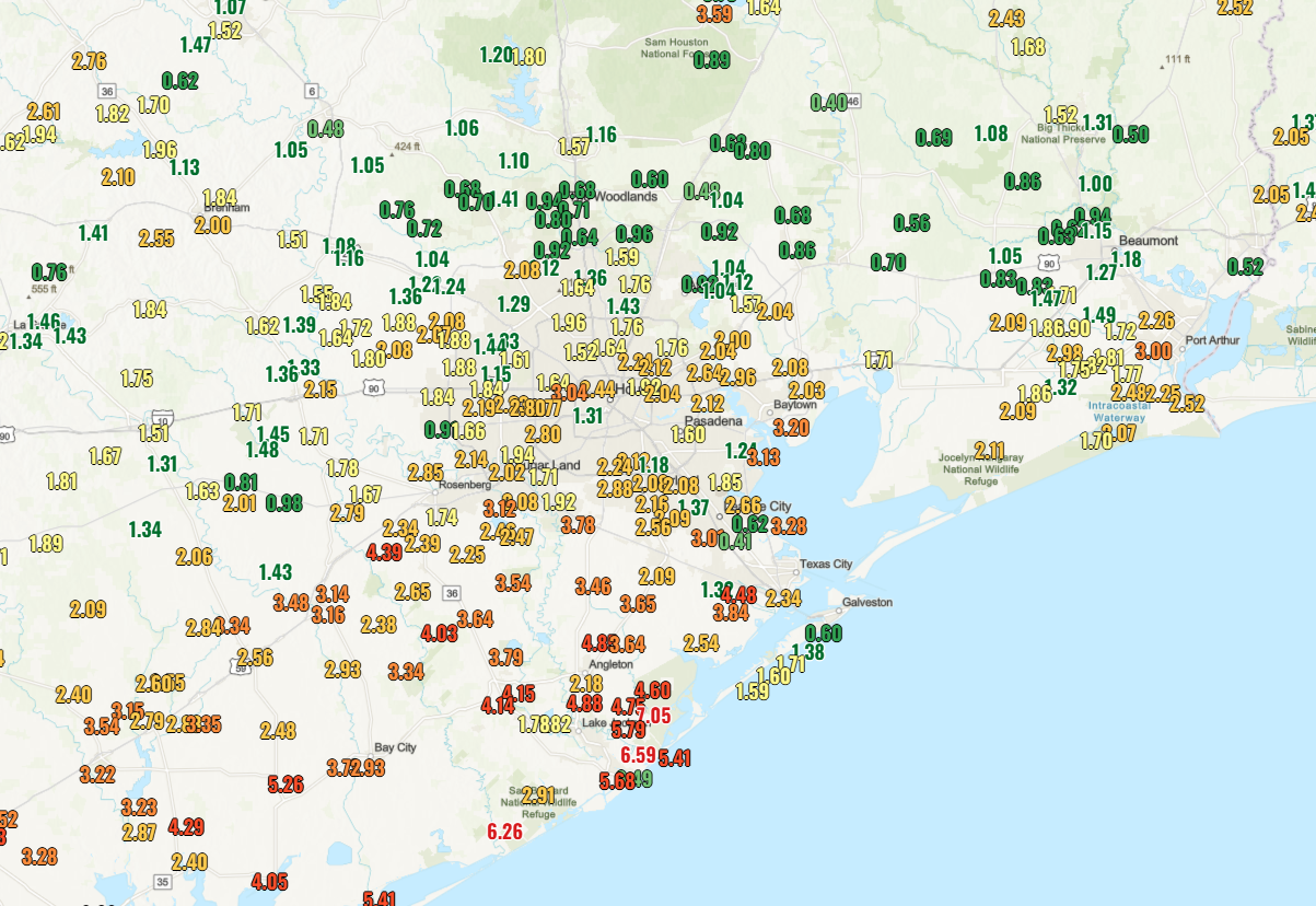
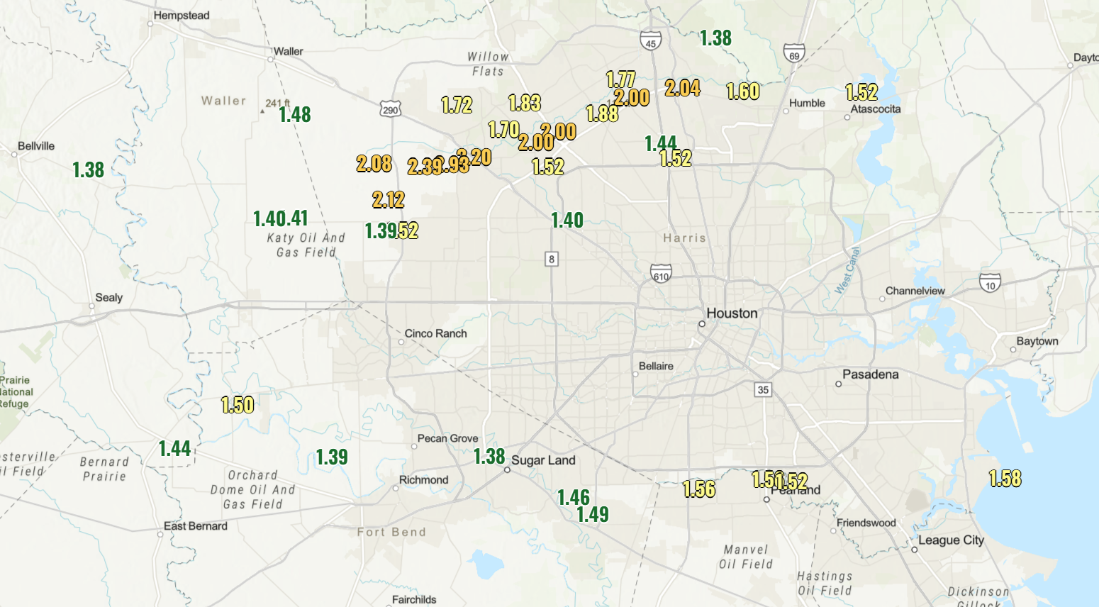
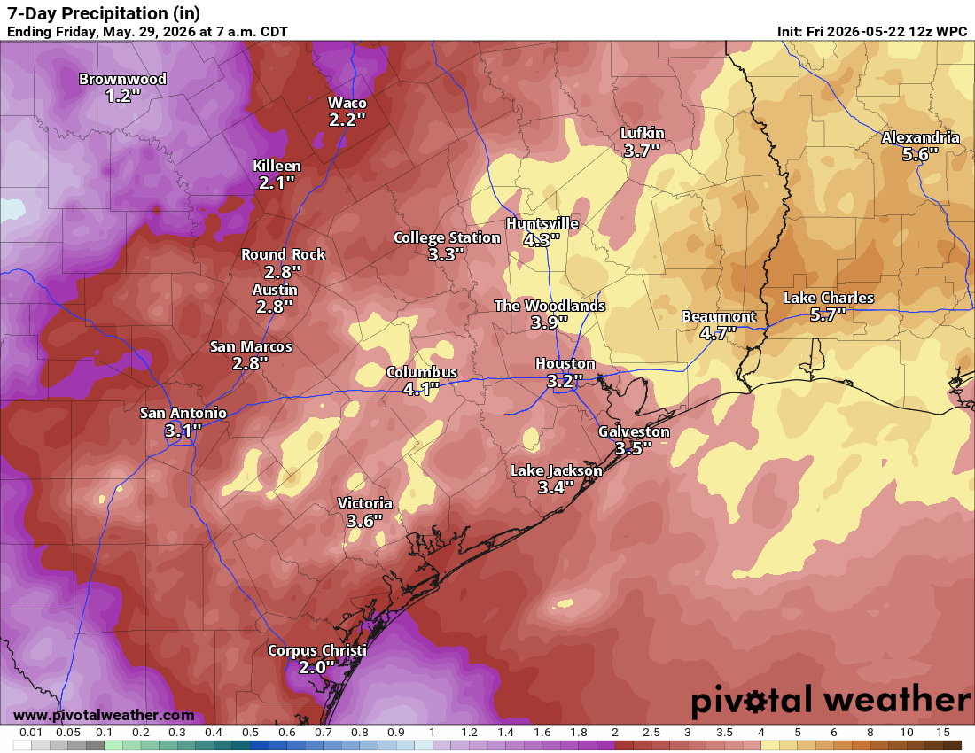
So far, the northern half of the area has seen a relatively pedestrian 1 to 2 inches (even less in spots), while the southern half has seen 1 to 4 inches on average, with pockets of 5 to 8 inches. We expect another 1 to 4 inches on average over the next week across the entire area. Isolated higher and a couple lower amounts are indeed possible.
For those concerned about the situation in Corpus Christi, Lake Texana has seen about 3 inches of rain, while Lake Corpus Christi has seen about 4 inches of rain so far. Areas upstream of those lakes have received anywhere from 2 to 4 inches as well. By no means does this “save” Corpus Christi from a very bad situation, but it obviously helps buy some time. And any help is great news down there right now.
Today through tomorrow afternoon
Right now, weather modeling is suspiciously calm today and much of Saturday across the area. Obviously, showers and thunderstorms are still possible. But I would suspect most places stay dry as the best “oomph” for storms remains south or offshore in the Gulf. We’ll probably see clouds and sun. Highs may nudge back up into the middle or even some upper-80s after a couple days of lower 80s. There will be plentiful humidity to go along with that.
Saturday night through Monday
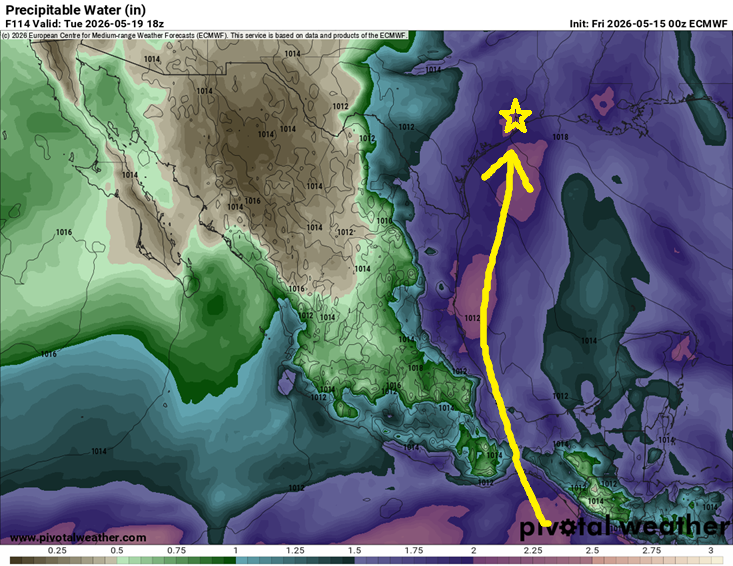
If we’re going to get smacked by rainfall, Saturday evening through Memorial Day would be the timeframe I’d be watching closest. A rather vigorous disturbance in the middle and upper atmosphere is going to swing into the Houston area on Saturday evening. This should provide the trigger necessary to get storms off and running. It’s impossible to really say exactly how things are going to setup right now, but expect increasing thunderstorm chances after about 4 PM on Saturday into Saturday night across the Houston area.
We’ll then need to watch for repeated development of storms and the risk for flash flooding, including in areas that have not seen much rain so far. With moisture in the atmosphere much higher than normal, any storms will be capable of dropping 2 to 4 inches of rain in an hour or so. Any “training” or repeating thunderstorms over the same area means those totals could add up quickly, hence the concern for some localized flooding and our Stage 2 flood alert. More to come on this throughout the weekend as we get more clarity on timing and locations impacted.
Next week
The area will remain under the influence of an unsettled weather pattern and above normal atmospheric moisture. I would expect this on again/off again type rain and storm stuff to continue through much of next week, though perhaps at a slightly slower pace. Either way, what we can say with fairly high confidence right now is that any sustained, strong early summer heat is not in the cards through at least early June.