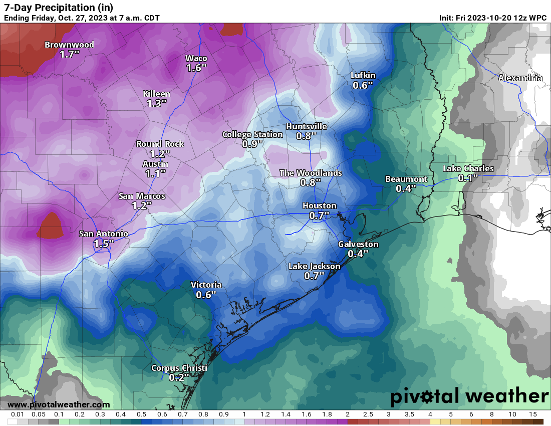
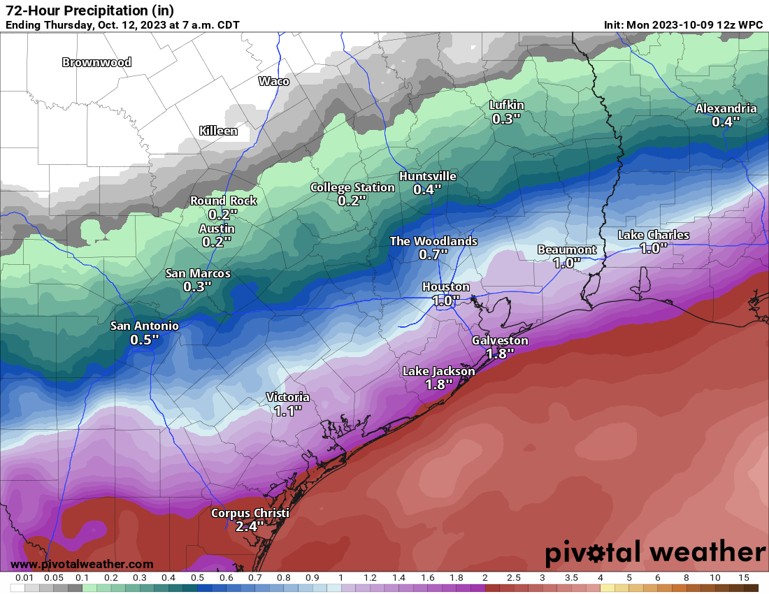
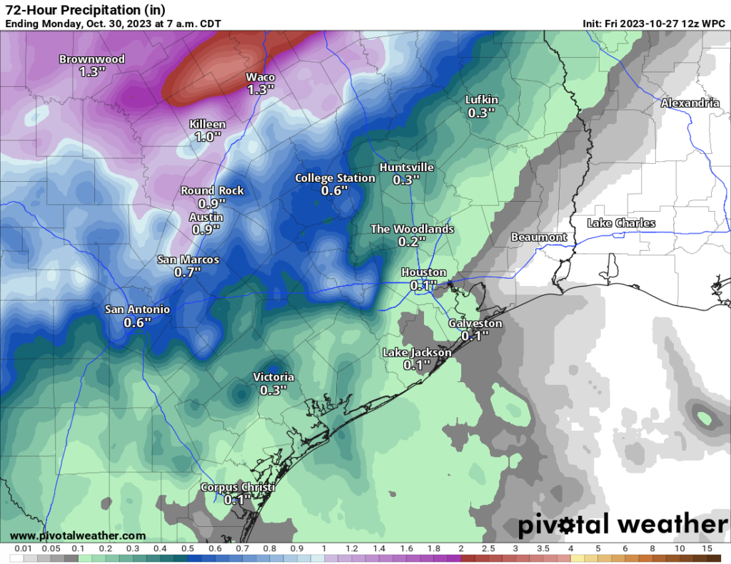
All is quiet across the area this morning, but yesterday definitely saw some heavy rain north and west of Houston, as a relatively persistent area of rainfall setup shop. This dumped as much as 3 to 6 inches over a fairly wide area northwest of Houston.
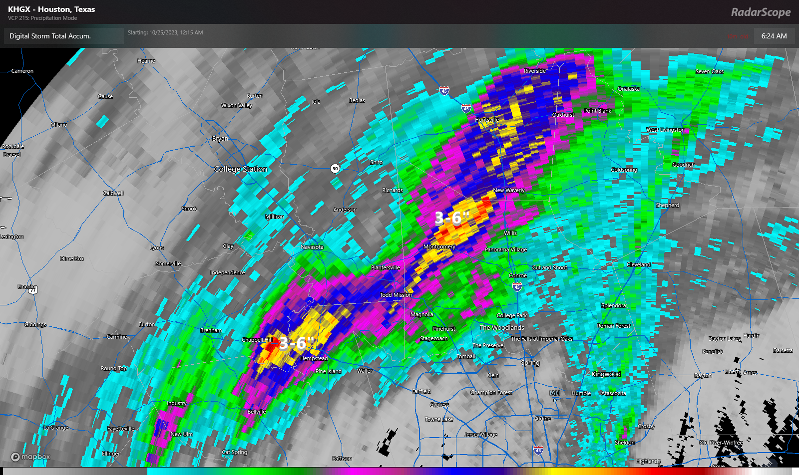
Much of the area at least saw some rain yesterday. We should at least see some more rain today, perhaps in those same areas.
Today
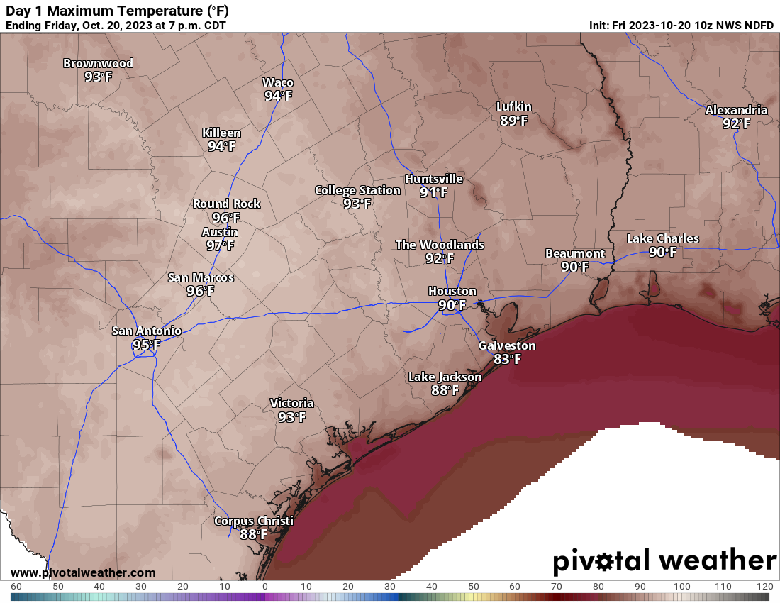
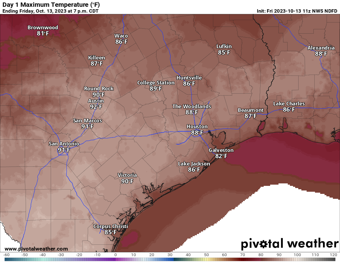
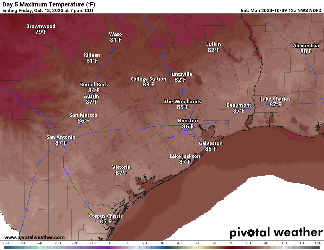
Look for another day of sporadic showers and thunderstorms across the area. Again, the best odds favor areas north and west of Houston for the most rain today, but rain could fall south and east as well, much like we saw on Thursday. It will remain warm and humid with highs well into the 80s.
Weekend
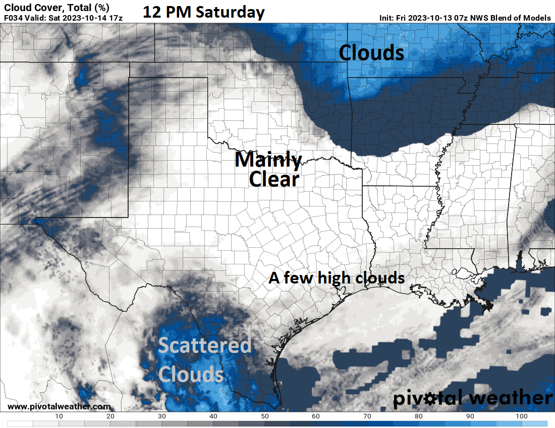
Both Saturday and Sunday will continue to provide warm and humid weather for the area. We’ll see lows in the 70s and highs in the mid-80s on both days. Showers will be possible, but I think the coverage and intensity will ramp down some from what we saw yesterday and what we will see today.
Monday
Alright, the latest the timing on Monday’s cold front brings it through Houston just after midnight, which will lead to plunging temperatures well before sunrise on Monday. In the afternoon, we will struggle to get past the upper-50s with a gusty north wind ramping up. If you have loose Halloween decorations, it’s probably a good idea to try to secure them as best as possible on Sunday afternoon. Anyway, there will be showers or some thunderstorms with the front as it pushes in, and clouds, light rain, and drizzle may persist for awhile through the day.
Tuesday
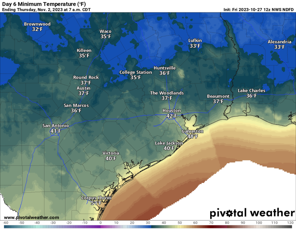
Look for lows in the 40s on Tuesday morning. Expect a breezy to windy day, especially near the coast, where winds of 20 to 30 mph or stronger are likely. We will see a good bit of cloud cover lingering on Tuesday, and that may keep temperatures in the 40s for much of the morning before some afternoon clearing allows us to warm into the 50s. For Houston, our coolest Halloween afternoon occurred in 1925 when we only hit 47 degrees. More recently, back in 2019 we only mustered 57 degrees, the 4th coolest on record. We may fall just short of that on Tuesday. The record low for Halloween is safe at 29 degrees back in 1993. For evening festivities, look for temperatures nudging back into the upper-40s or near 50 degrees with continued breezy conditions. Bundle up, kids!
Rest of next week
The rest of the week looks great. Expect sunshine Wednesday through Friday with temperatures slowly nudging back warmer. We should be in the upper-50s to near 60 on Wednesday, mid-60s on Thursday, and low-70s on Friday with morning lows in the 40s or upper-30s all three days. Sublime autumn weather in my opinion! We will probably hear about frost advisories at some point well to the north of Houston, particularly between Lufkin, Madisonville, and College Station. Even an isolated sheltered location or two up that way has a chance at a light freeze also. But this is highly unlikely in the Houston metro.