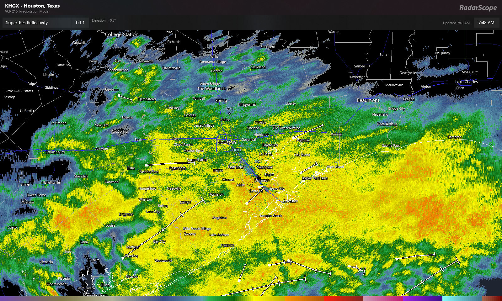
Good Saturday morning to you! You don’t need to be an expert on meteorology to look at the below radar image from 7:45 Saturday morning to know it’s probably going to be raining for awhile.
Rain will be with us all day today. We should see the rain become more intermittent or taper off after sunset tonight, but it may not clear out a ton before Sunday morning.
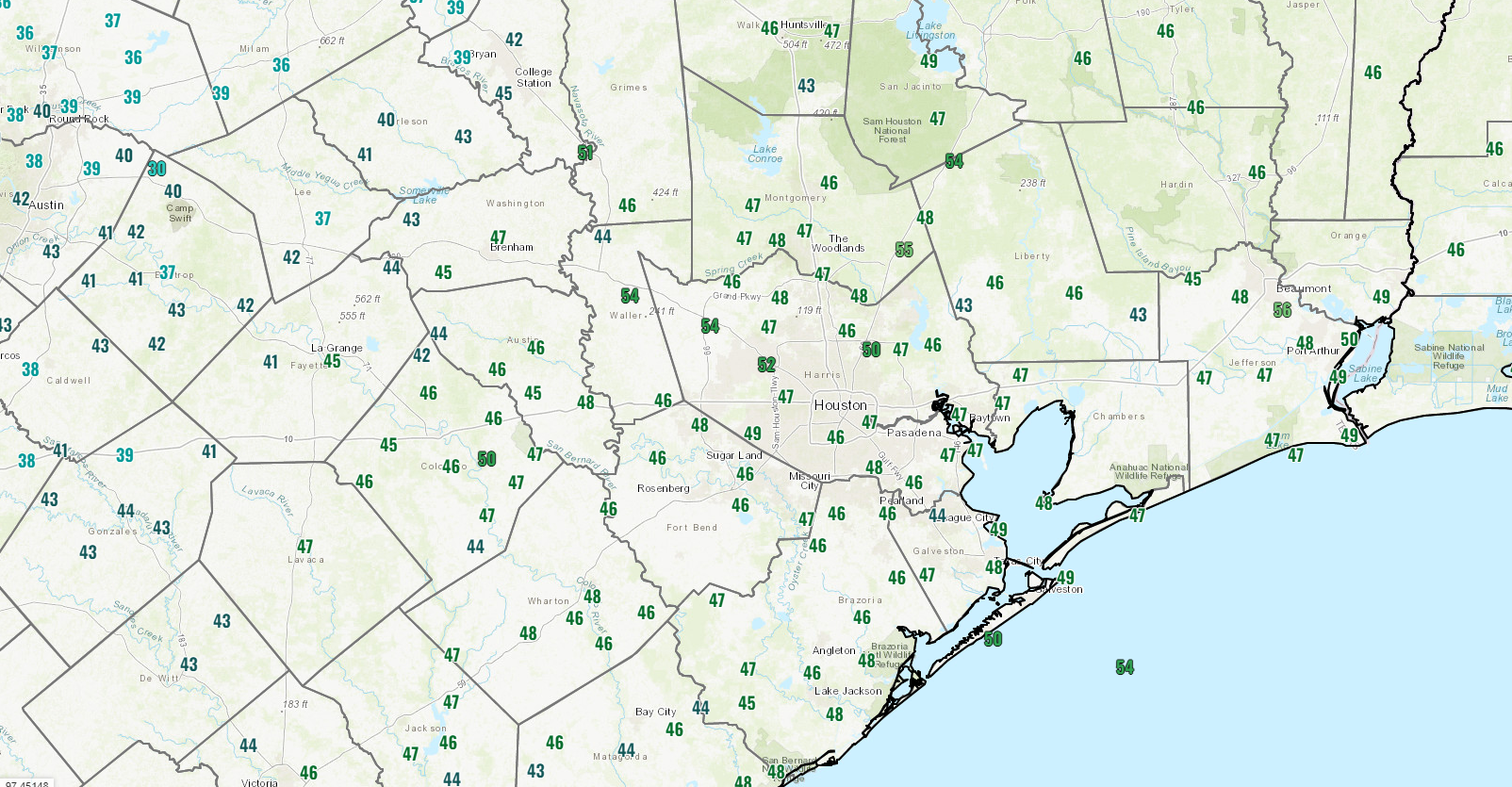
It’s in the 40s in most places in and around Houston this morning. Temperatures should refrain from budging much today, so expect the chill to remain.
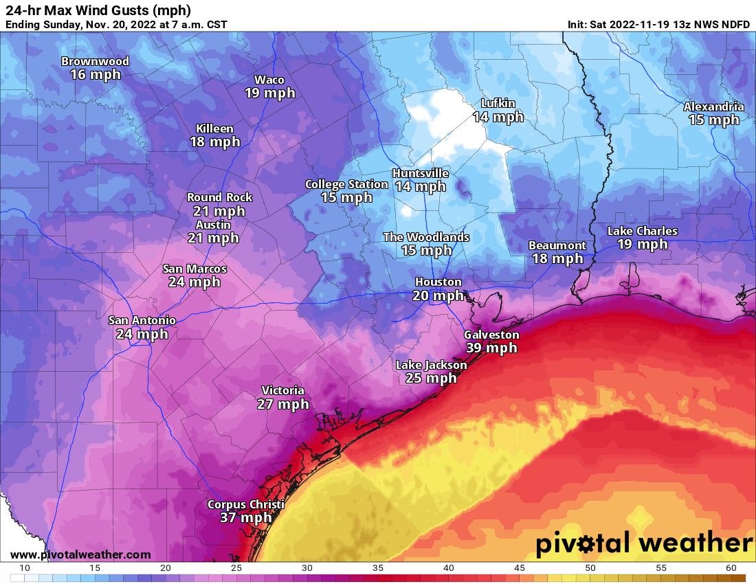
In addition to the rain and the chill, it will be breezy today. Inland areas will experience 15 to 25 mph wind gusts today. Areas along the Gulf or bays may even see some 30 to 40 mph wind gusts. Coastal locations have wind advisories, gale warnings (offshore), and small craft advisories (bays) all posted for today and tonight.
All in all, just a Southeast Texas winter type day today.
Sunday & Monday
Any lingering light rain or showers should taper off before sunrise Sunday. If we are lucky, we’ll be able to sneak in a few hours of sunshine tomorrow before clouds thicken back up. Showers could begin to break out again south and west of Houston by mid-afternoon. Those will overspread the area Sunday night and Monday before tapering off Monday night. Some of this rain could be just a little heavier at times than what we see today. Temperatures will be in the low-50s on Sunday, 40s Sunday night, and probably struggling to get to 50 on Monday.
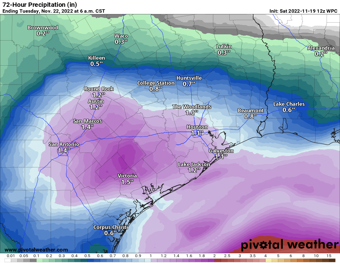
The farther north of Houston you are, the more likely you end up closer to a half-inch of rain. The farther south of Houston, the closer to an inch or more between today’s rain and Monday’s rain.
Tuesday through Friday
Some good news today: It appears that rain chances may be a little lower on Thursday. They certainly won’t be zero, and it seems likely that we see at least a period of rain at some point Wednesday night through Thursday. But it may be in a narrow window. Here is our updated thinking today:
Tuesday: Clouds, some sun, a shower possible. Morning lows 40s, daytime highs near 60.
Wednesday: Clouds, some sun, a passing shower possible. Morning lows upper-40s to near 50, daytime highs low-60s. (A note that travel conditions on Wednesday look decent across most of Texas and Louisiana)
Thanksgiving Day: Clouds with a period of showers and storms possible. Clearing late. Morning lows 50s, daytime highs upper-60s to near 70 degrees.
Friday: Sunny! Breezy to windy, however. Morning lows 40s, daytime highs around 60 degrees.
Fundraiser
Another thank you to all who have contributed to our annual fundraiser! It continues. You can click here to buy items. And if you don’t wish to purchase merchandise and just want make a contribution, click here and check the box that says “I’d like to make a donation only.” We are grateful for your support. Thank you!


Hi Eric and Matt just letting you know.that the links to the fundraiser and donation pages don’t seem to work in the SCW App. I had to click the links in the email. Did I miss an app update? May you enjoy a blessed and Happy Thanksgiving with your families! Appreciate all you do.
Good day to stay home and watch sports.