The good news today is that Friday’s forecast may not be too bad at all. Yes, there will be rain chances tomorrow, but the worst of the weather should pass by early morning. The bad news is that tonight may feature midnight rain, staggered sleep, and an excitable dog index of at least eight out of ten.
Today
Today will be a bit challenging to pin down exactly. The morning looks fine. By midday, we should begin to see thunderstorms develop west of the Houston area, mainly on a line from College Station through Columbus. These storms will gradually become a bit stronger and slowly slide east, perhaps to Conroe or Huntsville south through Katy by late afternoon. By then, any storms could become borderline severe, with hail and gusty winds. Areas east of I-45 and along the coast may see little to nothing for most of today.
By evening, we’ll see scattered showers and storms pretty much along or northwest of Highway 59/I-69.
Thursday evening and overnight
Main message: Phase one of storms mainly north and west of Houston will begin winding down this evening. The second phase of storms should be widespread and hit most of the area with heavy rain, lots of thunder and lightning, and potentially strong, gusty winds in the overnight hours. It would be a good idea to have a way to receive weather warnings overnight, just to be safe.
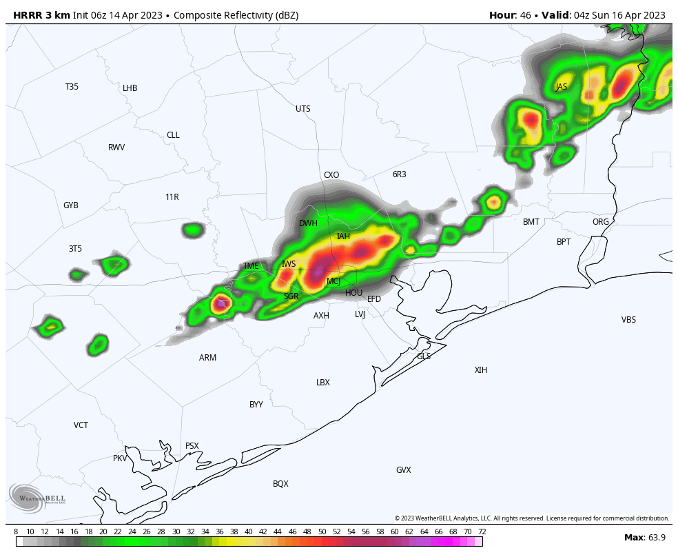
Details: Afternoon storms will also develop on Thursday out in Hill Country and along the I-35 corridor. That separate area of storms will likely congeal into a well-organized complex of storms that rushes south and east this evening. The bulk of that will pass along and north of I-10 around or after midnight. Additionally, new storms “feeding” the main complex will develop south of Houston and lift northward. This can be seen in the forecast radar from the HRRR model at 2 AM tonight. I annotated the two areas here.
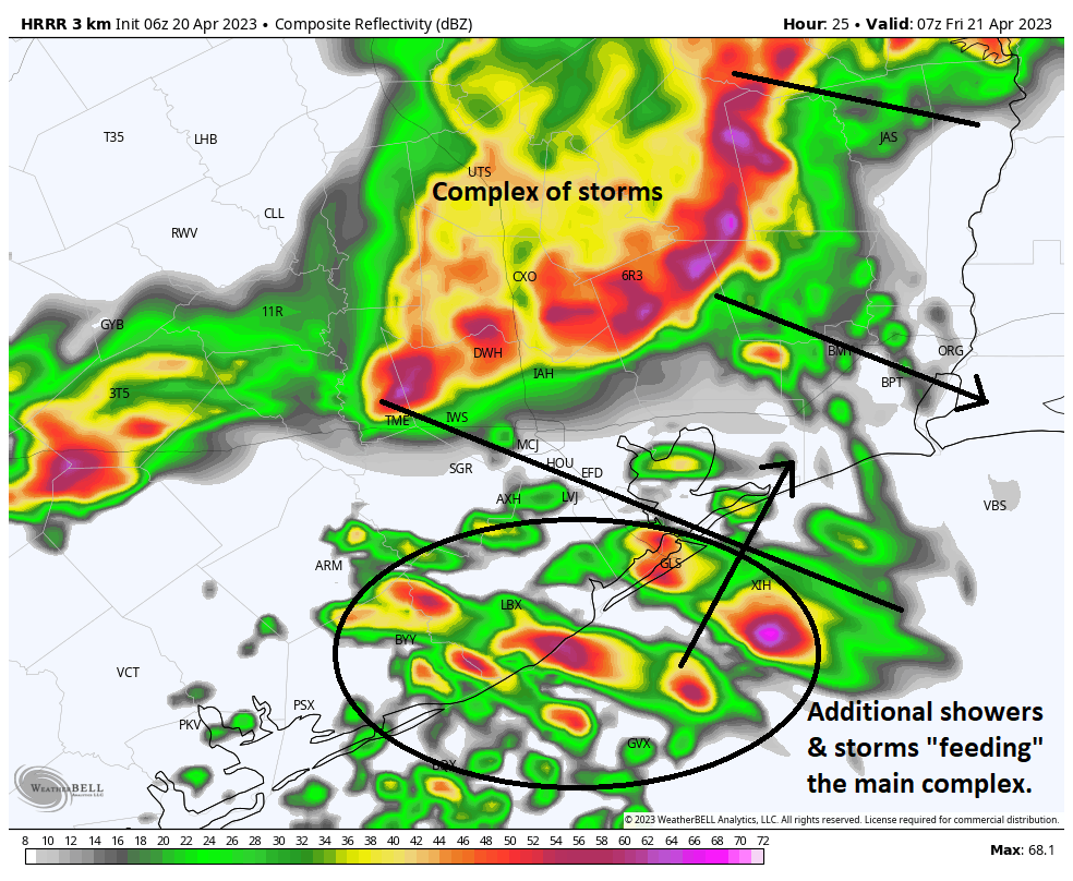
These types of setups are typically favorable to produce strong, gusty winds. Some of the storms developing to the south could become a bit severe as well, with hail or strong winds. Basically, all this adds up to a setup that is favorable to produce noisy weather in the overnight hours, probably beginning around or just before midnight north and west and then most of the rest of the areas between 12 and 3 AM. By 6 or 7 AM, most of the storms should be offshore.
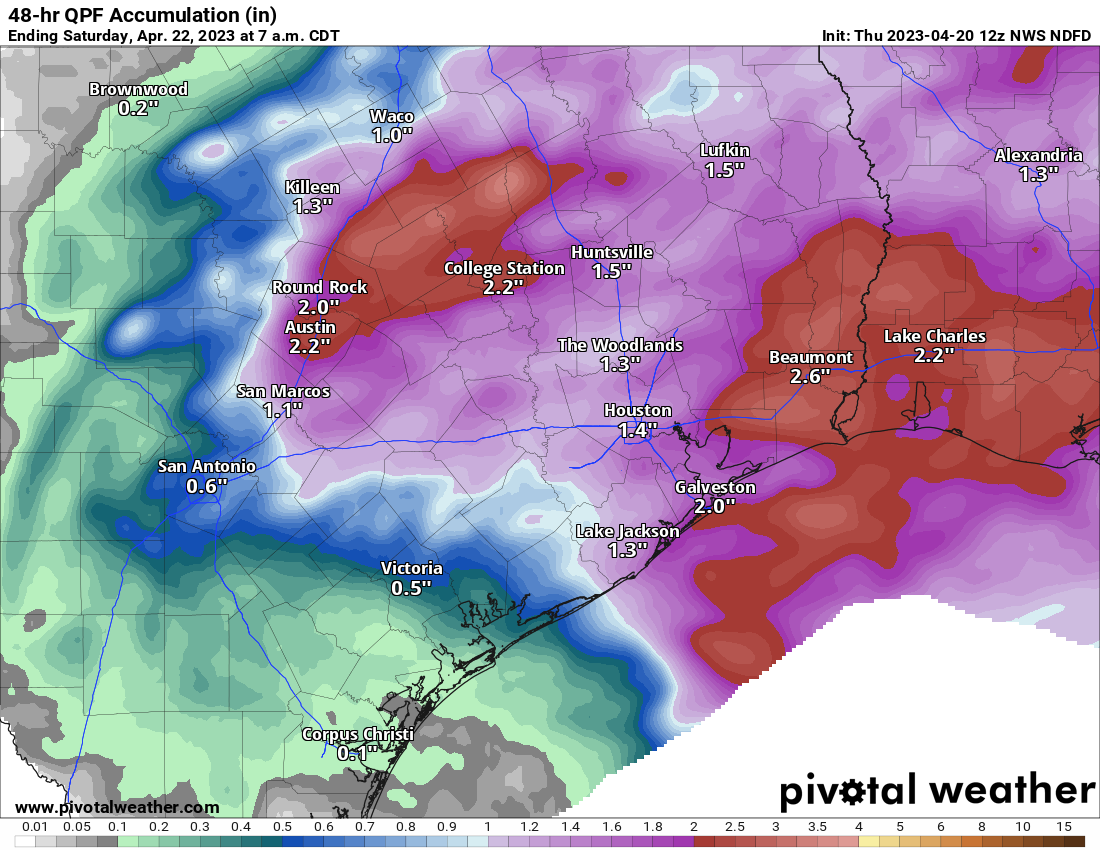
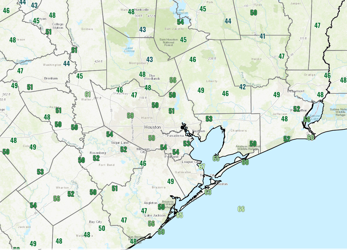
Rain totals will probably average 1 to 2 inches for much of the area. The exceptions to this may be southwest of Houston. The heaviest activity may miss north and east of there, so rain totals risk coming in under an inch for places like Fort Bend County back through Wharton. Northwest of Houston and east of I-45 could see slightly greater amounts, as this is where storms will probably be heaviest.
Friday
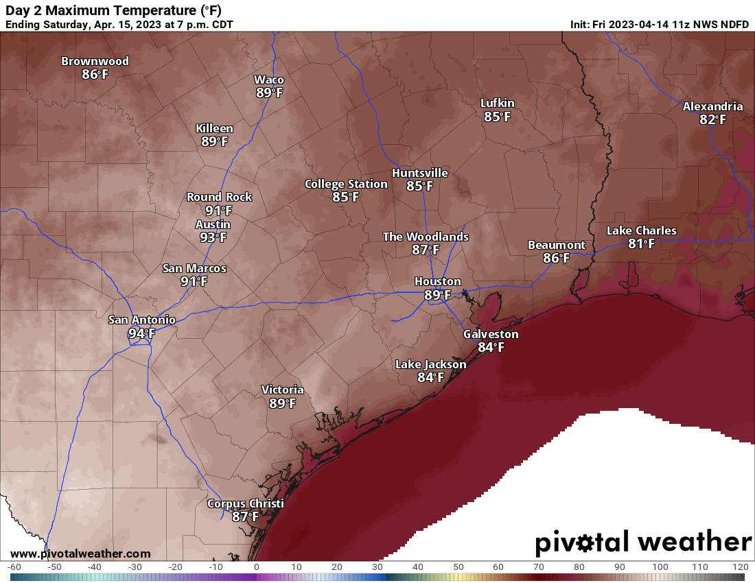
Showers and storms should race offshore in the early morning. Typically, the atmosphere is pretty worked over after an event like this, so while there will continue to be a chance of showers or even a thunderstorm as the cold front approaches in the afternoon, the risk of anything significant appears to be on the low side right now. Expect gradual clearing and highs in the 80s Friday if the sun can break out for a time.
Saturday
Definitely the pick of the weekend. We expect morning lows in the 50s or low-60s, sunshine, and afternoon highs in the upper-70s. Weather for Taylor or the Dynamo match versus Inter Miami looks great.
Sunday
The second half of the weekend is a much trickier proposition. Morning lows will be in the 50s or low-60s. Then, there will be two forecasts for Sunday: One will be north of I-10, and the other will be south of I-10. Keep in mind that this is meant to be a generalization, not an exact demarcation.
For folks north of I-10, you will likely see clouds and perhaps a little sunshine. There is a slight chance of showers in the afternoon, especially the closer you are to Houston. Highs will be in the low to mid-70s depending on how much sun can break through.
Those of you south of I-10 should see clouds thicken up with highs in the low-70s. Showers and thunderstorms are likely to develop during the afternoon, especially the closer you are to Matagorda Bay. Rain could be heavy at times.
I would caution that there’s still a fair bit of uncertainty on the specifics of Sunday’s forecast, so if you have plans, be they T-Swift or otherwise, check back in with us tomorrow for the latest.
Early next week
The front half of next week looks generally unsettled with a chance of showers, albeit a fairly low one Monday and Tuesday. There may be a better chance of showers or storms Wednesday. Highs will be in the 70s and 80s and lows generally in the 60s.
Late next week & MS 150 preview
Presumably, Wednesday’s storms will herald a cold front that should bring in cooler, drier air for late next week. This would mean highs in the 70s and lows in the 50s or low-60s, along with low humidity. What does this mean for next weekend’s MS 150 ride across southeast Texas?
Usually when we get fronts like this in late April, the cool air stays a day or two, and then onshore flow resumes and we’re back to warm and humid. This front may have a little more “oomph” behind it, so I might be willing to say that Saturday would continue to be pleasant, with highs in the upper-70s to near 80, sunshine, and comfortably low humidity. It’s far too early to speculate much on wind, but this type of pattern would probably produce a light east or northeast wind, so almost a tail wind for Saturday if you’re leaving from Houston. I would assume that winds would be out of the south and a bit stronger on Sunday, with slightly higher humidity and highs in the 80s. For now, rain chances look low, but I have to caution that it’s still early. We will keep you posted!