We are waking up to our coolest morning of the season so far today, with Bush Airport registering in the mid-50s. Rural portions of Montgomery County and between Houston and Beaumont in Liberty and Jefferson Counties are even in the 40s this morning.
We will continue this delightful stretch of weather into and through this weekend. So, if you’re free on Sunday, come celebrate with myself, Eric, and Maria (along with Dwight and Lee!) at the Houston Botanic Garden for our Fall Day!
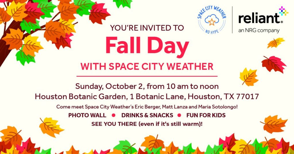
If you’ll be attending, we’d love if you could RSVP here if you wish. Thanks as always for your support, and we look forward to saying hello!
Today
Abundant sunshine and pleasant. Highs in the low to mid-80s. That’s it. We’ll also begin to see offshore waters calm down a bit as Ian’s distant impacts wind down. Winds should be 5 to 15 mph.
Weekend
We should see wall to wall sunshine this weekend. Look for highs in the mid-80s on Saturday, possibly creeping into the upper-80s by Sunday afternoon.
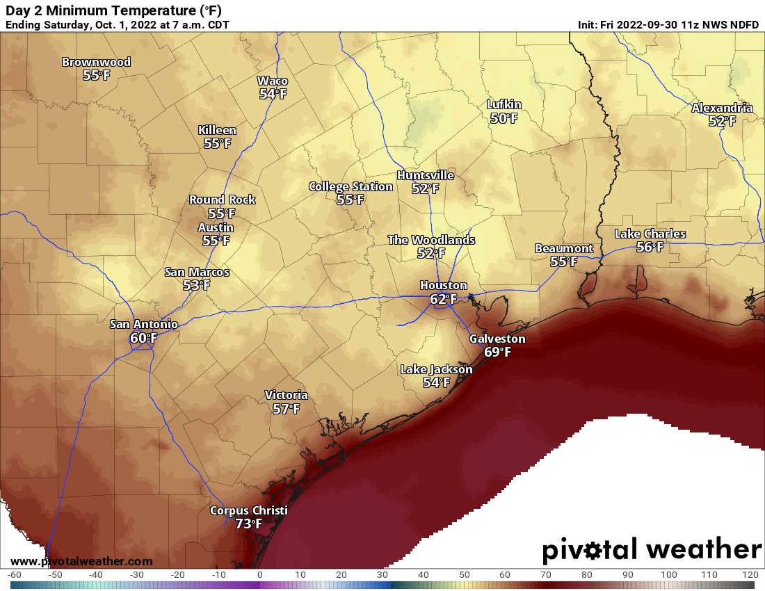
Morning lows will be mostly in the 50s tomorrow and upper-50s to low-60s on Sunday morning.
Early next week
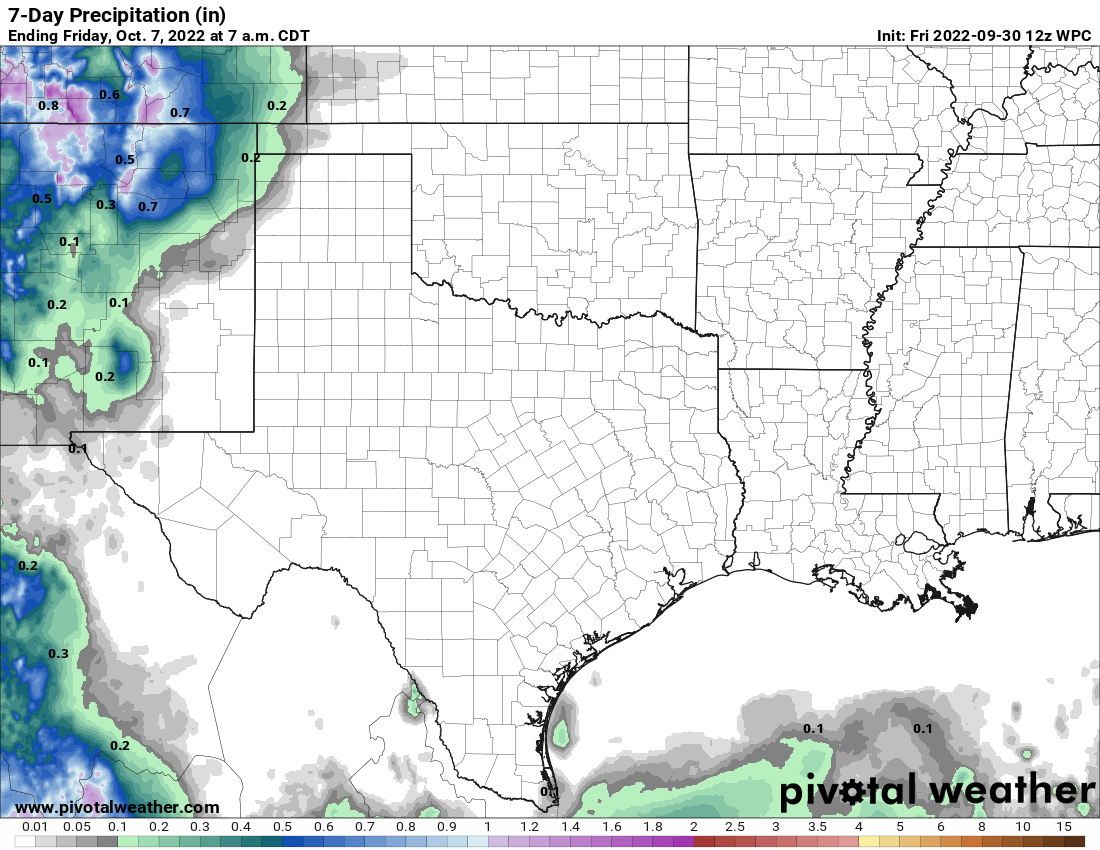
We’ll continue to see sunshine next week, but I am thinking there will be more high clouds to speak of, perhaps turning us mostly cloudy at times. A Pacific hurricane and some more upper-level moisture streaming across Mexico will likely spoil the blue skies. Unfortunately this won’t come with any beneficial rain it would seem, with most of it falling west of Texas.
In addition, we’ll slowly warm back up with highs in the upper-80s to low-90s and morning lows generally in the mid-60s.
Late next week
High pressure building across the Gulf from the Atlantic will allow us to warm up even a bit more later next week. Look for more 90s than 80s for a couple days I think. Our next front *may* get here next weekend, but it looks dry and weak right now, so I’m not optimistic that the dry weather and a late summer swoon will end. We shall see.
Tropics
As recovery efforts continue across Florida, Ian is approaching the coast of South Carolina this morning. It should make landfall later today likely near Georgetown, SC, between Charleston and Myrtle Beach. Ian reintensified into a hurricane yesterday as it moved offshore. It currently has a wide swath of tropical storm force winds and a small area of 75 to 85 mph winds near the center.
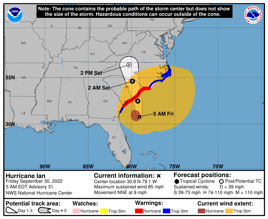
Notice how much wider the wind swath (orange) is than the cone (white) in the image above. It’s an important lesson in the limitations of the cone, as impacts can extend well outside the width of the cone. Whatever the case, here’s hoping Ian’s second act underachieves on the Carolina coast today and tomorrow.

What about the wave emerging off of Africa that has been upgraded to 60% chance to develop? Could this become a Gulf problem?
It’s gonna be awhile to see where it goes. long range forecasts can change where it ends up
It’s a longshot for Cape Verde storms to make it all the way west to the Gulf.
Troughs and cold fronts are more frequent so our season is well done for this year.
I am interested in attending the Fall Day but am not on FaceBook. Is there any other means of submitting my RSVP?
What in the world is going on? Drought and abnormal dryness cover 75% of the US now, and the next 2 weeks or so have almost no rain over a majority of the US.
Ever heard of climate change? Happening in real time apparently. Who would have thought?
Indeed- I remember in elementary school being taught that climate change would “probably” not begin or start being noticed until the 2050’s and that it would only get really bad around 2100.
I remember when I was in school, there was a big fear that a new ice age would soon be upon us, and many crops wouldn’t be able to grow, because there would be early freezing in many agricultural zones. Also, rivers and harbors would be frozen all winter.
While not a climate denier, I am agnostic on connecting climate change to specific events. Can you connect the dots from “climate change -> abnormally dry”. The US has had severe droughts long before the effects of CC could be argued.
I don’t believe there is such a thing as a climate denier. There are those that believe that the changes seen in the climate are minimally impacted by humans. They do not deny there is such a thing as climate.
I remember as a child we were going to run out of ground water by 2010 and Y2K and acid rain and hole in the ozone, I can keep going. Reflect on that.
CFCs were phased out of production in the mid-90s in order to halt the growing hole in the ozone layer, so it is a poor choice of support for the argument you seem to be making: in that case, humans changed their behavior to halt a growing threat to our planet. Reflect on that.
Changes were made to reduce our impact on all three of those. Funny that you don’t remember those too.
Matt, I know it’s not your fault, but I’ve always found it interesting the amount of effort required from meteorologist to explain that the cone is not the area of impact. It would seem to me that the national hurricane center needs a different method of communicating to the public? What are your thoughts on this?
Wow! You nailed it, landfall in Georgetown minutes ago. You ROCK!
I doubt if anyone knows where 1 Botanic Lane is, any chance of a map without going to Google?
It’s just south of 610, take I-45, exit at the Broadway exit (I think). I can’t make it to the event, but I have been wanting to see the Botanic Garden. Hummingbird season should be here, or at least starting soon–that period of late summer/early autumn when the hummingbirds are here before heading further south, until they get to the southern edge of their migration, after a short time, they turn right back around and begin heading north for breeding season. Amazing how these little birds can fly so far. They are migrating almost all the time.
Where is the rain? It is so dry!