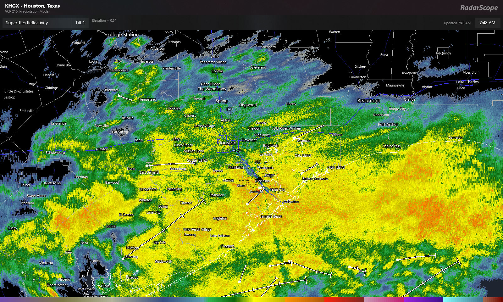
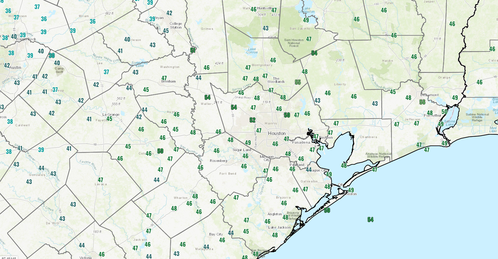
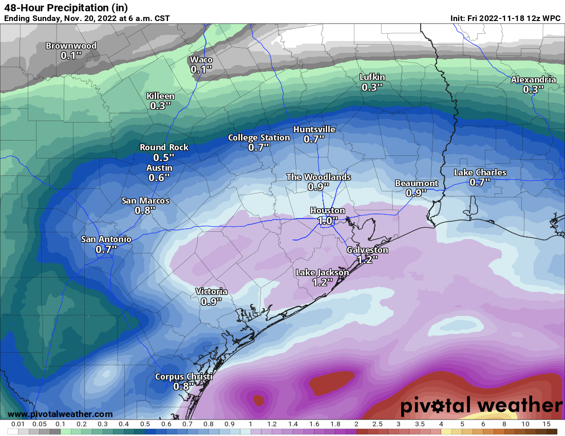
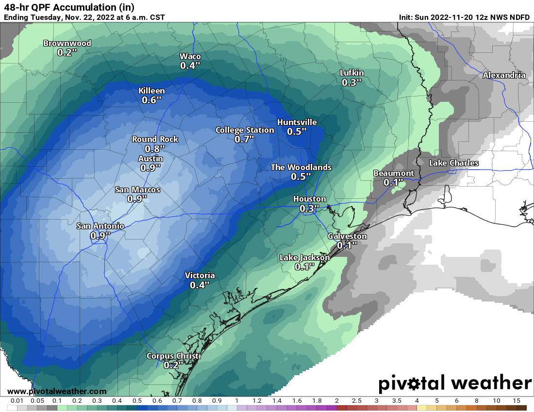
Yesterday didn’t disappoint from a forecast perspective. It pretty much went as expected. Rain totals ranged from around a half-inch to inch in Houston to around an inch and a half near the coast.

Your mileage may vary this morning, but the sun is out in force in my backyard, and it looks like many of us are enjoying a pleasant, albeit chilly morning! We will cling to this for a few hours before things begin to change. Again.
Fundraiser
We’re under 10 days left in our annual fundraiser, your one opportunity to directly support the site each year! The response has been amazing so far, and we are grateful to you all. You can click here to buy items. And if you don’t wish to purchase merchandise and just want make a contribution, click here and check the box that says “I’d like to make a donation only.” Thank you all so much!
Today and Monday
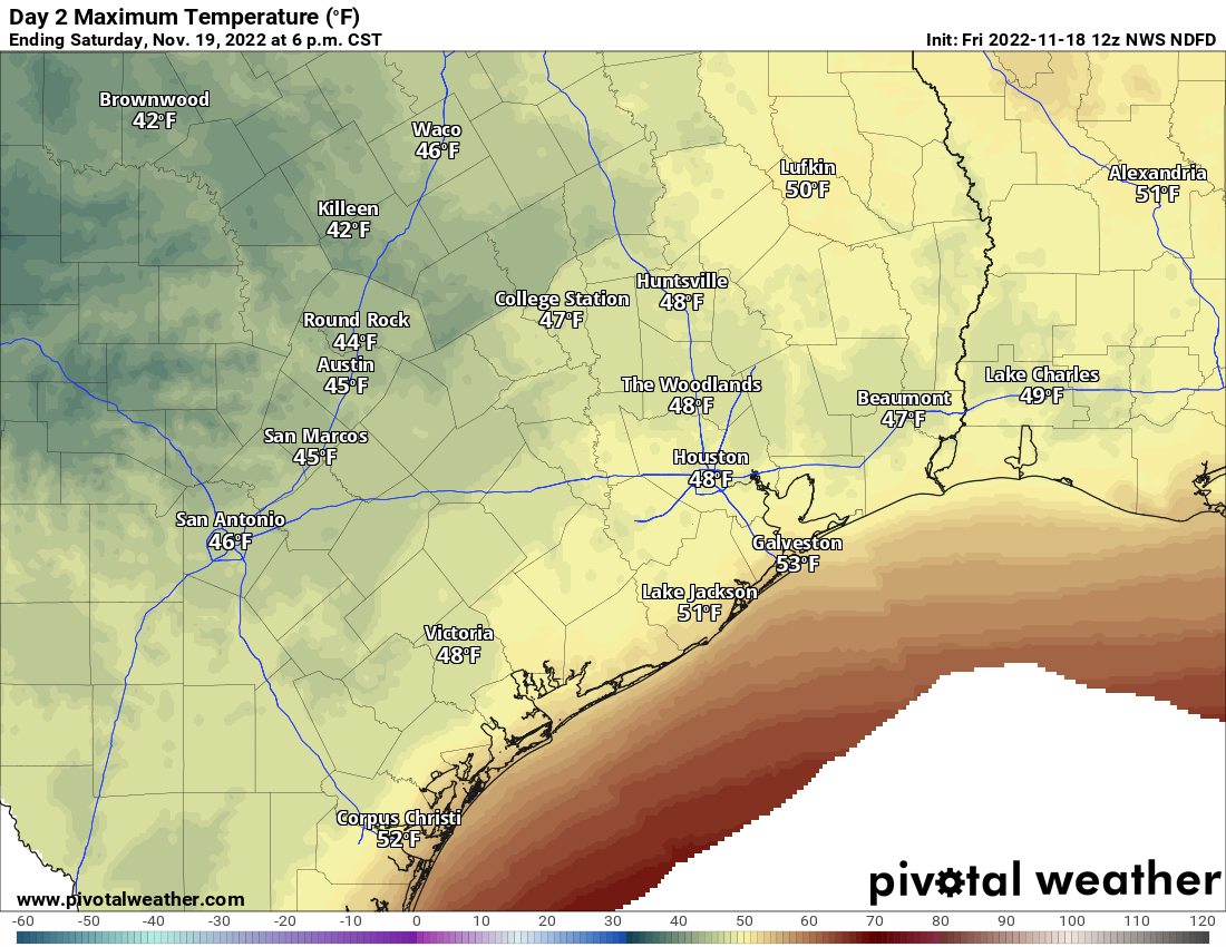
With many areas seeing sunshine this morning, it seems like it will be a nice front half of the day. As we go into the afternoon, clouds will begin to increase again. We are already seeing that creep into portions of Fort Bend, Wharton, and Brazoria Counties. Showers may begin to break out later today southwest of Houston. We should manage 50 to 55 or so this afternoon before temperatures are capped by increasing clouds. Areas southwest of Houston where clouds are already rolling in may not get above 50 degrees.
Rain will break out everywhere tonight. Periods of rain will be with us into much of Monday. The highest totals from this round may be north of Houston. That said, this rain looks as if it will be a little more sporadic in nature, so it may be truly “periods” of rain.
Rain showers should begin to taper off Monday evening and Tuesday morning.
Monday looks a lot like Saturday temperature-wise, with mid to upper-40s for most places at best.
Tuesday into the weekend
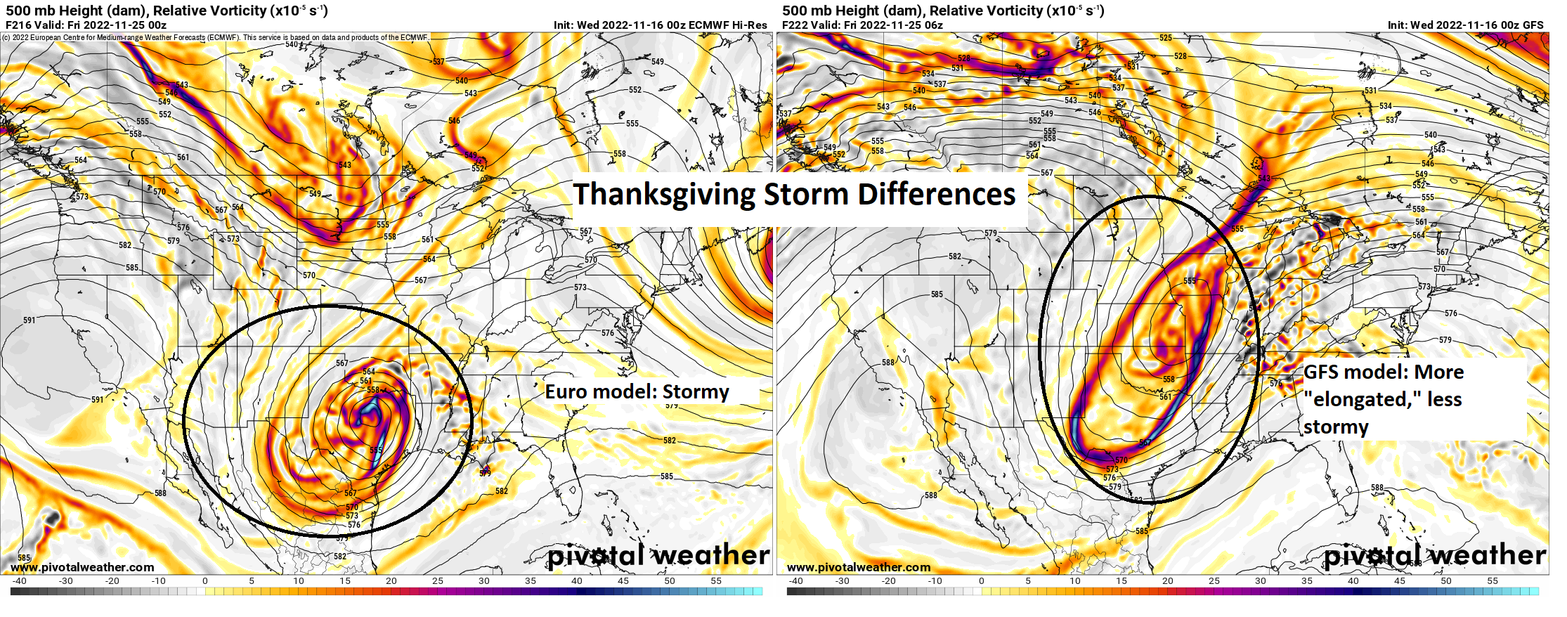
I think we’re beginning to get some decent clarity on this upcoming week. There are still questions about details regarding Thanksgiving itself, but our confidence is increasing for Wednesday and Friday.
Tuesday: Clouds, some sun, a shower possible. Morning lows 40s, daytime highs near 60.
Wednesday: Clouds, some sun, a passing shower possible. Morning lows upper-40s to near 50, daytime highs low or mid-60s.
Travel: We do not see any meaningful travel issues on Wednesday in Texas, Oklahoma, or Louisiana. Most major airport hubs look fine as well. Atlanta, Chicago, New York, DC, LA all look to be without major issues.
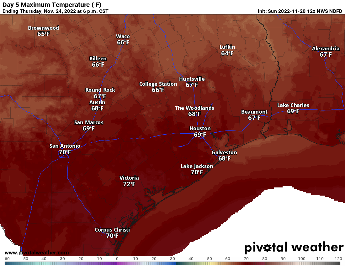
Thanksgiving Day: Clouds with a period of showers and storms possible. Exactly when & where is still TBD. Clearing late. Morning lows 50s, daytime highs upper-60s to near 70 degrees.
Friday: Sunny! Breezy to windy, however. Morning lows 40s, daytime highs around 60 degrees.
Eric will have a full update on things for you Monday. Go Texans!