In brief: As of 2 pm CT on Tuesday Tropical Storm Edouard has begun making landfall in extreme southwestern Louisiana, not far from Port Arthur and Beaumont. Houston will not see much in the way of winds and high seas, but what about rainfall?
Just a quick update this afternoon to provide some additional information on the status of Tropical Storm Edouard, which is coming ashore near the state line between Texas and Louisiana. Although Edouard has strengthened some today, it has remained a tropical storm rather than blossoming into a hurricane.
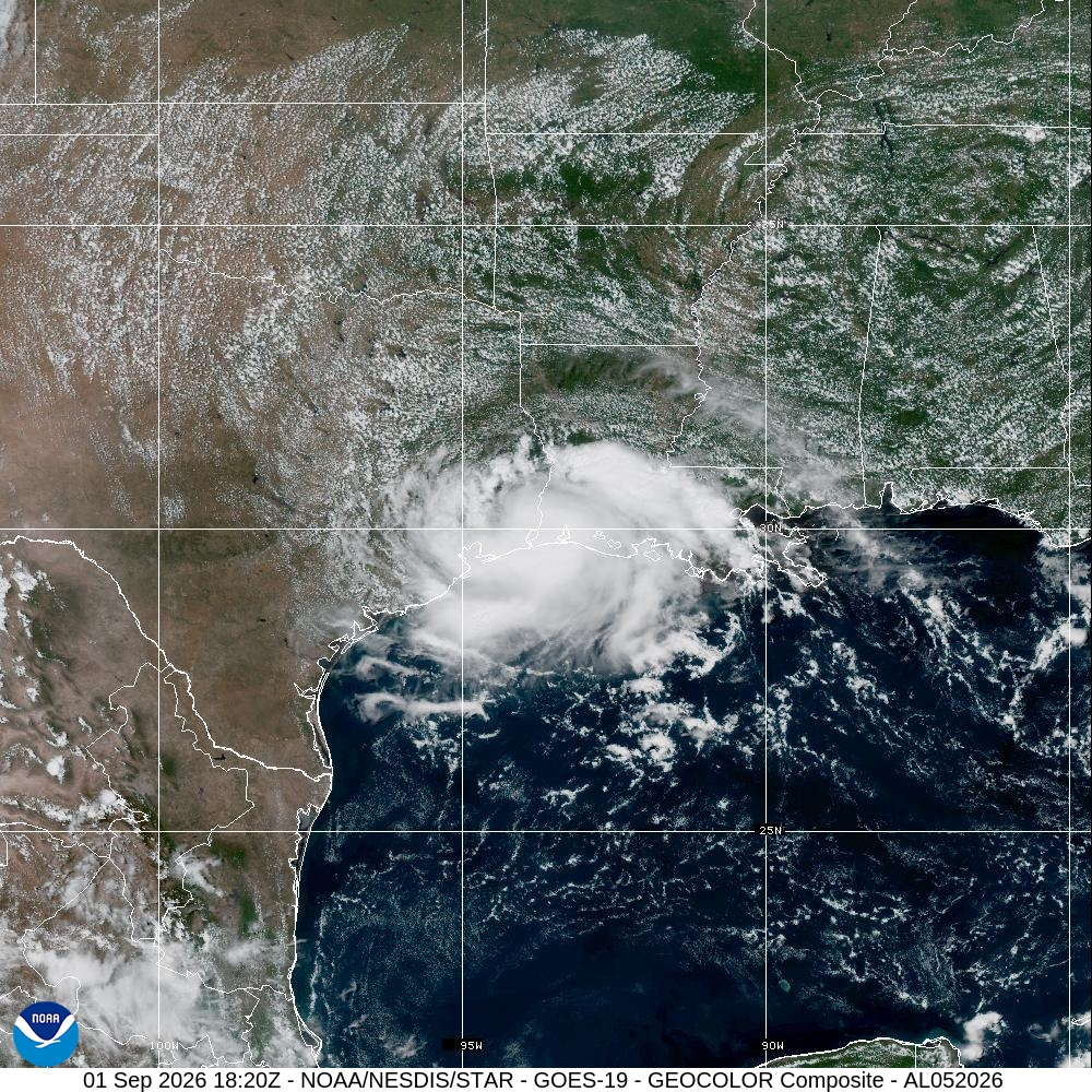
The storm is far enough away from the Houston metro area that direct impacts in our region (as we suggested on Monday evening) are minimal. Winds may turn a bit gusty this afternoon and evening, and seas along Galveston Island and Bolivar Peninsula may be a foot or two higher than normal at high tide. However, when one steps outside today it will not meaningfully feel like a tropical storm in Harris or surrounding counties.
So, is it going to rain?
This leaves us with rainfall potential. Our expectations for rain were never particularly high for areas west of Interstate 45, and now I am sorry to say—because let’s face it, after a long, hot, and dry August our soils are parched—our expectations for rain in these areas is even lower. Certainly we could still see some wrap-around showers over the next 24 to 36 hours, but significant relief is not coming for most locations.
For areas along and east of I-45 there still a good chance of at least some rainfall as a band or two moves through, particularly the further east you get, i.e. Baytown, Mont Belvieu, and into Chambers County. But even so I would not hope for much more than an inch or two of rainfall, and most locations may not even get even this. The best chance of rain may well come north of the Houston metro area, along and north Highway 105 in Montgomery County, near the center tonight.
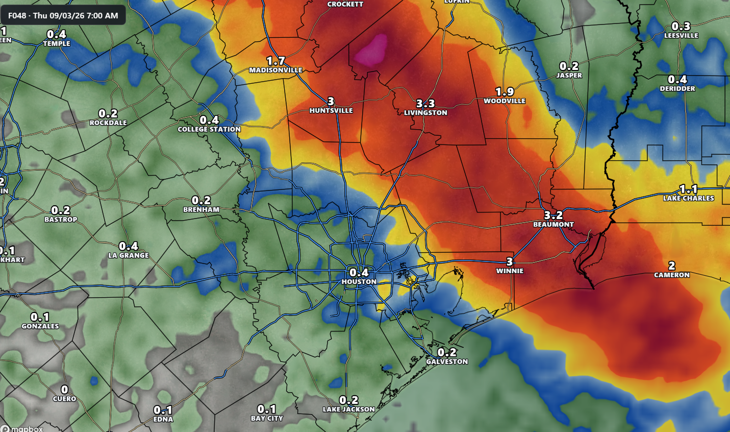
In any case, if you’ve been hoping for a good soaking from Edouard in Houston, I feel your pain. Ultimately the storm’s center just tracked too far to the east. Instead of making landfall on the Texas side of Port Arthur, it is doing so on the Louisiana side. That is going to end up pulling the most abundant moisture, and resulting rainfall, east of most Houston-area residents. Normally in this situation I’d say we should gang up and blame Matt, but he’s gone and moved to Connecticut, so I guess this one’s on me.
Our next update will come by or before 10 pm CT tonight.
