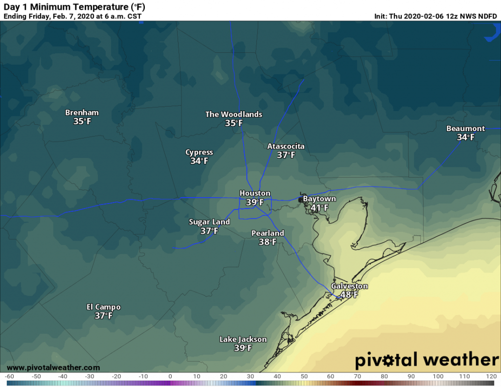
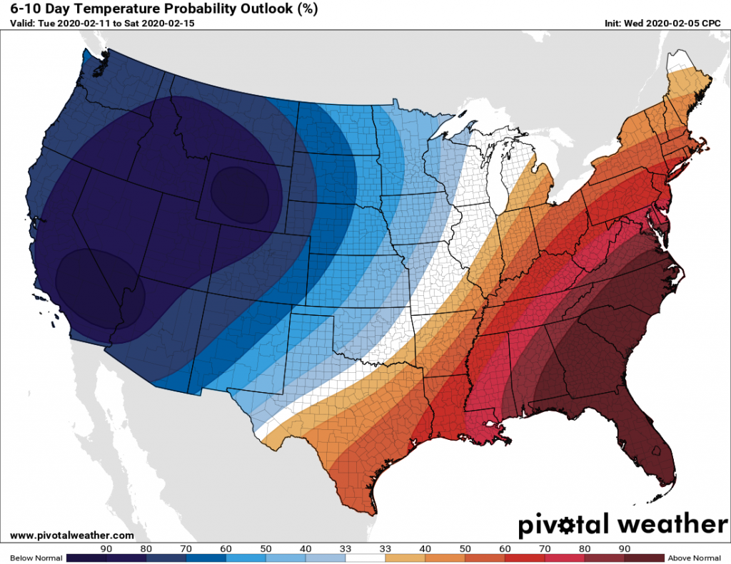
Temperatures have fallen into the mid- to upper-30s across most of the metro area this morning, with only areas immediately along the coast holding on to 40-degree readings. Clear skies tonight will allow for another chilly night before Houston warms up for the weekend. Most of next week looks unseasonably warm, likely with a string of nights in the 60s, and much of the rest of February will probably see above normal temperatures. Probably, this recent strong front represents the last gasp of truly cold air this season.
Thursday
Overcast skies this morning will begin to clear by or before noon, but a persistent northwest wind will continue to bring cold air into the region. This should limit high temperatures to about 50 degrees for most, with wind gusts above 20 mph making conditions feel cooler. Winds should die down somewhat overnight, and along with clear skies, this will help inland areas get down into the mid- to upper 30s again.

Friday
Onshore winds return Friday, but skies will be sunny all the same. Expect highs in the upper 60s to around 70 degrees with rather pleasant conditions. With the influence of southerly winds, lows on Friday night will likely only drop into the 50s for most of the area under mostly clear skies.
Saturday
The first half of the weekend will be pretty nice, with a mix of clouds and sunshine, and high temperatures working themselves up to around 70 degrees. As moisture levels increase, we can’t rule out a few scattered, light showers but for the most part, most of the region should remain dry. As clouds build further overnight, lows will only fall into the 50s for inland areas, and likely remain in the lows 60s right along the coast.
Sunday
Skies will be mostly cloudy on Sunday, with a slightly better (~30 percent) chance of light showers. Highs will likely get into the low- to mid-70s despite the clouds, and Sunday night will be warm in the 60s.

Next week
There is some question about the progression of a cool front on Sunday night or Monday morning, but the guess here is that it will stall near or over the Houston metro area. As a result, some inland areas may see somewhat cooler weather, but for the most part most of next week should be in the 70s, with lows in the 60s. The combination of favorable upper-level dynamics and surface moisture should lead to a fairly healthy chance of rain for most days next week, likely in the 40 to 60 percent chance through Thursday. I don’t think we’re looking at anything extreme, but expect gray skies next week, overall rain accumulations of 1 to 2 inches, and lots of muggy air. A cold front should finally arrive around Thursday night, hopefully bringing better conditions for next weekend.

Is this above average, warmer winter an ominous harbinger for hurricane season?
May be mistaken, but I believe there isn’t “ominous harbinger” for hurricane season after warmer than should be winter. Seems our biggest and baddest storms have come after colder winters (Alicia as an example, maybe Harvey too)
“Probably, this recent strong front represents the last gasp of truly cold air this season.” What?! C’mon, it’s February 6th! Noooooooooooo! /enters complete denial of what he knows is likely true/
Some of the longer range models still have cold outbreaks reaching us but this is probably one of the last few times, especially for high temperatures. As the days get longer, even if we start out in the 30s its unlikely will remain in the 40s or 50s like we are this time. And remember it could be a lot worse – we still have a good solid 2-3 months of semi comfortable weather before the miserable summer heat arrives.
My neighborhood’s covered in a rust colored dust. Anyone know where that came from?
I noticed it in the Heights.
I believe that is dust from the panhandle of our state…
Same near Lake Houston….Would like to hear the explanation for this as well. thanks
NWS is saying central and south Texas. Wind blew it up into the clouds which then rained on us.
Eric…..With such a cold upper level low….We had thunder around midnight BTW, why didn’t precip over us turn to snow as if began falling….
Disappointing news. Not looking forward to another year of high-density mosquito populations. Wish we’d gotten some real hard freezes in to help control their population.
I thought the spelling was “wintry”; guess I was out in the cold….r