Winter returns to Houston today as a cold front has pushed through most of the region already this morning. We’ll see much colder temperatures for sure. In addition, we might have some wintry weather overnight while most of us are sleeping. It will not amount to anything that would impact travel overnight or during Thursday morning’s commute, but nevertheless we will discuss it in today’s post.
Today
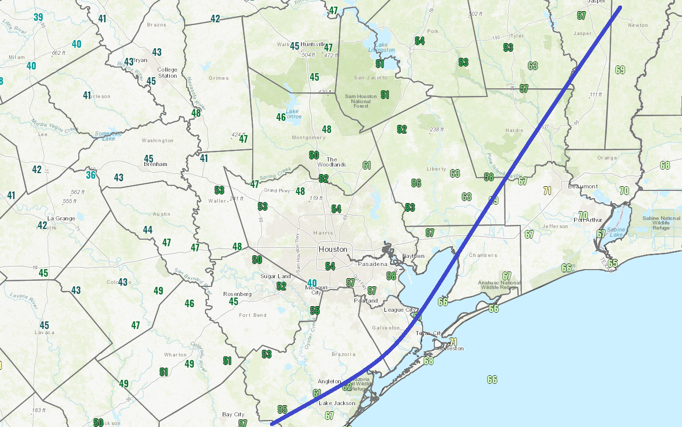
The cold front is now through about 80 to 90 percent of the region. Temperatures have fallen into the 40s out near Katy and Rosenberg and up toward Lake Conroe. We’re in the mid 50s in Houston proper.
Coastal areas that are still in the 60s or even near 70 will see the front arrive over the next couple hours. The Port Arthur area may have to wait until late morning or Noon for the front to swing through.
Temperatures will settle into the 40s and 50s. Because of the early frontal passage, we may see temperatures level out or warm back to the mid 50s this afternoon before resuming their fall tonight. Look for a northwesterly breeze as well to keep it feeling a bit colder.
It has been mostly dry so far. Scattered showers should develop this morning, especially from Houston east and south. I think the quicker timing of the front is out of sync with what we need in the upper atmosphere to get showers and storms going, and that’s why this system is going to disappoint in the rain department overall.Otherwise it will be overcast to mostly cloudy today.
Tonight
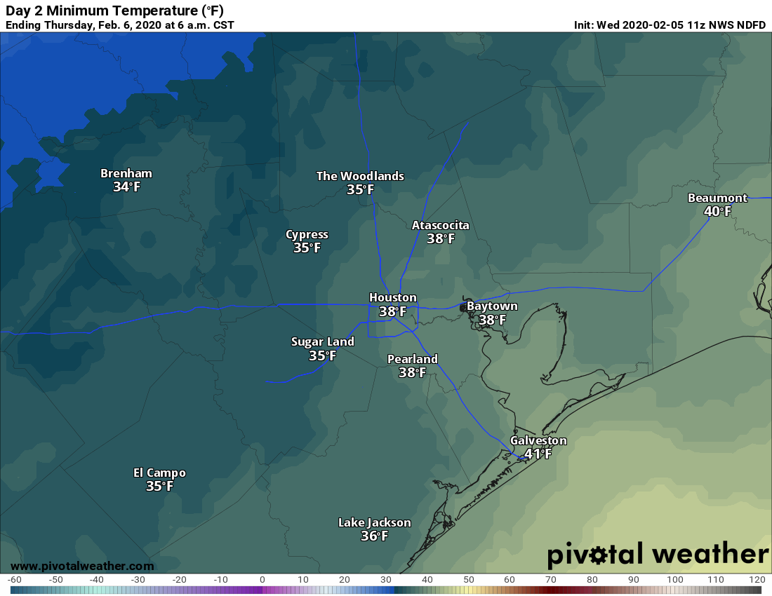
The back edge of this system is going to swing through the area overnight. As it does so, it may have just enough moisture to work with to squeeze out some precipitation. And with temperatures falling into the 30s across the area, it may be just cold enough to allow for rain showers to mix with ice pellets (sleet) or snow. Again, impacts are unlikely from this, but since it would be such a novelty to see snow in Houston, it’s worth discussing more in depth.
As I wrote yesterday, the exact details of winter weather scenarios in the Southern Plains are inherently difficult to nail down (a topic for another post). For this event, we have high confidence in timing (roughly midnight through 6 AM) and a lack of direct travel impacts. We have somewhat lower confidence in what exactly will fall from the sky.

The maps above show three different higher resolution weather models and what they predict radar will look like at Midnight tonight. The Texas Tech WRF (top left) and HRRR (bottom) both are rather uninspired, meaning any precip would be light and even the risk of mixing well north of Houston would be pretty low. The NAM model (top right) is a bit more aggressive, which could yield a mix of rain and sleet or snow north of Houston, possibly even into some of our northwest suburbs when the precipitation falls at a heavier rate. Both subsets of models here seem realistically possible, given the condition of the atmosphere tonight. If there’s not enough moisture, you get the first scenario, but if we can overcome that sufficiently, you get the second scenario. It will be interesting to watch the progress of these models through the day today to see which outcome seems more likely.
Either way, accumulation is not expected from this and neither are any tangible impacts. If this changes for some reason today, we’ll update you. Regardless, who am I kidding? I’ll probably be up at 2 AM looking out the window.
Overnight lows will fall into the low or mid 30s north and west of Houston, while it should be in the upper 30s in the city and elsewhere away from the coast.
Quick reminder: A good old fashioned winter storm is underway in West Texas with winter storm warnings from Marfa through Midland into Wichita Falls and up to Oklahoma City today. Visit the National Weather Service for the latest forecast information, and visit DriveTexas.org if you are planning to travel northwest of the Houston region today or tonight.

Thursday
Skies should clear out Thursday morning or early afternoon, and although it will still be cool and breezy, Thursday should end up a fairly nice winter day. Look for highs in the low 50s.
Friday
Glorious. Sunshine and highs in the 60s after a cool start in the 40s with light winds.
Weekend
We should begin Saturday a good bit warmer than Friday, with morning lows only bottoming in the 50s. From there, it should warm into the 60s, if not near 70 degrees. A weak cold front may or may not get to Houston in the morning. A shower is possible but it should otherwise be partly to mostly sunny. Assuming the front falters before arriving, Saturday night should see lows in the 50s again. We would be 5 to 10 degrees cooler if that front could make it to Houston or the coast though.
Regardless of Saturday’s story, Sunday should see onshore flow kick back into high gear. Humidity will rise, and a couple showers may occur, particularly south or west of Houston. High temperatures will peak in the 60s. Overall, it should be an okay weekend, but the edge goes to Saturday right now. Beyond this, it looks like another warm period is on the way to start next week.
What are the chances for snow/ accumulating snow in Austin tonight?
Very, very, very, very low. I would not be expecting accumulation there.
I saw that the NWS says there could be half an inch of snow in Austin as of their most recent update. Is there any sign of the moisture increasing tonight more than originally thought?
What are the atmospheric similarities between tonight’s forecast and the surprise snow of dec 17? I can’t help but remember that the chances of ‘a few flakes possible’ were very low and yet we ended up getting almost 2″ here in Tomball! I’m holding out hope for more surprises!
That’s a good question. There are similarities to that event in that what is coming through here has a lot of “lift” with it…in other words, it’s an aggressive system. What I think we’re missing is colder weather than we had in ’17 and maybe a bit less moisture too. So I don’t think the end result will be similar. Anecdotally: I started getting excited about Dec 17 about 18 hours before it began. We’re about there now and I’m not excited yet ha.
Matt – Are you sure it hit 80 yesterday? Where I work it was cloudy all day and when I left for home it was 74F according to the of course super-accurate car thermometer.
82° Westheimer Wilcrest area yesterday
Well, not everyone hit 80, but IAH did officially. Hobby hit 79. Close enough.
You know you have an enthusiastic meteorologist when he tells you he’ll be up at 2AM looking for some snowflakes!
I doubt that there will be any snow; highs in the 50s and lows perhaps in the 30s is not what I call “cold,” and is about normal for winter in Houston. I just don’t like the crazy swings in temperature. Nevertheless, this winter has been normal to above normal temperatures and I like that.
Any weather buffs who (like me) track weather internationally, that good old fashioned West Texas winter storm is gonna get picked up by a vicious jet stream, spun up into a quite spectacular low that’ll hit Ireland and the UK at the end of the weekend. They’ve named it storm Ciara and for us Brits that don’t usually see any extreme weather, it’ll be an eye opener.
Greetings from here in Oxfordshire.
Our granddaughter is taking a course at one of the colleges at Oxford. Greetings from here in The Woodlands TX.