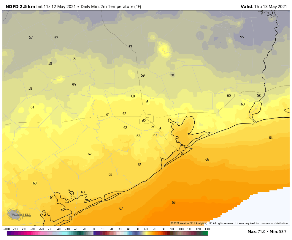
Good morning. The cool front and its associated showers—which truly were hit and miss—have moved through the area during the overnight hours. This will set the stage for some slightly drier weather and sunny skies until Saturday night, when rain chances return to the area. This front isn’t packing too much oomph, but it is mid-May after all. And this may be the last real front of the season, so enjoy the nights and mornings.
Wednesday
Most of the storms associated with the frontal passage have moved offshore, but we could see a few lingering showers this morning. Otherwise, skies will eventually transition from mostly cloudy to perhaps partly sunny this afternoon as winds blow from the north. Gusts could reach about 20 mph. Highs will generally reach into the mid-70s today, with overnight lows falling into the low 60s across Houston.
Thursday and Friday
These will be a pair of partly to mostly sunny days, with highs in the upper 70s to 80 degrees. Nights will be cool, rather than cold, but the moderately drier air will still feel pretty good. Even coastal areas will see some drier air, although its effects will be muted.
Saturday
The onshore flow should resume some time on Friday, and this will begin to produce a few clouds. I still expect Saturday to have some sunshine, as highs get into the low 80s. Some rain showers will be possible later in the afternoon or evening, but I suspect these will hold off until the overnight hours. Saturday night will be warmer with the southerly flow, likely only dropping to around 70 degrees.
Sunday
Better rain chances arrive on Sunday, as the atmosphere turns a bit more disturbed. Accumulations don’t look too great, with perhaps a few tenths of an inch of rain for most areas. Highs should range from the low- to mid-80s across Houston, with a bit of sunshine when it’s not raining.
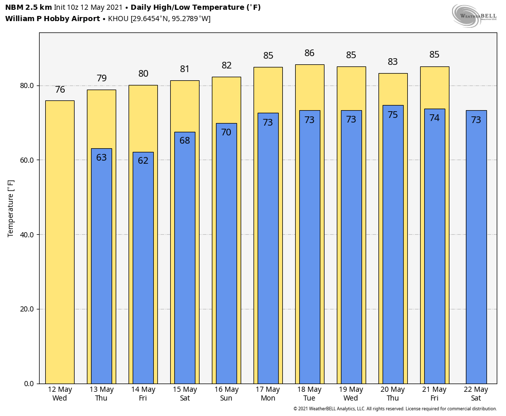
Next week
Overall, next week should yield warmish, cloudy weather, with highs in the 80s and lows in the 70s. I don’t have a great feel on when rainfall chances will be highest, but forecast models indicate the week could be fairly wet with a few inches of accumulation. Details, as one might expect, are fairly hazy at this point.
The storms last night truly were hit and miss. Looking at the radar, rain was heading our way and dissipated before it got here, then new storms formed southeast. I was very disappointed, haha.
It was just the right temperature when taking out the trash this morning. Too bad we can’t keep it stuck right here for about 3 weeks.
I can’t remember May in Houston being this cold. I wonder if this is due to the solar minimum?