Our forecast is going to be very hot, with heat advisories likely needed through the weekend. Before jumping into the details, such as they are, I wanted to say a word about Hurricane Ike.
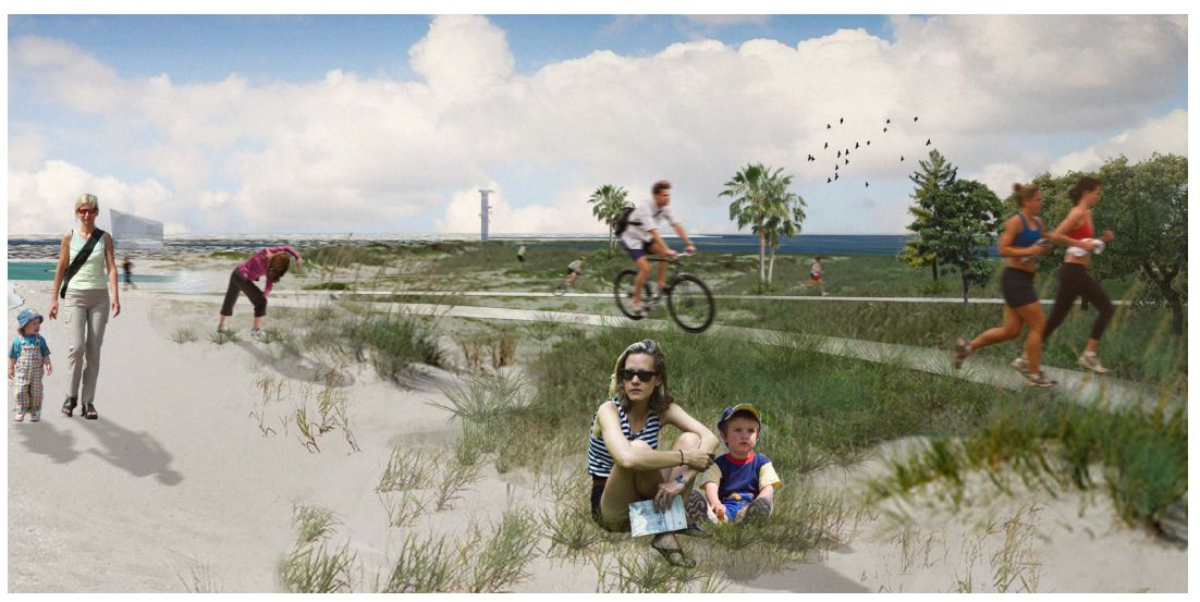
We are, amazingly, coming up on the 12th anniversary of Hurricane Ike. If you don’t remember, the storm hit Houston fairly hard, but made landfall just far enough east of Galveston that the worst of its storm surge missed Galveston Bay. It represented an enormous wake-up call for the region in terms of vulnerability of coastal residents, as well as the Houston Ship Channel. Unfortunately, while we have studied the problem in depth, we have yet to commit to any major projects that would address the threat and mitigate surge. There are two main proposals: A Coastal Spine Project led by the U.S. Army Corps of Engineers and the General Land Office, and an astonishingly beautiful Galveston Bay Park that would protect the Houston Ship Channel from a 25-foot storm surge.
While we certainly realize that America and Texas have a lot of other problems to deal with at present, it is time to pick one, or both, of these projects to move forward with for the good of the greater Houston region. Otherwise, we may not get so lucky with the next large hurricane that makes landfall along the upper Texas coast.
Thursday
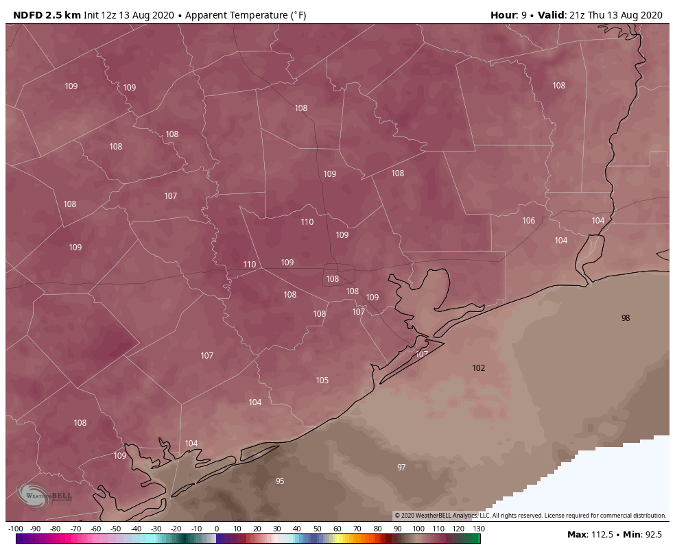
Houston’s high temperature hit 101 degrees on Wednesday at Bush Intercontinental Airport, and we can probably expect more of the same today with mostly sunny skies. The National Weather Service has issued a heat advisory for now through Friday evening, and in truth it probably will be extended through the weekend as high pressure continues to influence our weather. Southwest winds of 5 mph will provide very little cooling today. Nights will remain sticky and warm.
Friday, Saturday, and Sunday
More. Of. The. Same. It’s probably worth mentioning that we could see a few isolated showers pop up during the afternoon, with daytime heating. I’d sure welcome one, but it seems a forlorn hope at this point.
Next week
The heat should back off somewhat by Tuesday, as some sort of weak cool front approaches the area. We still don’t have great confidence in how far this front will reach, but it should help to increase rain chances by Monday night or Tuesday, and then knock back daytime highs into the low- or mid-90s. We’d love to get some dry air to help with nighttime temperatures, but I’m not ready to bet on that yet.

These projects won’t get done because it won’t help politicians get elected or profit from it.
As someone who has spent almost his entire career working on the Ship Channel, I ask people to consider the environmental disaster that could ensue by a 25 foot storm surge not only on the Ship Channel but the San Jacinto river where there are several old waste pits and two Superfund sites.
Man, it is a slap in the face to see that 12 years have passed since Hurricane Ike. That was a true mess for the Houston area.
And, what have we to show for all of the promises? Nothing on the bigger fix. As a lifelong Houstonian, I’m not pinning my hope on these since talk and planning happen but no actual start. We’ll just have another Ike, Allison, and Harvey in the meantime.
I don’t mean to sound glum but it is a fact of living on the Gulf Coast/Houston. We pride ourselves on rugged individualism and this is a perfect case: every man is out for themselves using flood insurance and jacking up their homes to offset a community failure to act.
So very true….I have been here off and on, since 1940, and, while times change a good deal of same ole same ole continues. Potholes (chugholes) continue but skeeters we seem to have conquered (along with lightning bugs, sadly).
I’ll play devil’s advocate here. We’ve had a history of much worse rainfall totals than storm surge historically. Ike as a near miss is still a miss. When we’re having so much trouble protecting ourselves from the more regular storms, there’s a big as for money for both volume and surge mitigation.
I’d be much more willing to talk improvements to our existing reservoirs, buying out homes that are deep in the floodplain that can’t afford to sell as no one wants a home that floods often, increased drainage, stream restoration of our major creeks, etc. We could spend the same amount here and help a large amount of people far more often.
That said, sure, I agree we need something to protect surge. The time it finally happens, it will be bad. Ideally I’d like to put more of the burden to pay for it come from the industries that most benefit from the protection. Yes, petrochemicals may not be at their strongest right now, but when we talk storm surge, we’re talking about protecting those plants and the pollution that will come from them.
We just do a terrible job of saving for those emergency situations, much less prepping for it.
All great points, nothing I’ve seen to date on surge would have done a thing for Claudette, Allison or Harvey. In fact it can be argued that current proposals would have made these events worse by slowing down water trying to exit the bay.
Had a good rain yesterday, in the late afternoon/early evening, at about 6:30, with a rainbow, and then a moderate to heavy shower for about 20 minutes.
I sure remember Ike, but how come you bring up the projects now?
Ditto! the rain was amazing – felt so good! I was outside at the Menil.
I remember Ike as well. I sat in the garage…re-reading Lonesome Dove for the 4th time, smoking and waving to the folk who had to get out in the weather. Wish I hadn’t been smoking as I pay the price now w/ COPD. 🙁
Eric & Matt… This question may be a bit out of your range, but my hometown in Iowa just experienced a “land hurricane” with sustained winds of 100 mph (Cedar Rapids)… how does a “land hurricane” happen in the Mid west with no way to look at possible upcoming storms like we do in the gulf? In all my years there (most of my life here) I have never seen/heard anything like this…. can you elaborate a bit on that?
Try Googling “land hurricane”.
I believe they are called “derechos” and while not common, they happen. https://www.spc.noaa.gov/misc/AbtDerechos/derechofacts.htm
“Land hurricane” is a term someone created to sound like a cool way to describe a “derecho,” as another posted commented. We usually see one or two every year or two somewhere in the U.S., not just the Midwest. The one that hit Iowa this week was exceptional and very rare in how strong it was and how large it was. A derecho is a cluster of thunderstorms like you’d normally see in spring or summer anywhere. But what sets it apart from a normal cluster of storms is that it hits a very large geographic area with damaging winds. Sometimes it’s widespread 60 or 70 mph winds, which can also do significant damage. But the Iowa/Illinois one had widespread 70 to 100 mph winds, which makes the damage worse. Exactly how it works is difficult to explain in a single comment, but it’s basically the same processes that create damaging thunderstorm winds anywhere, just over a larger area. So it has nothing to do with tropics or a hurricane at all.
Any seawall that helps one area will trash adjacent areas. Move to Oklahoma if you are worried about hurricanes.
Traditionally, Houston is hit by a major hurricane every ten years. The Houston area has about seven more years to add one of two or two of two major projects. In the meantime, the Houston area will be built up more with roads used as drainage into the Gulf replacing vegetation used as my guess is as kind of natural sponges absorbing the excess water.
Traditionally, Houston is hit by a major hurricane once every ten years. In the meantime, the Houston area has about seven years to build one of two or both projects. In the meantime, the Houston area will be built up with roads as drainage instead of vegetation used as a natural sponges.