The weather story for this week continues to be the potential for heavy rainfall late tonight through Thursday morning, with subsequently clearing skies and really quite nice weather for Easter weekend. Let’s jump into the timing for this week’s storms.
Tuesday daytime
Temperatures are very warm this morning for late March, with lows only dropping into the low 70s. Even with mostly cloudy skies, we can expect high temperatures today to rise into the lower 80s. And while there will probably be some scattered showers later this afternoon, I think we’re probably going to have to wait until Tuesday night for the heavier rain to begin.
Tuesday night through Wednesday
A slow-moving cold front will be part of a large area of disturbed weather moving toward the greater Houston area tonight, and right now it appears as though any heavier showers probably won’t reach the metro region until after midnight. The general expectation remains 1 to 3 inches of rainfall for most people, with isolated, higher totals possible through the day on Wednesday.
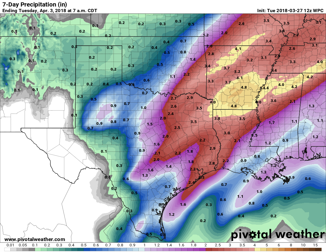

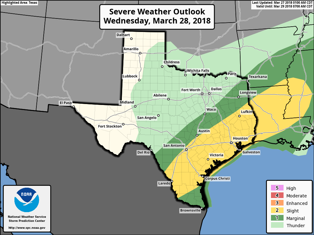
Although we are not going to over-hype this—the ingredients right now just don’t seem to be there for really sustained, very heavy rains that produce flooding—things could get somewhat messy on Wednesday, with intermittent heavy rainfall, and the potential for hail, damaging winds, and perhaps a few tornadoes. It won’t be that way for everybody, but just take some extra care if venturing out into storms. Obviously, we’ll also be keeping tabs on the situation and update as warranted.
Thursday
Most of the available model guidance shows the rainfall ending from west to east beginning Wednesday night through Thursday morning. Skies will probably remain mostly cloudy for most of the day, with highs of around 80 degrees, before drier air and cooler temperatures arrive later in the afternoon and evening hours.
Friday and Saturday
Both of these days look stellar, with highs in the upper 70s to 80 degrees, dry air, sunny skies, and cooler nights falling into the 50s for inland areas, and 60s closer to the coast.
Easter Sunday
We’ll be a bit warmer by Easter, and a little more humid as the onshore flow returns to the area, but conditions still should be quite nice. I’m calling for partly to mostly sunny skies, with high temperatures in the low 80s for most of Houston. Rain chances remain near zero.
Thanks for everything you guys do! Keep up the great work.
Are there specific areas that are more likely candidates for the hail, damaging winds, and potential tornadoes?
Thanks, guys.
Is there any potential for severe weather over night or is that something we won’t have to worry about until Wednesday morning/afternoon?
Thanks
So Tuesday into Wednesday instead of Wednesday into Thursday, all of the news stations are saying Wednesday into Thursday?
The city of Houston seems VERY concerned, as I’ve gotten two AlertHouston emails today since this post was published. However they could just be communicating out of an abundance of caution.
We issued an AlertHouston for the potential, and a few hours later, the NWS issued the Flash Flood Watch, so we updated the information with an additional alert. We’re watching the system, but not overreacting. We’re putting things into place in case we need to bring more resources to bear, like high water trucks. This system will likely cause some street flooding, and increases on bayous, streams and creeks. Updates will be posted at houstonemergency.org – Michael (City of Houston OEM)
Thanks Michael!
Good to see crossover between here and your outreach effort.