Good morning. Not going to lie, the intensity of storms on Monday surprised me. First, some areas northwest of Houston saw as much as 6 inches of rainfall. Then, early on Monday evening parts of Austin County—only about 60 miles west of Houston—saw about 10 inches in a short period of time. So it’s with more than a little trepidation that I approach the forecast today.
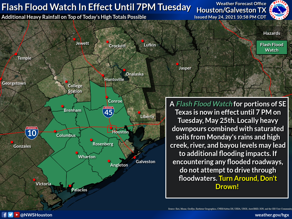
Generally, we should see fairly calm conditions this morning, with storm coverage increasing this afternoon as temperatures warm. A flash flood watch is in effect for central and western parts of our region due to the potential for additional heavy rainfall today.
Tuesday
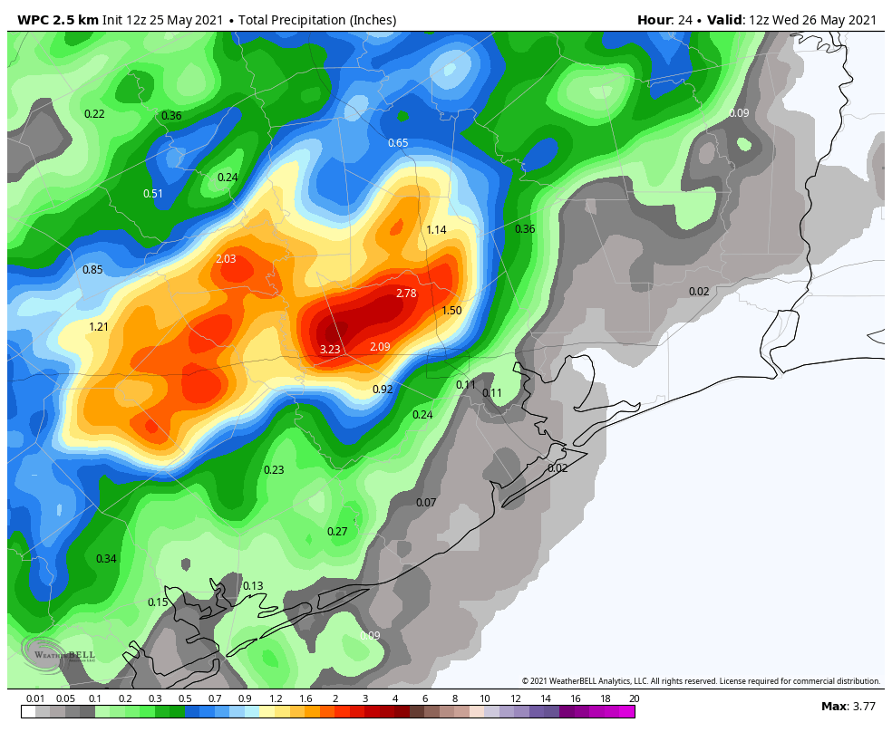
The atmosphere remains plenty moist to support heavy rainfall today, particularly north and west of the Highway 59/Interstate 69 corridor. This includes the particularly hard hit areas of Austin County. In this general area we are likely to see widespread accumulations of 1 to 3 inches today, with higher isolated totals approaching 5 inches. Given the sodden soils well west of Houston, this could cause some problems both on roadways and along swollen creeks. These storms are likely to develop after noon, and wane during the evening as the sun begins to set. Highs will otherwise be about 80 degrees.
Wednesday
Atmospheric moisture levels should begin to fall on Wednesday, and accordingly we expect much less coverage of showers, and less intensity where rain does fall. Overall, perhaps 30 percent of the area will see rain on Wednesday, with highs reaching perhaps the mid-80s. Skies remain partly to mostly cloudy.
Thursday and Friday
As high pressure continues to build over the area, we expect these to be mostly sunny days, with highs in the mid- to upper-80s. This should allow for the region to begin to dry out.
Saturday, Sunday and Memorial Day
Let’s start with the fact that we have questions about the weekend forecast. It will be complicated by an approaching, weak front that appears likely to stall out just north of Houston. Skies will probably start out at least partly cloudy on Saturday, and depending on the movement of the front, areas north of Interstate 10 could see some scattered showers during the afternoon and evening hours. These may even spread across the entire region. Not helpful, I know.
Sunday’s weather will also depend on the front’s position, but there is a better chance for more sunshine on Sunday. Both days should produce highs in the upper 80s. Memorial Day will probably fall on the partly to mostly sunny side of things, but overall confidence is low. Sorry, I know everyone has weekend plans, and would like some certainty.
Personally, I’m going to interpret this as “soggy and will continue to be soggy unless directed otherwise, along with good chance for being very wet”. That should cover everything. Ha ha ha!
One can hope for a dry(er) June.
Hang in there guys! It’s been a rough forecast week or so but dependably boring forecasts are right around the corner.
Am I crazy that I’m hoping for the drought to come back….?
If this continued rain means the Gulf is letting off energy gradually, rather than one (or two or three or more) big release sometime in July through September, then let it rain!
Is Houston weather forecasting still hampered by lack of nearby regular weather balloon launches? Thanks for all of your work – your information is so helpful.
I think it will always be the case just about anywhere. But it is quite bizarre that the HGX office doesn’t launch the twice daily radiosonde. Especially the case when trying to forecast on the mesoscale, where increased data sampling of the local environment is crucial. I mean, this is the resolution of the NWS radiosonde network:
https://www.weather.gov/upperair/nws_upper
Having lived and studied meteorology in the Pac NW, it gets quite challenging forecasting for the Puget Sound area when you consider that to your west is the wide open expanse of the Pacific Ocean. So you’re heavily reliant on ship, aircraft, and buoy data, which is sparse to say the least, and satellite data. Oh, and one balloon launch out on the coast. People would have greater appreciation for the challenges of forecasting if they truly understood the factors involved in producing them.
Those of us who had been bending God’s ear to end drought in Texas are asking for Oregon now.
Any chance we’ll get to see the eclipse in the morning?
Was wondering that myself.
In Pinehurst, Texas which is just NW of Tomball we’ve measured a little more than 7” over the past week.
This has been a great week. I feel bad for those directly impacted by the rain but for the most part it has been a very beneficial rain event. Up to this point I have had only 2″ since Jan 1.
And, as a bonus, all this has been happening around full moon so I do not feel cheated out of my astronomy time!