In brief: We are going to have two splendid, sunny days ahead of the weekend, when we may see some fairly widespread showers on Sunday across the Houston region. In today’s post we also offer a way, way too early forecast for the week of Thanksgiving.
Thanksgiving
We are just starting to come within the outer limits of our forecast models for the week of Thanksgiving, and the holiday itself, which comes in just two weeks’ time. In the coming of days we will experience a couple of fronts, but by the middle of next week we should see high pressure holding sway. This will push daytime temperatures into the upper 70s, probably, with mild nights in the 60s.
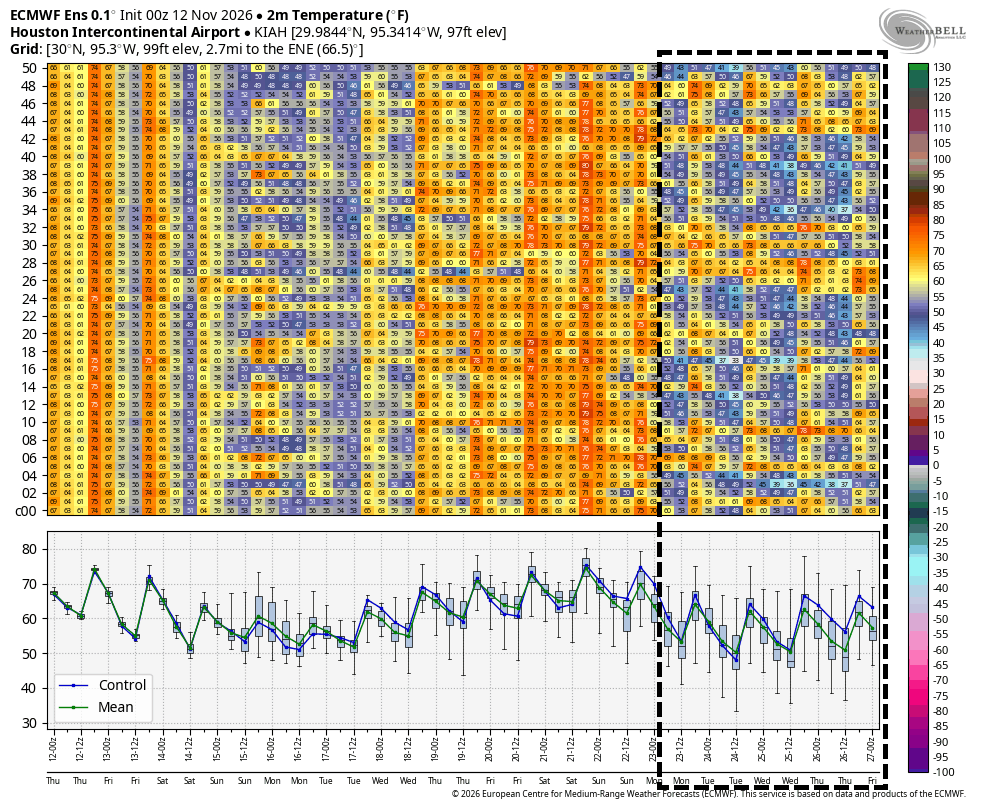
About 10 days from now, the most likely outcome is that the region experiences another, somewhat stronger cold front. This would set the stage for a cooler Thanksgiving week, with nights in the 50s or possibly 40s, which would be our coldest nights of the season. This cooler weather would probably persist into Thanksgiving Day (highs in the 60s?), providing a festive feeling for the holiday. As for rain chances, it’s all a little too fuzzy at this point.
Should we feel confident in this forecast? Given that it’s so far out, probably not too much. But there is decent agreement across the ensembles of several models, so I think it’s a reasonable possibility. Or who knows, maybe this forecast ends up looking like it was written by turkeys.
Speaking of giving thanks
Our annual fundraiser remains ongoing. Your support via donations or merchandise purchases really does help out tremendously. Thank you to everyone who has given generously so far!
Thursday and Friday
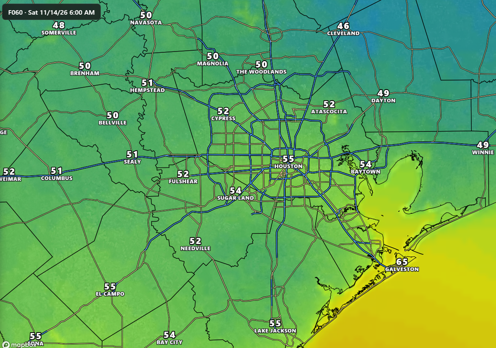
We’ve been saying for awhile these two days are going to be splendid, and Mother Nature is indeed delivering. With a weak front moving in overnight, we are going to enjoy drier air, sunny skies, and highs in the 70s. Overnight lows will be in the low- to mid-50s in Houston, with cooler conditions for outlying areas. Really, it does not get much better than this.
Saturday
This should also be a pleasant fall day, with highs in the upper 60s to around 70 degrees, with partly to mostly sunny skies. However during the daytime on Saturday we’ll start to see increasing southerly winds, gusting up to 20 or 25 mph. This is one sign of increasing atmospheric moisture levels, which will set the stage for rain showers. These may begin on Saturday night, but more likely on Sunday morning.
Sunday
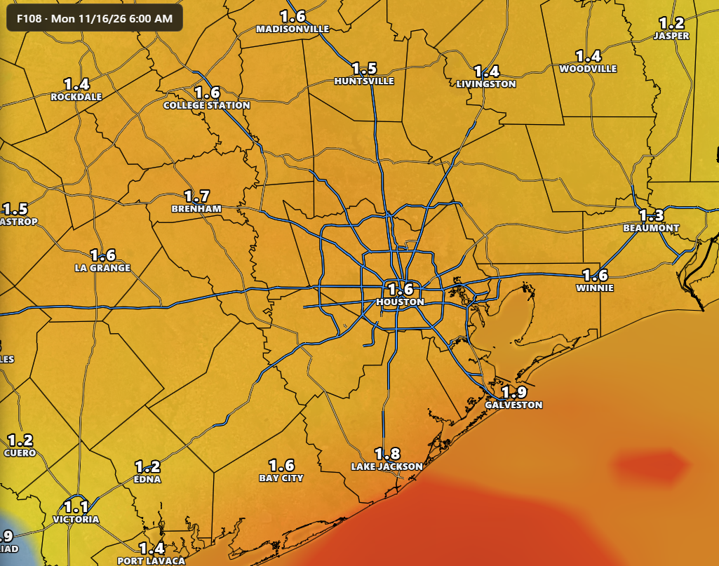
We are likely to see widespread showers on Sunday with the approach of a cold front from the northwest. Showers will be most likely during the afternoon, probably, but could occur throughout the day. I expect much of the region to pick up 1 to 2 inches of rainfall, although at this point I do not believe we will see much, if any, severe weather. Highs on Sunday will be in the mid-70s, before the arrival of the front later on Sunday or Sunday night pushes temperatures into the 50s by Monday morning.
Next week
With high pressure in place after the front, we should see highs in the 60s to start next week with partly sunny skies. Eventually, during the second half of next week, we should see the aforementioned warming trend with highs pushing into the 70s, and possibly upper 70s. And then we’re getting close to the week of Thanksgiving, which we discussed at the outset of today’s post.
