In brief: Houston may be turning the corner in terms of rainfall as winter approaches. Another storm system this weekend is likely to douse much of the area with a fair bit of rain Sunday, and more may be on the horizon. Along with the rain, some chilly weather too.
Fundraiser
Thank you to those who have participated in our annual fundraiser each year. As Eric noted earlier this week when we launched the 2026 edition, we keep this deliberately limited to November for the holidays and avoid asking for money during hurricane season. Your support greatly helps in keeping the site and especially the app current! I have been floored by how many little things go into making an app functional and current. The site is live here.
Without fail we always get some complaints from folks that they just want to make a donation and can’t quite figure out how. It’s definitely a little less intuitive than we’d like, but it’s part of the deal. So! If that’s what you’d prefer to do, we explain on the fundraiser page, but here’s a quick outline.
1.) Click this link.
2.) There’s a little checkbox at the top that says “I’d like to make a donation only.” Click that, and the shirt will disappear.
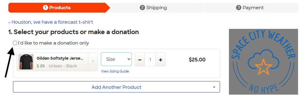
3.) Choose your amount and the details they ask for.
4.) Click continue at the bottom, and it should take you to the checkout process.
However you choose to support us, be it by reading, buying merch, spreading the word (please keep spreading the word!), or donating, we are grateful to all of you for keeping this enterprise flying high for the last 11 years. Thank you!!
Onward.
Turning the rainfall corner?
While the weather is truly lovely at present, we have seen some rain this week, and we are likely to see more this weekend. So, are we turning a corner? The answer is maybe. We can assess this by looking at the forecast of accumlated precipitation over the next couple weeks from the 51 member European ensemble model.
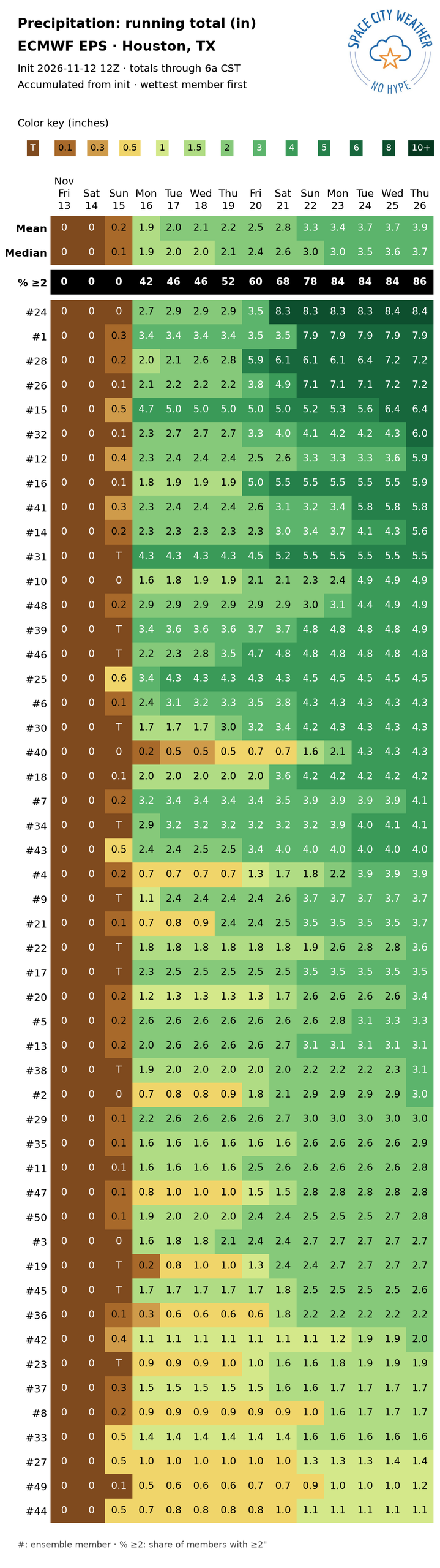
You can see a couple things. First, almost all of the ensemble members are forecasting a good bit of rain in Houston this weekend. Yes, you have a couple that show 0.5 to 0.8″ only, but most settle in at over an inch, with many close to 2 inches. But beyond that, there are a good number of ensemble members that bring in another shot of rain later next week and some that include more rain late next weekend or early on Thanksgiving week. I recall a few comments from folks lambasting the hype over the El Niño as providing false hope for rain. While we may not be getting soaked constantly this winter, we will likely get our share of storms and rain and hopefully push out drought once again.
Today
Just another absolute gem of a day. Highs in the low 70s with sunshine and low humidity. Enjoy!
Saturday
Tomorrow should start out lovely once again, with lows in the 50s. As the day progresses, it will turn cloudy, however. Highs should only make the mid 60s because of that, and we will pick up a bit of an east wind around 10 to 20 mph.
Sunday
The weather gets more interesting on Sunday. As an upper level storm system digs into the Texas Panhandle, it will help fire up rain and thunderstorms out ahead of it across interior Texas. By later Sunday morning those storms will be knocking on the doorstep of the Houston area. As this system moves through, a pretty potent little surface low pressure system is going to develop off the coast.
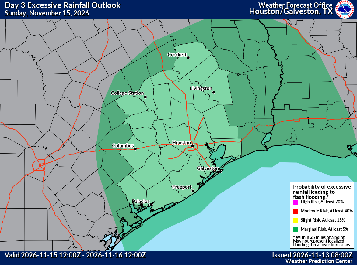
This means periods of rain, heavy at times on Sunday, along with thunderstorms. While we do not expect much severe weather, some storms near the coast could be on the stronger side with gusty winds. Those areas are highlighted in a marginal severe weather risk as well (level 1/5). Regardless, it seems likely that Galveston Island may see 30 to 35 mph gusts late Sunday into Monday behind the storm and front. Expect Sunday to be a rather nasty day.
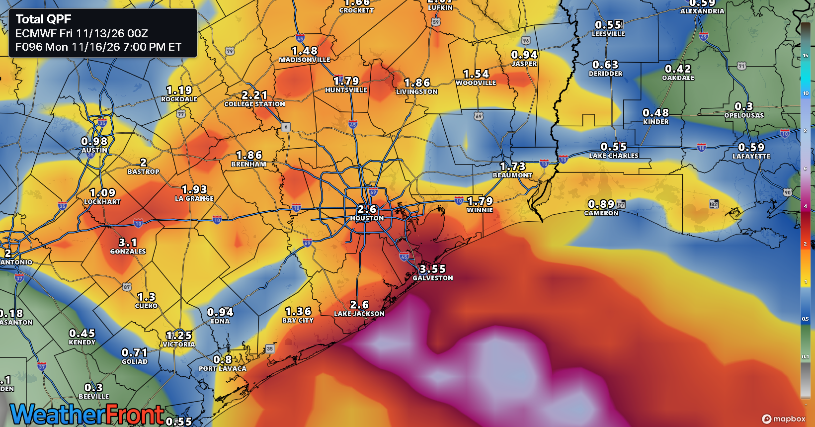
In terms of open questions: How much rain falls, and is it worse in the morning or afternoon? Right now it seems like the entire area will see 0.5 to 2.5 inches of rain, with highest amounts near the coast. But this could change. I expect Eric will chime in with an update tomorrow for the latest on this storm and to see if we need to push out a Stage 1 flood alert.
Early next week
As the storm passes east of the are on Monday, clouds and some showers may be left behind, along with a cool northeast wind. We may struggle to get above 60 degrees Monday, with temps in the mid to upper 50s most of the day. Things should clear a bit on Tuesday, allowing for sunshine and a return to 60s.
Later next week
Additional rounds of rain are possible later next week along with more cloud cover. Temperatures should rebound some into the 70s, along with a bit more humidity. A relatively active weather pattern seems to be settling in across the Southern U.S., typical for strong El Niño late autumns.
