After what seems like months of build-up, speculation and watching, Tropical Storm Hermine has finally formed in the Gulf of Mexico. The system still looks somewhat ragged, but its wind speeds have come up, and there’s now the potential for further development before it nears the Florida coast in about 36 hours.
The system has gotten a lot of hype for a mere tropical storm. Part of this is because about a week ago the respected European model really showed strong development (which hasn’t occurred yet), and the fact that it has been nearly three years since a hurricane formed or passed through the Gulf of Mexico. And while this system, formerly known as Invest 99L and Tropical Depression Nine, has been subject to some derision it now should be taken seriously—not only by Florida but much of the east US coast.
Right now this is a big tropical storm, with tropical-storm force winds out to about 100 miles from its center. Those winds may well intensify as the storm has the potential to strengthen into a Category 1 hurricane before landfall, although this is far from certain. Hermine also is both a rain (10-15 inches for some locations of Florida is possible) and surge threat to the west coast of Florida. The National Hurricane Center has these threats covered in its rainfall and storm surge products.
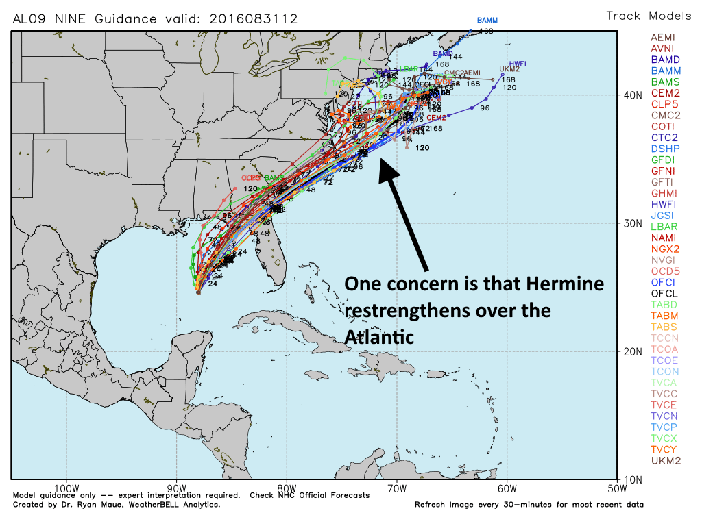
One of the big questions concerning Hermine is what happens after it makes landfall. Along the storm’s more or less northeasterly track it could bring heavy rains to coastal areas of Georgia and the Carolinas. Both the GFS and European model now indicate the storm may have an opportunity to restrengthen over the Atlantic, after moving off the Carolinas. In this scenario, a wobbling Hermine might bring a very wet and windy Sunday and Monday during the Labor Day holiday, and beyond, for some areas between North Carolina and Boston. Steering currents don’t appear to be very strong which could allow the storm to stall just offshore.
Texas won’t see any direct effects from Hermine, but the system should help usher some northeasterly winds into Texas by Friday or so. This will make for some moderately pleasant (for early September) evenings this weekend.
Beyond Hermine additional tropical system development is likely across the Atlantic basin during the next week or 10 days, but there are no immediate (or short-term, even) threats to the Gulf of Mexico.
Looks like the “BAMM” model decided to join the others and gave up its predicted motion to the lower Texas coast!
“Beyond Hermine additional tropical system development is likely across the Atlantic basin during the next week or 10 days, but there are no immediate (or short-term, even) threats to the Gulf of Mexico. ”
The CMC/GEM has a hurricane slamming into Texas on Sept 10, Eric.
And I would not give this a second thought at this time.