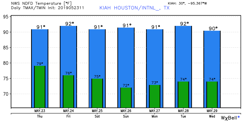
The story for the remainder of May will be building heat, the absence of rain, and lots and lots of sunshine. This isn’t full-on summer with highs in the mid- to upper-90s, but it’s darn close. We haven’t really experienced this kind of sustained heat in eight or nine months, so be sure and take care during any outdoor activities.
Thursday
The atmosphere may be able to squeeze out a few isolated showers today, especially to the southwest of the Houston area, but for the most part this will be a dry day today. A wind advisory will remain in effect along the coast, with gusts up to 30 mph. Otherwise, we can expect a partly sunny day with high temperatures of about 90 degrees.
Friday
This day will be a lot like Thursday, albeit with slightly lesser winds and rain chances near zero.

Memorial Day Weekend
Not much to say as high pressure exerts control over our weather. Look for lots of sunshine, with highs in the low 90s, and overnight low temperatures in the mid-70s.
Next week
The Memorial Day weekend pattern of mostly sunny skies and hot days will persist through much of next week. A slight chance of afternoon showers, likely due to the sea breeze, may creep back into the forecast by Tuesday or Wednesday. Forecast models are showing some slightly better rain chances by Thursday or Friday as the ridge of high pressure weakens somewhat. We shall see.

You know the weather is starting to get nasty in Houston when I am actually looking forward to a business trip to Cleveland next month!
I hope that this wind stops soon. It has been steady wind all week long. Makes my TV reception not so good and makes it hard to ride a bicycle to work every day. Also now I heard about a new, fearsome storm. The wedge cyclone which struck in Missouri. It is wider than it is tall.
I say y’all should take the weekend off but keep an eye on the weather ‘just in case’. We know how some things can surprise us. I am glad to have a 3 day weekend ahead…..and AC.
At some point might you describe ozone action days?