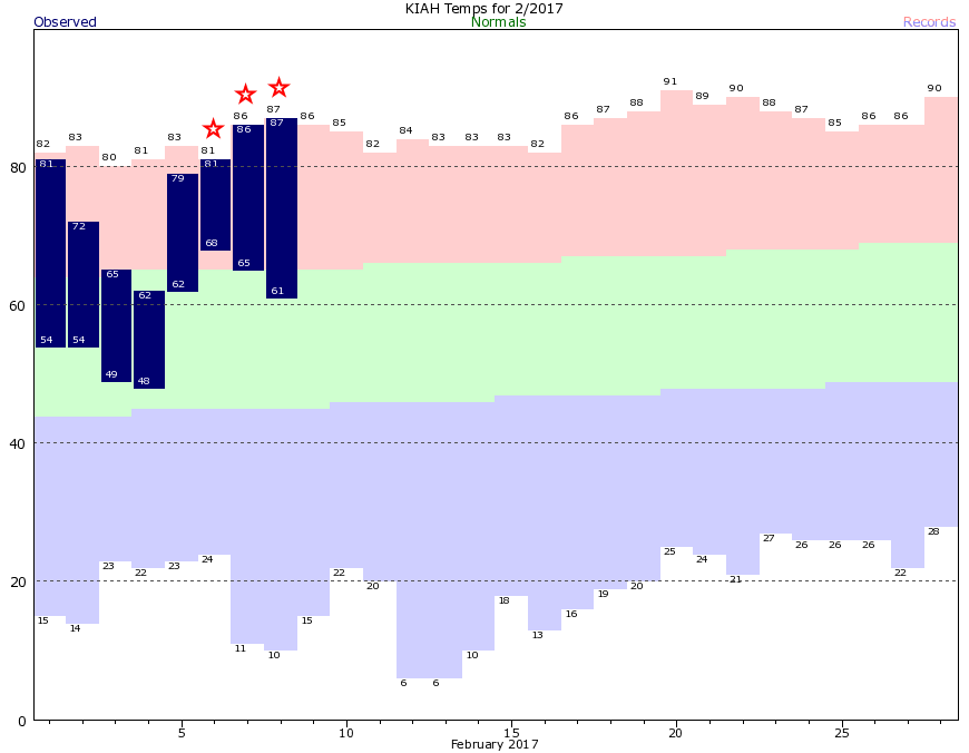
What start to the week it has been—three consecutive 80-degree days, and three record highs. Overnight lows, too, have been anomalously warm. Here’s what that looks like in graphical form, with this month’s temperatures plotted against normal levels.

After a cold front the region will see a bit of a reprieve from the heat, but we’ll warm back up this weekend before more seasonable temperatures return next week.
Today
After a cold front moved through on Wednesday, conditions for Thursday will be splendid. Highs should reach into the upper 60s with mostly sunny skies. Lows tonight will fall into the low 50s for most of Houston.
Friday
After a cool start, Friday will warm into the low- to mid-70s as winds begin to swing out of the southeast. This should allow for some clouds to return as well.
Saturday and Sunday
As the onshore flow resumes the region should see a partly sunny weekend, with highs in the upper 70s—some areas will probably hit 80 degrees if it stays sunny enough during the afternoon hours. Beginning on Friday night there will be enough moisture to squeeze out a few scattered showers throughout the weekend, but accumulations should be very slight.
(Space City Weather is sponsored this month by Darrell Lee’s The Gravitational Leap)
Monday and Tuesday
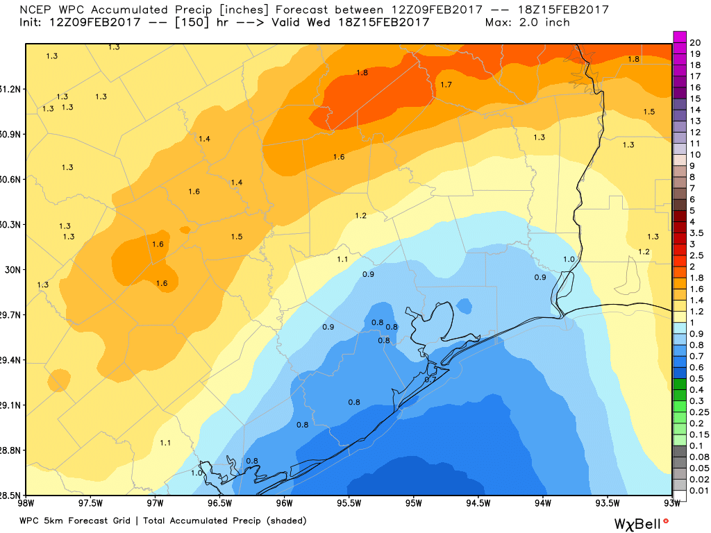
As a cold front sweeps down across the United States and into Texas on Sunday, it will begin to bring better rain chances into the region by Sunday night and Monday. I think the most likely scenario is that of intermittent light-to-moderate rainfall for Monday and Tuesday, with most areas seeing perhaps 1 to 2 inches of rainfall in total. It probably won’t be a washout. At the same time the front itself will likely move through late on Monday, or on Tuesday, bringing colder air into the region.

Wednesday and beyond
Depending on how fast the storm systems move through, rain chances may continue into Wednesday, but at some point the front will finally move beyond the area and the rest of next week and weekend looks seasonably pleasant, with highs around the upper 60s, and lows in the 40s and 50s.
Posted at 6:50am CT on Thursday by Eric
There’s already pollen covering my car… in early February!
Two days ago, the azaleas are starting to pop/bloom.
That’s a great graphic on temperatures. Puts very much in perspective where are recent temps have been compared to normals. Seems ridiculously hot right now, but I can see it was mostly in the high side of the box, with just a few poke outs. Good data representation, thanks.