Today’s the day. Yesterday was more of a false start than anything. We had a modest cloud deck that just setup shop overhead on Thursday, causing temperatures to stay in the 30s all afternoon once more. Today, regardless of clouds, we will finally leave the frigid weather behind this afternoon. But that does come with some rain chances.
Today
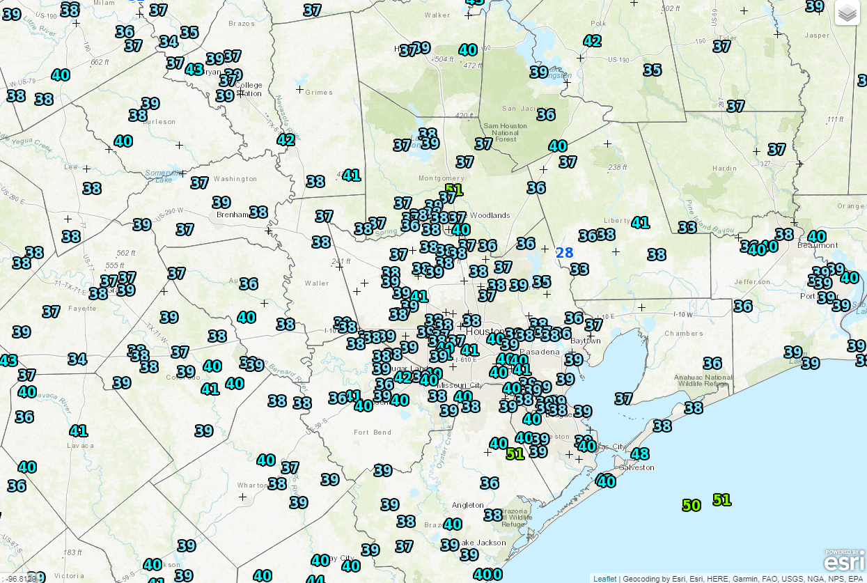
It’s starting off cold once again this morning, but not nearly like we’ve seen. Officially, we didn’t get below the mid-30s overnight. And the entire region is pretty uniform this morning, averaging between 35 and 40 degrees as of 6 AM.
Clouds are firmly entrenched over the area, which has helped keep temperatures above freezing just about everywhere. These clouds will continue to hold firm today. Meanwhile, a system off the coast will bring scattered showers to the area through the day. El Campo and Bay City are already seeing some of that this morning. They will spread north as the morning goes on. The odds for rain will diminish as you head north and west of Houston however. So in this scenario, rain is more likely in League City than, say, Hempstead. Included with the rain will be a slight chance for thunderstorms near the coast. Nothing serious, but don’t be shocked if you hear some thunder in Galveston or south toward Matagorda Bay.
Rainfall amounts should average about a quarter of an inch south of I-10 and east of US-59 south of Houston. A few isolated spots could see a half-inch or so. North and west of Houston, most areas will see a tenth of an inch, give or take through Saturday morning. Temperatures today will need some encouragement, but they should top off in the lower or middle 50s by later this afternoon.
Weekend
Saturday should feature mostly cloudy skies with a slight shower chance. Most of us probably stay dry Saturday, but there could be a brief shower at virtually any point during the day anywhere in the region. That chance continues Saturday night and it may increase a bit during the day Sunday. On Sunday night, a cold front will sweep through the region, bringing a short period of showers and a chance of thunderstorms, especially along and north of I-10. Total precipitation this weekend will vary, averaging around a quarter to half-inch of rain in most spots; some could see a bit more, some a bit less.
But break out the shorts, as temperatures will feel downright warm (only being half sarcastic). Look for Saturday morning to start in the low-50s, warming into the upper-60s to around 70° Saturday afternoon, maybe even a bit warmer in spots. Sunday starts in the upper-50s to low-60s and warms into the lower or middle 70s!

Another thing you’ll likely notice at times this weekend is fog. Look for periods of dense fog at the coast and around area bays. Water temperatures at the entrance to Galveston Bay are frigid.
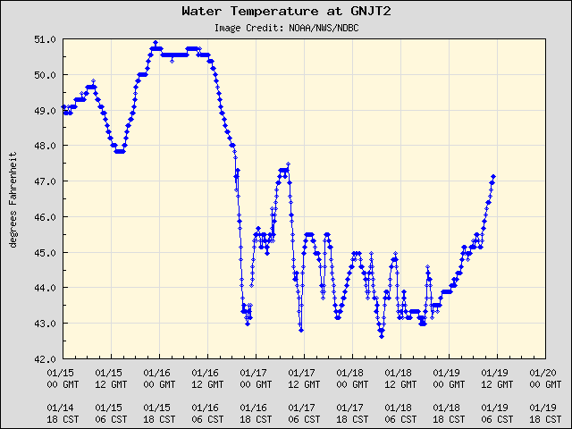
We’re up to 47° as of this morning, but we had been as cold as 42-43° earlier in the week. As 70 degree air temperatures and high dewpoints (humidity) move across these colder waters, that’s a perfect recipe for some locally dense fog. Keep that in mind if you’re planning to go southeast of Houston this weekend. The fog will end behind Sunday night’s cold front.
Next Week
Behind Sunday night’s cold front it will turn cooler once more, but this will be nothing like what we’ve just experienced. This is more of a traditional South Texas winter cold shot. We’ll see lows in the upper-30s to low-40s Monday night and Tuesday night, with high temperatures probably in the low-60s both days. It should be pleasant and sunny to start the week.
We’ll likely warm back up fairly significantly later next week, with more 70s possible, along with a couple rain chances. There are some signs that another strong shot of cold (though not quite to the extent of this recent one) may be in the offing again by next weekend or a bit beyond. It’s too early to get too specific, but I’m thinking 30s will be making at least a few more visits to the Houston area this winter after early next week. This winter has been something else. More on this next week.
Thanks so much, Matt.
I gotta say, I’m not looking forward to the 70’s. It’s nice to have the ice gone, but 70’s is just too hot for winter for me. We’ll have enough warm to go around March through October. But, I can’t change the weather! If I could it’d be 40’s all winter!
Thanks again for the updates.
One good thing about this winter, no constant stream of record high (80°+) temperatures like the past two winters
Finally – – – Warmer than Fairbanks, Alaska, where it was a “sultry” 5 F this morning! Then they get a “high” of MINUS 21 F on Monday.
Loving this winter. Houston is too hot and humid way to much. This reprieve is welcome.
Amen! Would be better, though, if this city wasn’t so easily paralyzed by a minimal amount of sleet. At least our being “weather weenies” gave my relatives a good laugh- though at our expense.
I saw a damn lizard running around outside yesterday AND THE DAY BEFORE THERE WAS ICE ON THE GROUND. Welcome to Houston.