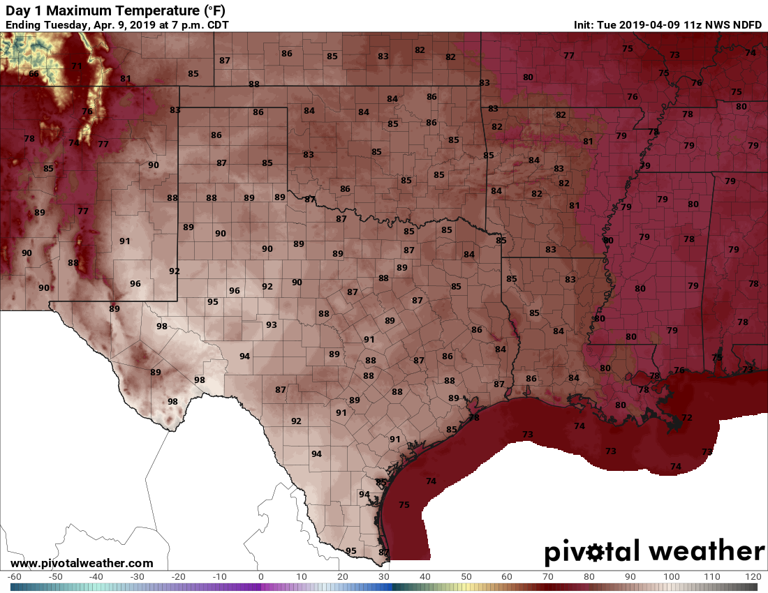
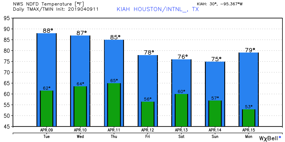
Houston’s temperature last reached 90 degrees way back on October 14, 2018. Since then, 177 days have passed—nearly half a year. However, our string of sub-90 degree weather may soon be at an end. High resolution models indicate that both Tuesday and Wednesday (less likely) have a chance of hitting the 90-degree mark at Bush Intercontinental Airport and other parts of the city. The odds are probably a bit less than 50-50, but definitely non-zero. Cooler weather lies beyond.

Tuesday
With sunny skies, somewhat dry air, and light winds, conditions will be ideal for heating today, and so most of the region should see the upper-80s. We are already at a time when the Sun is high enough in the sky—it reaches an angle 68 degrees today, about the same as Labor Day weekend—to fairly quickly cause sunburns so please remember that if you’re outside for extended periods of time this week. Lows tonight will fall into the 60s.
Wednesday and Thursday
By Wednesday morning, a fairly robust onshore flow should kick in. While skies will remain mostly sunny, this mixing in of more moisture will help moderate temperatures somewhat, probably making for slightly cooler days in the mid- to upper-80s. By Thursday evening, a weak cool front should slide into the region (likely a dry front) bringing a cooler night in the upper 50s for inland areas, and 60s near the coast.
Friday
In the wake of Thursday’s front, Friday looks seasonably pleasant, with highs around 80 degrees and partly to mostly sunny skies.
Saturday and Sunday
In yesterday’s post, we talked about the potential for another round of storms this weekend, and that’s still a possibility. But for now, the dynamics for severe weather and heavier rain look a bit more favorable to the east of us, over Louisiana. At the very least I think the region can still expect some rain, especially on Saturday, but we can’t have much specificity yet. We’re also still monitoring for the potential for more storms.

Saturday probably will be a partly to mostly cloudy affair, with highs in the 70s, and rain chances north of 50 percent. After a front moves through, I’m hopeful we may see some clearing later on Sunday, which has the potential to turn into a pretty nice afternoon at least. Hopefully we’ll have some better details for you tomorrow. The early part of next week looks great, with sunny skies and 70s.

90s ?!?!?!?! NO NO NO NO!!!!!! NOT AGAIN !!!!