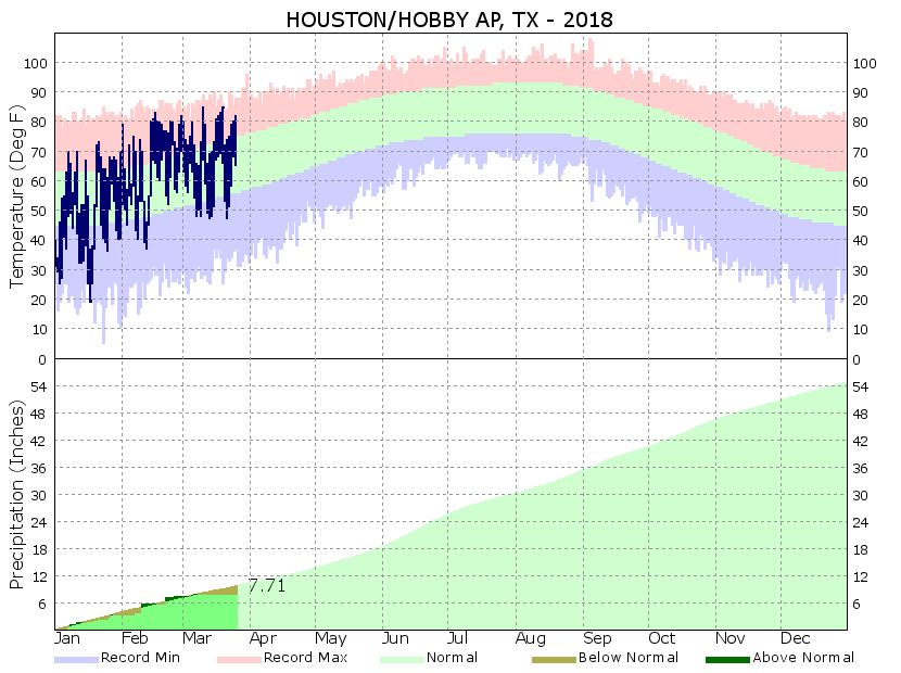
Except for a few areas of Fort Bend and Brazoria County, the greater Houston area is not under a drought—or even abnormally dry—and yet much of the area has begun to accrue a rain deficit for 2018. For example Hobby Airport, a good marker for central Houston, has received less than one-half inch of rain in March. And with extremely heavy levels of tree pollen still around, we could use a good shower (or two) to knock the pollen out of the air and wash it away. Well, that’s what is coming this week.

Monday
Monday will probably end up being similar to Sunday temperature-wise, although there will be a few more clouds, some slight rain chances, and some gusty southerly winds. Most people probably won’t see rain, but the breezes will definitely be felt as winds gust into the mid-20s. Highs in the low 80s.
Tuesday
We’ll say goodbye to the sunshine for a few days, as mostly cloudy skies return. Temperatures will remain warm and muggy before a front arrives later this week. That front, along with very high moisture levels, will drive the potential for heavy rainfall later this week, but for now I expect only scattered showers on Tuesday, with not terribly great accumulations.
Wednesday and Thursday
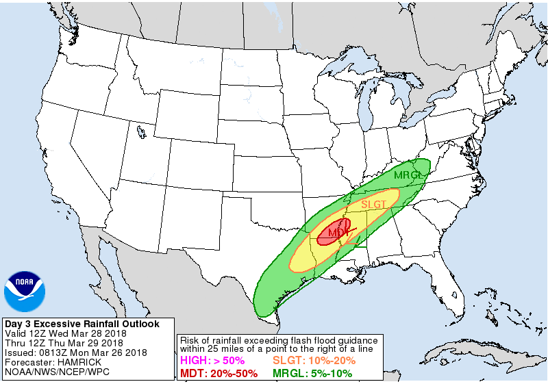
A large complex of rain showers and storms will develop later on Tuesday or early Wednesday, and move through the state (including Houston) on Wednesday. For our area, the best chance of rain showers will come on Wednesday and Wednesday night. Right now I don’t expect a major flood storm, rather, I’m hopeful that most areas will get a beneficial 1 to 3 inches of rainfall that will take a bite out of the pollen and help our lawns and trees as we move toward a warmer time of year. The front itself should move through the region some time on Thursday, ending the storms and bringing about clearing skies later in the day or during the overnight hours.

Friday, Saturday, and Easter Sunday
Friday and Saturday will see cooler, and exceptional weather. Look for mostly sunny skies, highs generally in the upper 70s, and cooler nights. Lows will fall into the mid- to upper-50s for areas well inland, while remaining in the low 60s along the coast.
Easter Sunday looks pleasant as well, although the onshore flow will kick back on sometime (probably) on Saturday. This means high temperatures will be a bit warmer, perhaps around 80 degrees, with partly to mostly sunny skies. The weather should be just fine for outdoor activities on Easter.

Eric,
Can you give your best guess on wind speed & direction on the coast Friday (from 11-3pm ish)? Specifically the Port O area if that matters.
Thanks!