Typically in Houston, early August sees high temperatures in the mid- to upper-90s with full sunshine as high pressure dominates our weather. However, this week Houston will lie on the periphery of high pressure, and this will allow us to see a healthy chance of rain showers this week along the moderately cooler weather. As ever with forecasting rainfall along the Gulf coast, there is a good deal of uncertainty in timing and amounts. But the bottom line is that for August, this week shouldn’t see suffocating heat.
Monday
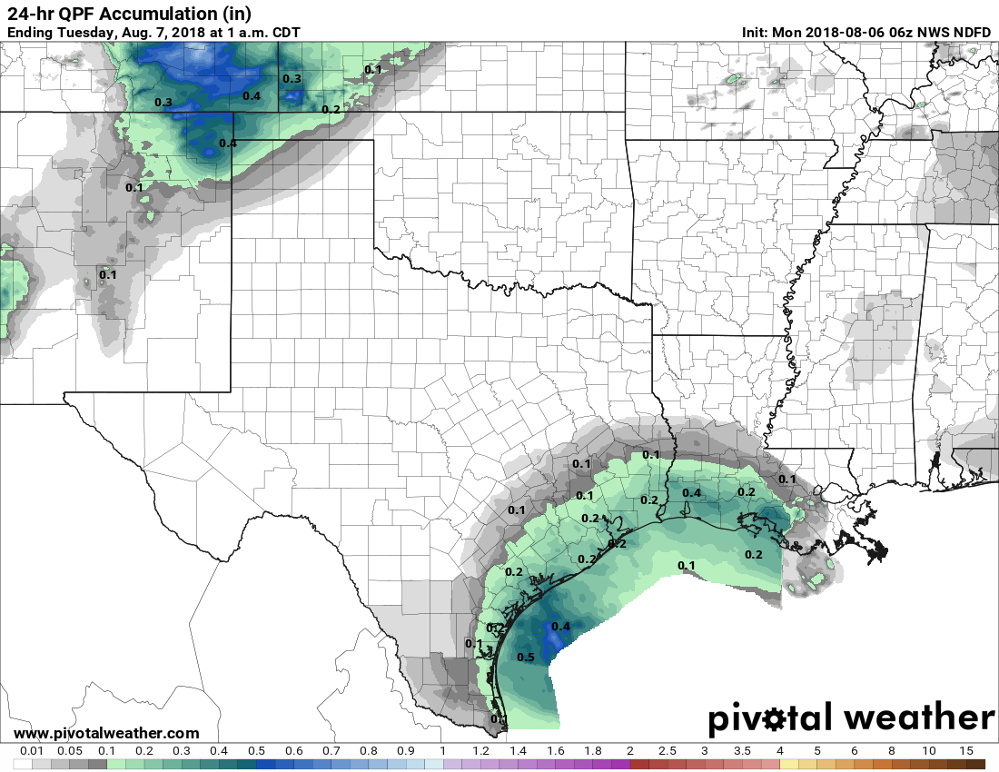
High temperatures today should range from about 90 degrees to the low 90s, depending upon cloud cover and the extent of rainfall. I think most of the area will see one or two tenths of an inch of rain today, with some areas seeing higher amounts in heavier storms. Rain chances will be highest during the afternoon and early evening hours, but I don’t expect any significant disruptions during this evening’s commute.
Tuesday
Probably more of the same as Monday, albeit with slightly less coverage and temperatures perhaps a tick or two warmer.

Wednesday and Thursday
If you’re looking for two days that may be drier and hotter this week, Wednesday and Thursday are it. I think we’ll see partly to mostly sunny skies on both days, with highs perhaps in the vicinity of 95 degrees. Rain chances won’t go away, but will scale back to 30 to 40 percent for most of the area.
Friday, Saturday, and Sunday
There is some uncertainty about the forecast for this weekend, and if you have outdoor plans, you’re going to want to watch the forecast over the next few days. A frontal boundary should reach northern Texas later this week, and produce a number of large storms. Right now, the heavy rainfall potential associated with these storms is likely to remain north of Houston—in East Texas, southwest Arkansas, and southeastern Oklahoma. However that is something we’re still going to have to watch for its potential to slide down into the greater Houston area.

Regardless, Friday, Saturday and Sunday should see a healthy chance of rainfall, on the order of 40 to 60 percent. With some clouds, we can probably expect highs to remain confined to the low 90s. We’ll try to provide a higher fidelity forecast when we get closer to the weekend, but for now the details are pretty messy.
🙂 Not going to write anything that might “jinx” us, just that I can live with this. 🙂
We plan on taking a fishing trip Friday – Sunday about 120 miles out of Galveston…thoughts? :/
Bring the rain!!!
Got none Saturday in NW Houston. It sprinkled for about 3 minutes late Saturday afternoon. I was working outside and it wasn’t enough to bring me inside. BUT the temps outside Saturday afternoon/evening were nice, 82 at my house.
Thanks, Eric. Any issues in the tropics we should be watching right now?
In the Atlantic, absolutely none.
🙂 Let’s tow some giant icebergs offshore the US Gulf Coast! 🙂
Hi, Eric! Later Saturday afternoon and evening out in Cypress was just incredible – about 83 degrees, lower humidity and a genuinely cool southerly breeze. We thought that it was October. I know that summer storms can have an odd cooling effect, but even though we got maybe 10 minutes of a wimpy drizzle, it sure transformed the rest of the day. It wasn’t a front, but it behaved a lot that way. What exactly happens in situations like that to rather significantly cool and dry out in the air without the presence of a real front?
We plan on taking a fishing trip Friday – Sunday about 120 miles out of Galveston…thoughts? :/