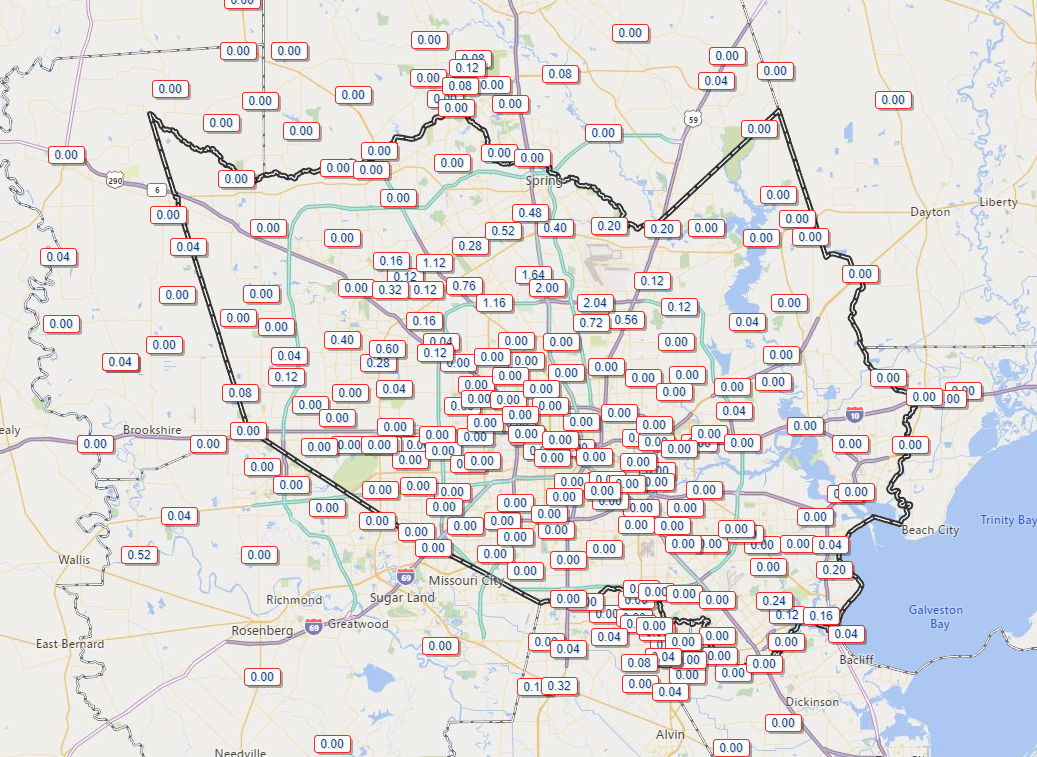
We got some sunshine yesterday after all, pushing temperatures up to and over 80° (several degrees above normal) in much of the area. And then the rains came for some of us. The area near Greenspoint hit the jackpot yesterday with about 2″ of rain.
While I don’t expect as much activity today, the chance of a downpour cannot be ruled out.
Today
Dense fog has developed, mainly from Houston south and east this morning, and advisories are posted. Give yourself a few extra minutes heading out the door this morning if you are commuting in those areas.
Half-mile or lower visibility is being reported along the coast and at least as far north as Hobby Airport and Southwest Houston. Like yesterday, fog should lift and dissipate through this morning, setting up a partly or even mostly sunny afternoon. Look for temperatures to surge back into the 80s again. As noted above, a shower or downpour is not likely but is possible today.
Fog is possible again tonight, especially from Houston south and east toward the coast.
Thursday and Friday
Rain chances look minimal both of the upcoming two days, and I would expect more of the same. Look for morning low clouds and/or fog to yield partly to mostly cloudy skies during the late morning and afternoon. High temperatures will range from the upper-70s to low-80s, slightly cooler at the coast, with morning lows generally in the 60s. Mostly light winds are expected.
Weekend
Rain chances look fairly low this coming weekend, so I would go forward with whatever you have planned. Low does not mean “zero,” however, and as of now, Sunday carries a better chance of showers than Saturday. The best chance will be from about Conroe northward on either day. It looks like a minor story right now, with no serious rain expected in our area, but nevertheless it is one we’ll keep watching for any changes.
Temperatures should be generally within a stone’s throw of 80 each day, with nighttime temperatures not far off 70 in a lot of spots.

Next week
The front we’ve been discussing that gets stranded to our north may not get a push into or through the area until late next week. So that means that Monday through Thursday may be like this week: Clouds, some sun, and maybe even some shower chances. I don’t see anything particularly intriguing in the world of weather modeling right now in terms of rainfall, but we’ll see as we get closer if anything changes. Warm temperatures up near 80 would likely continue most of the week.
This is purely speculation on my part, but if we can get a cold front around Friday, that could setup a really nice weekend next weekend. I won’t “wishcast” anything, but, one can hope!
Answering weather questions!
Yesterday, thanks to the pretty stable forecast, I began answering some Houston weather questions posed to me on Twitter. Let’s do it again today! We’re going to start with 4 questions that are all related. And I absolutely love it.
Why does it seem like all fonts break apart before it hits Galveston bay/SE Harris County? I’m in DP and all the storms seem to miss us!
— imtindomeiel (@imtindomeiel) March 7, 2020
Why does most of the rain fall east of 45 or north of the Woodlands? Or is that anecdotal?
— Richard Pravata (@pravata) March 7, 2020
Why has it seemed like this past year, rain coming our way has dissolved over NW areas (Katy/Hockley/Cypress) and reformed on the other side of the beltway?
— Devyn Price (@DevynPrice) March 10, 2020
What is it about the Houston area and upper Texas coast that we seem to have capping in the atmosphere a lot. Also, is there a website that shows where atmospheric caps are?
— Weather Lover (@everlovnweather) March 10, 2020
The first things that stands out? Everyone thinks they get the shaft when it comes to rain. I love that. It’s such a human perception issue, and I’ve felt it too at times and I have seen it happen in other places as well. The last question is related, and I explain why below.
So there are a couple ways to look at this. First off, this winter is a terrible litmus test to use since so many fronts have underachieved. So taking out recency bias here, I could see a couple reasons one might presume that storms miss parts of the area. Part of it may have to do with the chaos of how sea breezes behave in the spring, summer, and early fall, where storms develop south and east of Houston but quickly lift north. That’s when places like northwest Harris County or The Woodlands see some heavier rains. There are other days, however, when southeast parts of the area get in on all the action from the sea breeze storms too. Ultimately, it usually all balances out.
Getting to the primary reasoning though. First, here’s a look at Texas’s average annual rainfall:
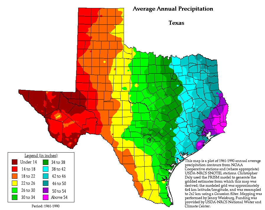
It is interesting to note that Deer Park and other parts of eastern and southeastern Harris County have some of the highest average precipitation in the area. So when you factor everything together, y’all do pretty well in that part of the region! But this does confirm the idea that I-45 is a nice general boundary to use. East of 45 is wetter than west of 45. Coastal areas also lean wetter, likely because of both sea breeze storms and the number of tropical systems skewing averages over the years.
So I think a lot of the concept that you’re being “missed,” especially this time of year, can be due to cold fronts and capping. You hear meteorologists use the phrase “capping” a lot in winter, spring, and fall when we get cold fronts. What is it? I’ll answer in a brief manner. If you want a more thorough answer here, I suggest reading my colleague Dennis Mersereau’s post on this topic from a few years back.
Locally, let me ask you a question: Ahead of a cold front, what happens? We turn warm. Onshore winds usually kick up, and we see temperatures in the 60s, 70s, and occasionally 80s during our “cool” season. That warm air flooding in off the Gulf warms up the atmosphere, especially aloft. Water temperatures over the Gulf are typically cool during that time of year, so while the air aloft is nice and warm, the air closer to the surface is modified cooler by the cool Gulf waters (that also tangentially explains sea fog). So you end up having temperatures that turn warmer as you move up higher in the atmosphere. This creates a “cap” aloft that prevents air from rising too high in the atmosphere, limiting how tall clouds can get, limiting how strong storms can get.
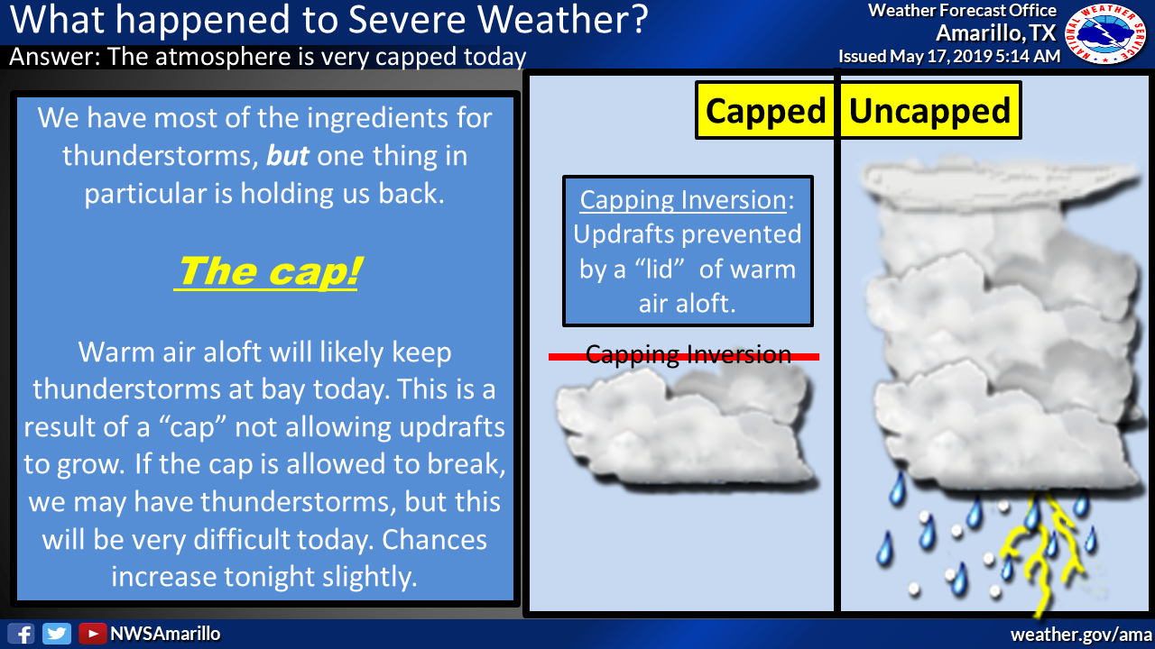
Generally, the closer you are to the Gulf, the more likely you are to be impacted by the cap. As you go north of Houston and east, you tend to lose the impacts of the cap and that explains why fronts sometimes tend to look bigger and badder up toward Tyler or Shreveport or Arkansas or east into Mississippi.
Anyway, hopefully this helps shed some light on this thinking.
I always enjoy your explanations. Thanks so much for taking the time to explain a little weather with us all. Reading this site daily, I feel like a meteorologist.
I always assume the cap was warmth from the concrete/paved city contributing more than the Gulf. Or maybe its a bit of both.
The urban heat island can help, but it’s not large scale enough to do it on this scale. What could be missing from my explanation is that sometimes warm, dry air from the Mexican Plateau will get shipped our way too. That may be more impactful than the Gulf air.