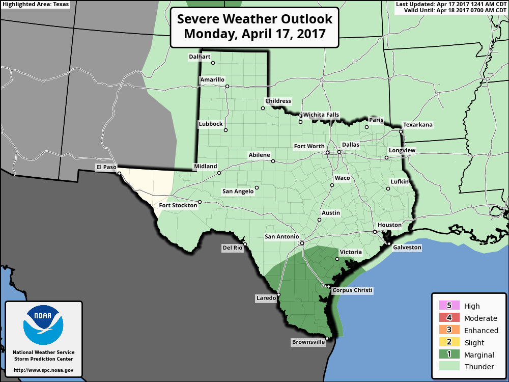
After a calm Easter weekend, some modest storm chances return to Houston this week. We’re also going to have a real cold front at the end of the week, which should be one of the last of the season, so we should look forward to that.
Today
A complex of showers and thunderstorms has developed over South Texas this morning, from Brownsville to Corpus Christi. This system should moved to the east-northeast later this morning, and may bring some scattered storms into the Houston region. I think the threat is probably highest for areas to the southwest of Houston (i.e. from El Campo to Lake Jackson), but there’s enough moisture out there that we can’t rule out some storms making it into the entire Houston area. These storms could produce some heavy rains over a few areas, while parts of Houston remain dry. Highs today will reach the low 80s.

Tuesday
Another potentially unsettled day, with low pressure hanging around the Texas coast, and atmospheric moisture. Most areas will probably only see a few tenths of an inch of rain—or less, and I’m not overly concerned about the threat of severe weather. Highs again in the low 80s.
(Space City Weather is sponsored this month by The Mole, a Jonathon Price novel.)
Wednesday through Friday
Pressures will rise to some extent, limiting if not altogether suppressing rain showers across the area. It will be warmer, with highs in the mid-80s and partly to mostly sunny.
Saturday
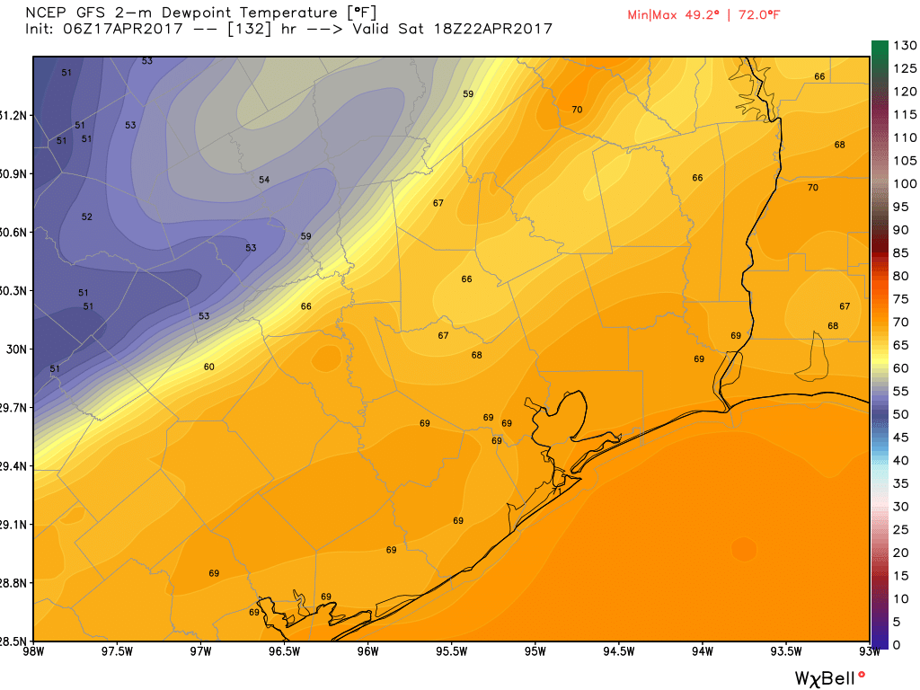
With a lot of outdoor activities planned for next Saturday, we’re closely watching the timing of a cold front that’s likely to move through sometime during the daytime or early evening hours. At this time it appears most of the activity associated with a potentially severe weather outbreak across the southern United States will remain north of Houston. For us, then, I’d expect a warm-ish morning in the 70s, with a front moving through later in the day. It’s hard to say whether this rain is most likely during the morning or afternoon hours, but in either case right now it doesn’t look like a washout.

Early next week
After the front clears the area, we should see quite cool conditions to start next week, with lows possibly falling into the upper 40s for northern parts of the Houston metro area on Monday morning, and down to around 50 degrees for most of the rest of the city. If you’re longing for one more cold snap before the inevitable onset of summer, this is probably it.
BP MS 150
Some people have asked about conditions for the weekend of April 29-30, when the MS 150 ride will take place from Houston to Austin. I’ve looked at both the GFS and European model ensembles for that weekend, and there’s just no clarity. The GFS generally shows a cold front moving through on the Friday night before the ride, with attendant showers lingering into Saturday. The European ensembles are all over the place.
Posted at 6:55am CT on Monday by Eric
Great website. Could we get more info on Saturday’s weather (I know its a little far out for firm predictions). I’m doing the Ironman race Saturday at the Woodlands and would just like to get an idea of what to expect. Thanks!
I put most of what I could comfortably say in the post. But my best guess is a warm, humid morning with some light rain possible. A front could move through during the early afternoon or evening hours. But ultimately the weather will be determined by the front, and we just don’t have a 100 percent confident answer on when that will be.