As is often the case in August, in Houston, we’re going to remain more or less under the influence of high pressure for the next several days. Who knows, maybe for most of the rest of the month.
If there’s anything positive to be taken away from this it’s that this dome of high pressure isn’t so dominant as to eliminate all possibility of rain, nor push temperatures above 100 degrees, and afternoon heat levels to dangerous levels. We’ve been able to remain just cool enough that the National Weather Service hasn’t had to issue heat advisories for the Houston metro area. At least not yet.
But these are small comforts, and it’s still August. Therefore rain is going to be hard to come by during the next week, even though some moisture will return to the area on Friday. Here’s a look at the NOAA rainfall accumulation forecast for now through next Wednesday evening.
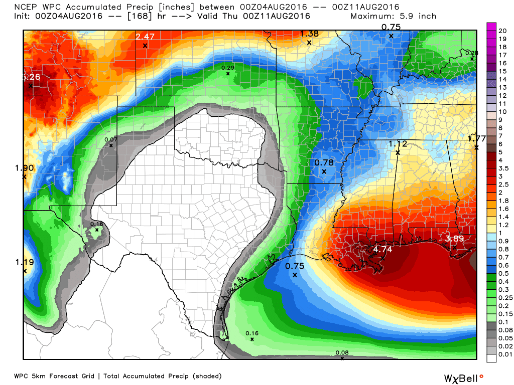
What you’ll notice about the forecast map above is that for most of Texas the only real rain chances are along the coast, and that’s probably the pattern we’re going to see, more or less, over the next week. Warm nights with lows only in the upper 70s, hot days with highs in the upper 90s, and sea breeze-driven showers during the warmest, afternoon hours, mostly along the coast.
This is pretty much textbook weather for August—a month to be survived on the way to more temperate fall weather in late September and beyond.
Posted Thursday at 6:30am CT by Eric
“Textbook August weather ”
I finished school over 30 years ago…. why bring textbooks into it?
And the high pressure keeps the tropical lows away!!
Eric, you said:
“for most of Texas the only real rain chances are along the coast.”
Does that mean Galveston, Tiki Island and places like that are more likely to get storms as opposed to say, downtown Houston?
Eric:
Just one off-topic question:
How good is the UKMET when it comes to predicting tropical cyclones and their chances for formation?
I’d rate it just below the Euro and GFS.
Dear Eric:
TROPICAL WEATHER OUTLOOK
NWS NATIONAL HURRICANE CENTER MIAMI FL
200 AM EDT FRI AUG 5 2016
For the North Atlantic…Caribbean Sea and the Gulf of Mexico:
The National Hurricane Center is issuing advisories on Tropical
Storm Earl, located over eastern Mexico.
A trough of low pressure is expected to form over the northeastern
Gulf of Mexico late in the weekend or early next week. Some
subsequent development of this system is possible as it remains
nearly stationary.
* Formation chance through 48 hours…low…near 0 percent
* Formation chance through 5 days…low…20 percent.
Just thought you’d like to know. Kinda scared we may be looking at another Alicia.