The heat rolls on for Houston, and after a 99-degree day on Tuesday we can probably expect more of the same for most of the rest of this week. We should see some better rain chances by the weekend however.
Today and Thursday
With high pressure anchored over Texas we’ll see some more scorchers, with some inland areas likely reaching 100 degrees. After some isolated showers on Tuesday morning we can probably expect the same today and Thursday. Most won’t see rain, however.
Friday through Sunday
As the high pressure backs off a bit, and moisture levels increase, I think we’ll see some better rain chances beginning later on Thursday or Friday. It looks as through the best possibilities for rain will come on Friday. Depending on how widespread the rain is, it could hold temperatures down into the mid-90s some days. However let’s be honest, it’s still going to be hot as hades out there, with precious little respite from the heat. Showers will likely be scattered at best most days.
Next week
It appears as though we’ll continue in a more or less summer like pattern, with highs in the mid- to upper-90s, and afternoon showers possible with daytime heating. All in all, any time we get at least some possibility of rain in August in Houston, it’s difficult to complain too much about things. It beats the depths of a drought or an impending hurricane.
Tropics
Speaking of hurricanes, Earl is nearing hurricane strength as a 70-mph tropical storm, and will probably hit Belize early on Thursday as a hurricane.
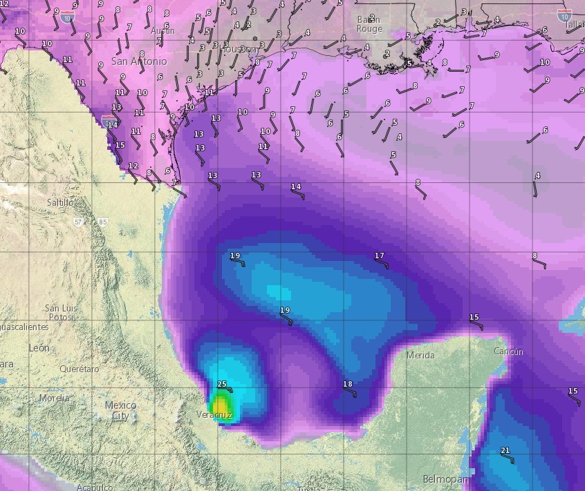
The storm is going to remain far enough south in the Gulf of Mexico such that, even if its center even reemerges into the Bay of Campeche, Texas is not really going to see any effects from this system.
These are the days that make me long for October.
Will any of these storms be strong/severe? Dangerous lightning, gusty winds, powerful lightning, and all that?
Hi, Eric:
Are you aware that the GFS and Euro continue to advertise an upper trough drifting across North Florida and into the Gulf of Mexico early next week, and even generating a surface reflection of low pressure in the Euro where the feature is stronger.
BUT:
Not even in the stronger Euro is this low enough to bust down the ridge and move into Texas. Despite that, it looks to make enough of a dent that the lowering heights would again promote more numerous diurnal convection over our area early next week.
I can’t find out any more about this. Do you know anything useful to add?
The Euro is backing off stronger development at this time. I’d not sweat things too much.