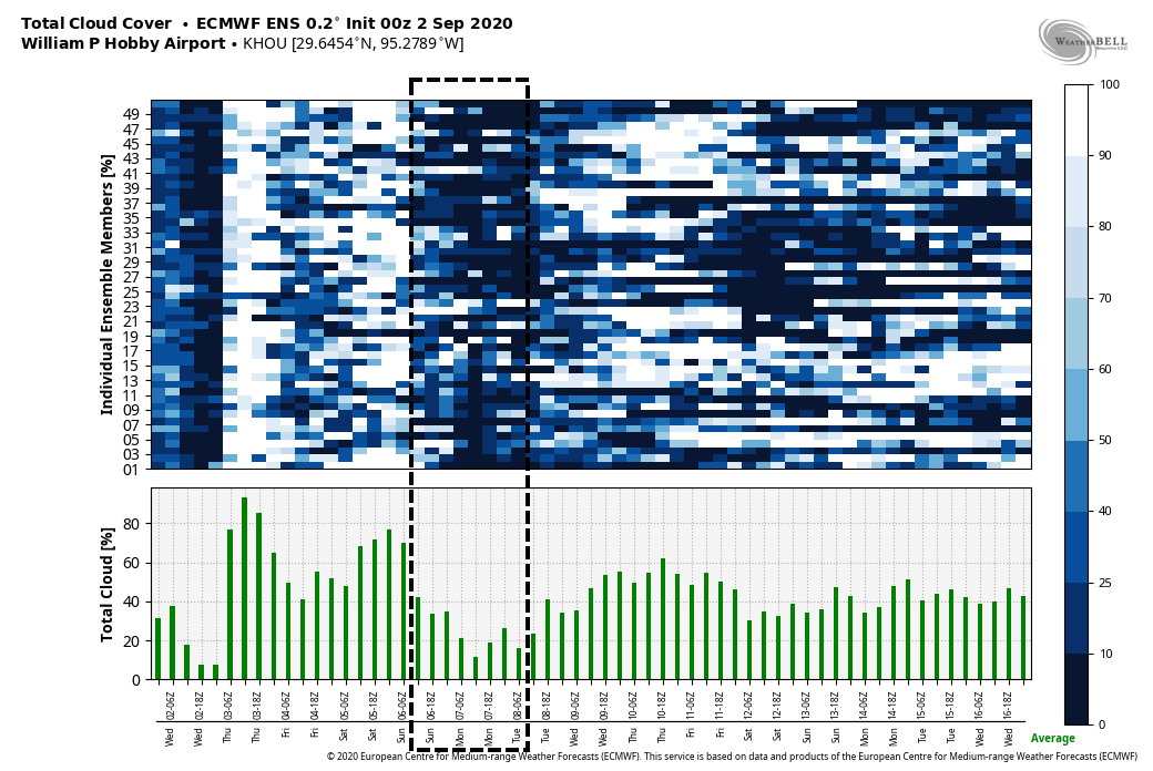
Good morning. The main story of our weather continues to be heat—Houston’s high temperatures for most of the last week have reached 99 degrees or above—but after today our hottest weather and extreme heat indices should be in the rear view mirror. We expect to see a few more clouds today, and then better rain chances starting tomorrow should help to temper our peak daytime heating just a bit.
Wednesday
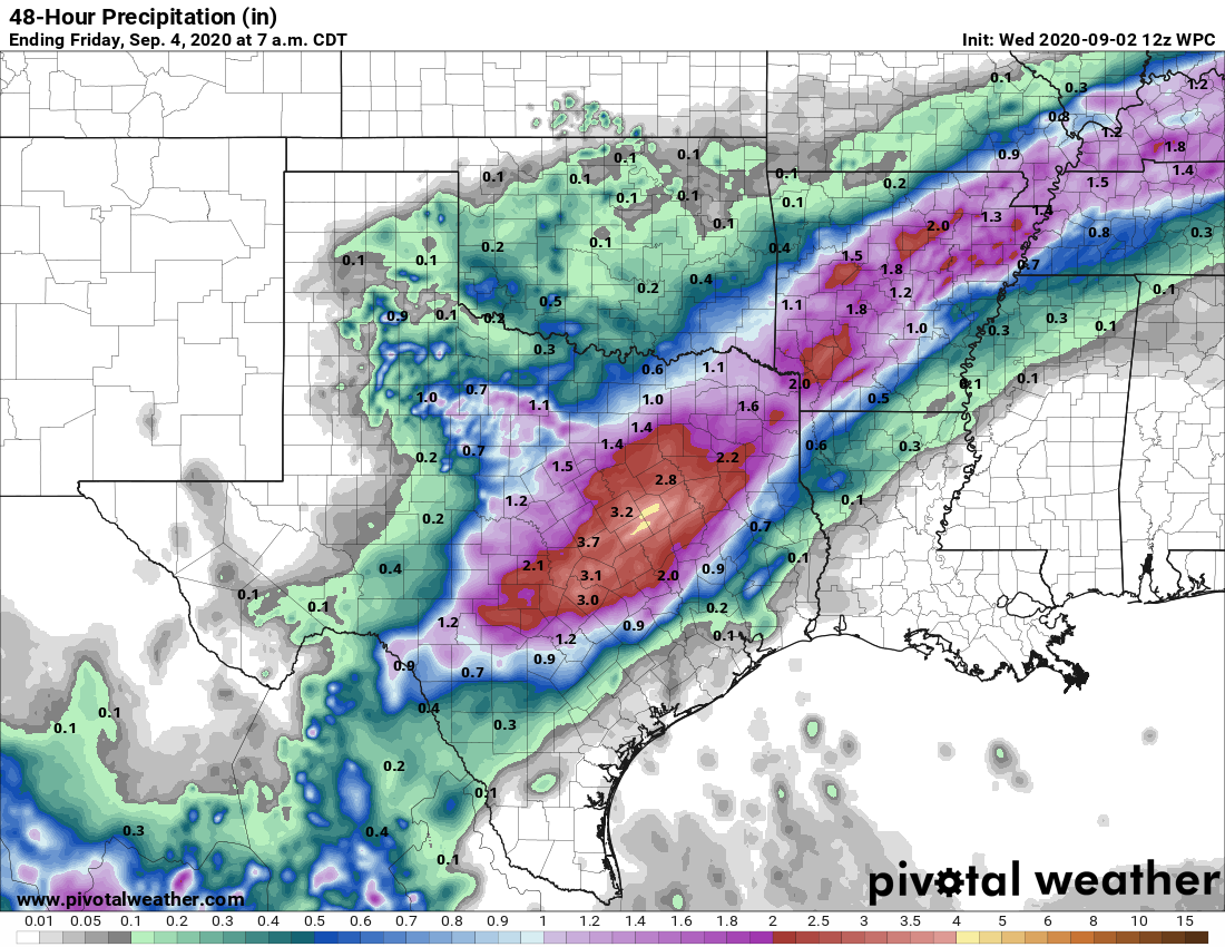
A large complex of storms that has produced several inches of rainfall over North Texas should continue to sag southward this morning. But most likely these storms will stall out to the northwest of our area—the rains will probably reach a line from Sealy to Conroe before dying out. Areas northwest and along this line may see some additional on and off rainfall through this evening. Otherwise it should be a partly to mostly sunny day for most of the metro area, with high temperatures in the mid- to upper-90s. Winds will again blow from the south, gusting perhaps to 20 mph due to a tight pressure gradient.
Thursday
As more moisture moves into the atmosphere we’re likely to see more clouds on Thursday, and this should help to moderate temperatures slightly. At least some scattered showers will be possible as highs get into the low- to mid-90s. Nighttime lows will remain sticky, in the upper 70s.
Friday
A bit more of a disturbed atmosphere on Friday, in conjunction with ample moisture in the atmosphere, should lead to more widespread showers on Friday. Accumulations will likely vary widely across the region. Highs will depend upon the extent of rainfall at your location.
Saturday, Sunday, and Labor Day
The weekend weather looks fairly standard for this time of year, with partly to mostly sunny skies and highs in the low- to mid-90s most likely. We’ll have some decent rain chances—perhaps 30 percent?–each day along the sea breeze.
Next week
We’re still watching the potential for a fairly robust cool front to arrive in Houston later on Tuesday or Wednesday of next week. If it makes it, this front will provide a nice shot of drier and cooler air, but it remains too close to call or guarantee a week out.
Laura wrap-up
As some of you may know, for my day job I write for a publication called Ars Technica. On Tuesday, we published a feature on Hurricane Laura, and the very close call on whether the region enacted a more widespread evacuation. And it was very close.

Excellent article, Eric — thanks for the link!
You, Space City, are so admired, respected, and appreciated. We have family and friends in the PAC NW, Louisiana, Mississippi, Arizona, and Florida areas who’ve followed you. You’re invaluable to them, as well as us who live in the Houston area. Thank you!
I read your Ars Technica article yesterday. Really good stuff. It mirrored my feelings as a Houstonian: utter dread Tuesday morning, decreasing anxiety by Tuesday night. It was fascinating to read about the parallel experiences of forecasters and local leaders.
Just finished the Ars Technica article – very nice writeup on the story behind the story.
So many don’t realize that even though Hurricane Rita was 15 years ago, it goes into every longtime Houstonian’s calculation of “stay or go” when a hurricane may clobber us. My parents evacuated into town from the coast and knowing some of the major arterial streets helped us get out of a clogged Beltway 8. Since everything was dry, the major arterial streets got us moving at a relatively quick 35 MPH to the Woodlands.
You saw the same calculation happen in Ike (2008) and then Harvey. For Laura, I hedged my bets: created a “go” bag, booked a hotel in Austin, and then waited for the last possible forecast seen on Space City Weather.
I always follow your reports. So much more reliable than other forecasts out there. Thanks for all you do.
Love, love, love your weather reports. Straight to the point!
The article you wrote for Ars Technica was very interesting. I will have to say that this is the first time ever that I have actually considered leaving town because of a hurricane. For Rita I already had a trip to San Francisco planned so I left but not because of the storm.
This time, I had the car packed with water and food for the dog and I. I also had a bag packed with clothes that I could grab and go. I almost left early to stay with a friend in the ‘burbs so that I was at least away from the downtown area but nervously stayed. I will have to say that I haven’t been that worried in a while.
Incidentally, the link that you posted for the storm surge evacuation zone map was a little shocking. My zip code is bordered by Zip Zone C on two sides. I have lived here for 7 years and never knew this.
Your Ars Technica article was a good read. A well written story. Send it to a friend of mine and she literally told me: “it reads like the plot of a movie.”
Lived in Houston since 1948. Lived close to Nassau Bay since 1968 – thank you for your weather reports – You guys really know weather.
I’m in Clear Lake, but high enough to have no flooding potential. Not close even in Harvey.
For me, the key for Laura was Lat 25N Long 90W. The ensemble members that hit too close to Houston and west tracked south of this point. At 4p Tuesday, Laura was 24.7N 88.3W and looked to be tracking north of 25-90.
We had done most prep, and needed 2 hours lead time to leave. I made the final call at 4a on Wednesday. I told my wife I’d wake her at 4a if we were going. She said she’d punch me in the nose. 🙂 The position was 26.1N 90.7W. We stayed.