In brief: In today’s post we look ahead to Friday’s front, and just how low temperatures may drop on Saturday night. It is not out of the realm of possibility that lows reach 50 degrees, or below, for inland parts of the Houston region.
Houston’s last sub-50 degree night?
It has been a long time since it felt chilly outside in Houston. Like, a really long time. The last morning the temperature in Houston officially fell below 50 degrees outside came all the way back on March 19, when the low at Bush Intercontinental Airport reached 49 degrees during the morning hours. So it has been nearly seven months or 208 days.
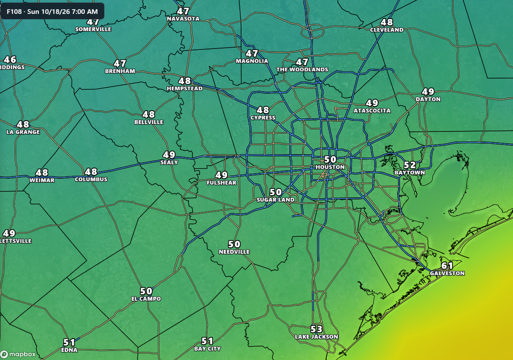
I am not guaranteeing Houston will record a sub-50 degree night this weekend. But I do think it is possible. If such a reading comes, it would do so early on Sunday morning, around or before sunrise. Some of our guidance predicts low temperatures in Houston in the mid-50s. However, I believe there is probably at least a 50 percent chance that our lows on Sunday morning reach 50 degrees, or below, for inland areas, including the majority of the region along and north of I-10.
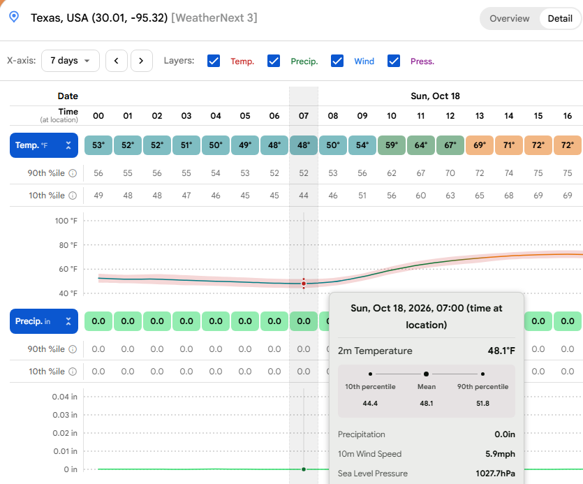
This will be a relatively short-lived front. Dewpoints by Monday or Tuesday will really start to recover, returning us to humid conditions. But for mid-October what is ahead will be a fairly potent front, and a reminder that although fall has arrived late here, winter is not too far around the corner.
Wednesday
But before we get to the front we have to contend with some stupidly high humidity for another day or so. The low temperature at Hobby Airport this morning is 78 degrees, and the dewpoint is 78 degrees. (I know this because I checked our app, which I encourage you to do as well!) It is, umm, fairly gross outside, especially for mid-October.
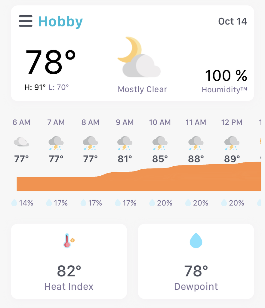
Some slight change is on the way, however. By this afternoon dewpoints should start falling a few degrees, and this will make for slightly lower humidity. We also will see a mix of clouds and sunshine this morning, with the afternoon likely turning more sunny. Highs will reach about 90 degrees in Houston, or slightly higher for inland areas. There is perhaps a 20 percent chance of rain. Lows tonight will fall into the low- to mid-70s thanks to the slightly lower dewpoints.
Thursday
Welcome to the cold front waiting room, and please take a seat. This will be another hot day, with highs in the vicinity of 90 degrees. Skies will be mostly sunny with only a slight chance of showers. Lows on Thursday night should fall into the lower 70s.
Friday
Front day, finally!
We’ll start out fairly warm and muggy, but by mid-morning winds should pick up out of the north at 15 to 20 mph. We cannot rule out some showers ahead of the front, but as of now they appear unlikely. Friday will be a windy day, with gusts out of the north up to about 30 mph in Houston, and higher gusts along the coast. This will be bringing much drier air into the region. Highs on Friday will likely peak in the lower 80s, with partly sunny skies. Overnight lows in Houston on Friday night will probably range from the mid-50s to around 60 degrees.
Saturday
We’ll continue to see somewhat gusty conditions early on Saturday, but these winds should die down during the daytime. After that we’ll be left with a lovely, sunny day with highs in the … 70s?!? Yes, I think it’s possible that highs on Saturday will not get much above the lower 70s, which would be amazing. As noted above, lows on Saturday night have the potential to fall to around 50 degrees in parts of the metro area, if not lower. We shall see.
Sunday
This should be another great, sunny day with highs in the upper 70s, probably. Lows on Sunday night probably will fall to around 60.
Next week
I don’t have a great handle on weather next week. We probably are looking at something like highs in the upper 80s, lows in the 70s, plenty of humidity and improving rain chances.
