In brief: Houston has had a mild fall so far, but that looks set to change next week as we get our first sustained experience of temperatures that feel almost winter-like in Houston. Before then, however, we are going to experience mild, pleasant conditions.
What is winter in Houston?
Temperatures vary widely during the winter months in Houston. We will often see balmy stretches of mild weather with highs of around 80 degrees, punctuated by one or two freezes during the months of December, January, and February (in recent years these have often been Arctic freezes). But when you average temperatures out across these three coldest months of the year, Houston typically sees highs in the mid-60s and lows in the mid-40s.
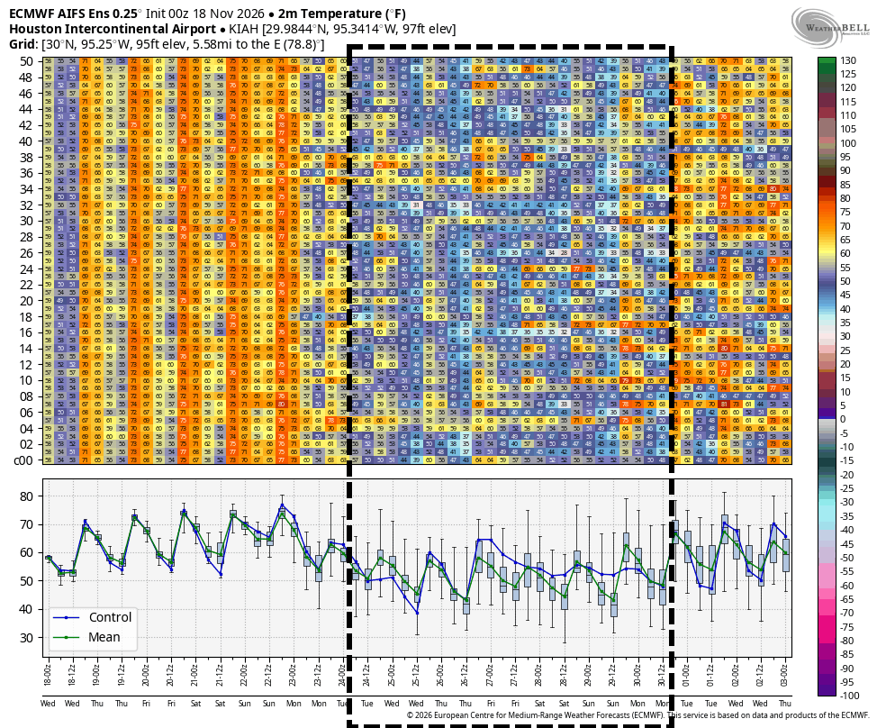
That’s likely what the region will experience next week. Although some questions remain about the details, an initial front will arrive in Houston on Sunday, and we should see the influx of increasingly cooler air for much of next week. By Tuesday, or so, we should start to see daily highs in the 60s, with nights in the 40s most likely persisting into next weekend. Based on weather alone, it will be a festive Turkey Day in Houston!
Wednesday
Temperatures are in the 50s across most of the Houston region this morning, and we should see warming into the lower 70s this afternoon with partly sunny skies. Winds will be light, from the northeast tonight, with lows likely dropping into the mid-50s in Houston, with cooler conditions further inland.
Thursday, Friday, and Saturday
A mild, pleasant pattern will continue into the weekend. Rain chances are essentially zero during this time period, and we should see plenty of sunshine. Look for highs generally in the mid-70s, with mild nights in the upper 50s. Humidity will increase a little from not very humid on Thursday to moderately humid on Saturday. Conditions continue to look fantastic for the Reliant-sponsored drone show before the Houston Texans game on Thursday evening.
Sunday
As noted above, a cold front will arrive on Sunday (or possibly Sunday night). At this point it does not look like the front will bring much in the way of precipitation, so I expect partly cloudy skies on Sunday with highs in the mid-70s. This also is unlikely to be an “in your face” front with a strong line of blustery winds that move in. Rather, I expect colder and drier air to filter in over time next week. Accordingly, lows on Sunday night may only drop into the upper 50s.
Thanksgiving week
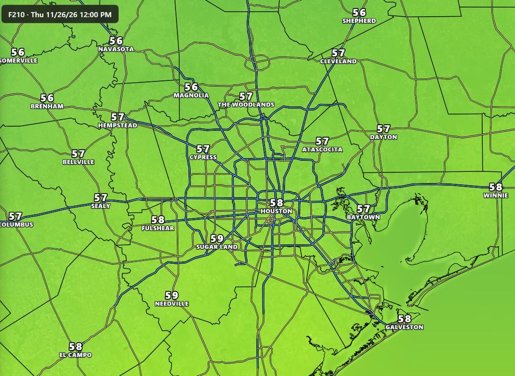
Monday may still see highs around 70 degrees, with mostly sunny skies. But after that we are going to see more clouds and better rain chances on Tuesday and Wednesday due to an upper-level disturbance. This could be the kind of thing where we see scattered showers and thunderstorms, or more widespread showers where most of the region picks up one-half inch of rain or so. We’ll have to see. Rain chances, at this point, do appear likely to back off for the Thanksgiving holiday, so I’m hopeful we might see some sunshine. As for temperatures, I’m going to ballpark highs in the mid-60s for most of next week, including Thanksgiving Day. Lows probably will be in the vicinity of 45 to 50 degrees. We may even be a bit colder. As noted above, this will be our coldest stretch of the season so far.
Fundraiser
Our fundraiser continues this week, and we genuinely appreciate all who participate. This is our 11th year of doing Space City Weather and it remains a truly homegrown product. Thank you again to all who have contributed or bought some holiday gifts for friends or family yourself.
