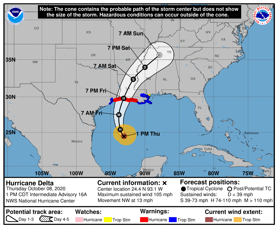
1:45pm CT Update: Good afternoon folks. We promised an update on Hurricane Delta today, but to be honest there are no significant forecast changes to report. As expected, the storm’s wind field is expanding, and its maximum sustained winds have increased slightly, to 105 mph today. Confidence in the forecast track bringing Delta to southwestern Louisiana late Friday afternoon or evening remains high—all of the 12z model guidance today supports this. The National Hurricane Center’s track is on point.

In terms of local impacts, they remain the same as we posted about this morning. We expect moderate effects in Houston: Decent rain chances, gusty winds on Friday, and seas a few feet higher along the coast. Winds get stronger east of High Island, right along the coast.
Unless there are significant changes in the forecast, our next post will come on Friday morning, by 7:30am CT.

Eric or Matt—why does it seem like most tropical cyclone landfalls happen at night? It feels like the timing works out like that waaaaaaaaaaaaaaaay more than 50% of the time. What gives?
At least if it happened in the morning, you could have Helen Reddy singing from above.
Lee….you got company (me) with that observation & question…
I love your forecasts! I truly wish you would include the Beaumont/Port Arthur area in ALL of your forecasts.
I live in the Panhandle. Should I evacuate? Follow up question: If my power goes out will it ever come back on? Thank you.
1) Yes (Run Forrest run!)
2) No
Eric…great work by you guys as usual…announcing your next post will be in the morning (unless whatever) provides “extra” comfort on our situation here in Houston…enjoy the rest of your day…
I Love you guys and rely on you for up to date tropicics updates. I have found your site to be the most reliable source and very informative.
Thanks once again for the awesome informative y’all put out there. It’s greatly appreciated 👍🏼