Good morning. Houston’s weather will generally remain on the chilly side for the next 7 to 10 days as mid-December feels a lot like mid-December in Houston. This has been a difficult year for many, for many reasons, but at least Mother Nature seems to be doing its part to help us feel like we’re entering the holiday season.
Tuesday
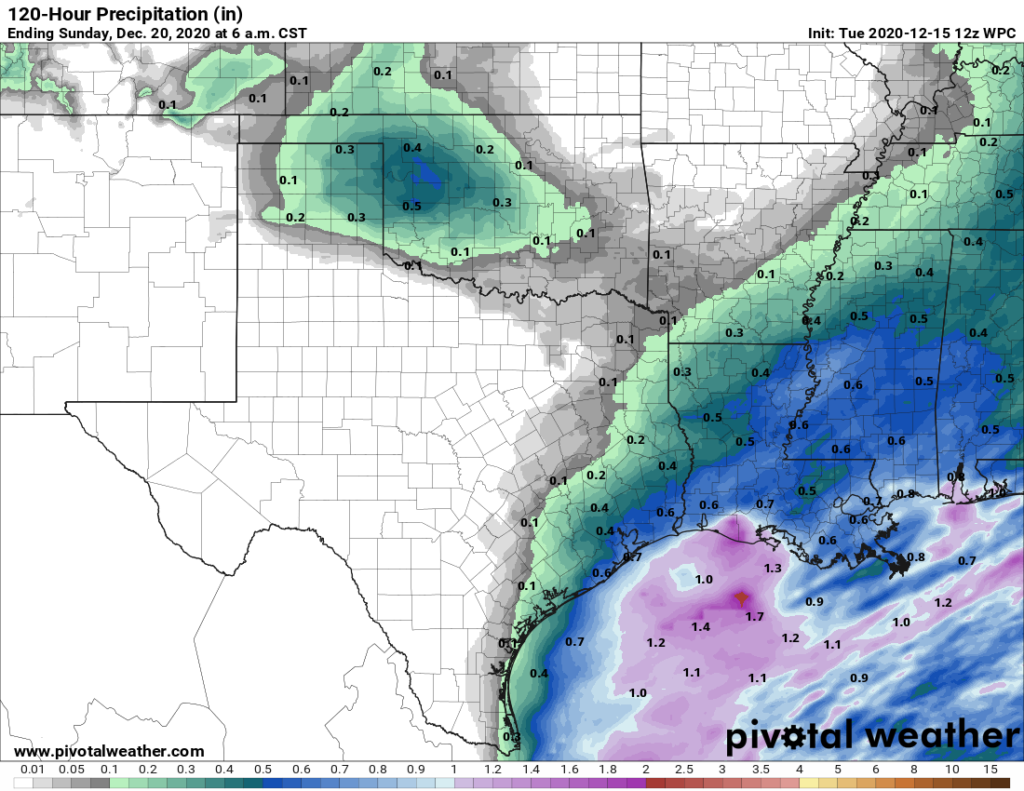
The onshore flow has resumed, with winds blowing out of the southeast at 5 to 10, and as a result we’re going to see mostly cloudy skies today. There should be enough moisture and lift this afternoon to produce widespread, but light showers. I’m expecting most areas to not see more than one- to two-tenths of an inch of rain, primarily during the afternoon hours. A cold front will reach the western parts of the metro area this evening, and likely push off the coast before sunrise on Wednesday morning.
Wednesday
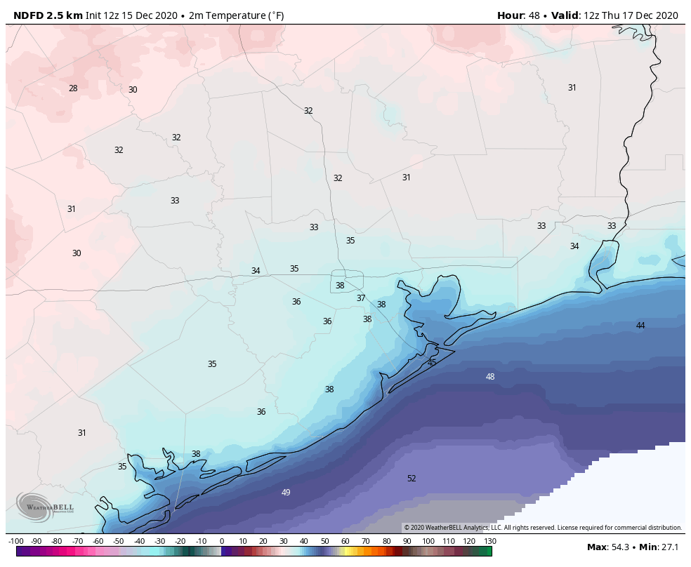
This will be a cold day, with winds from the northwest at 5 to 10 mph. Although skies should clear out during the morning hours to bring us some sunshine, much of the area may not get above 50 degrees. Clear skies and cold air will set the stage for a night that will likely bring a freeze for much of the area outside of the city’s urban core, and away from the coast. Lows in Houston itself will probably drop into the mid-30s.

Thursday
Another sunny, slightly warmer day as winds become calm. Highs may get into the upper 50s, and lows Thursday night will probably be 5 to 10 degrees warmer than Wednesday night.
Friday and Saturday
Some clouds begin to return by Friday along with the onshore flow. Because this more moist, southerly flow will have a better chance to get established it will lead to warmer days and, eventually, a better chance of rain. Highs both Friday and Saturday will likely get into the mid- to upper-60s. Rain chances will increase Friday night and into Saturday as a front approaches Houston. I’m still not overly confident in accumulations this weekend, but I’d guess for now that much of the area will see around one-half inch. The next front should push through Saturday afternoon or evening, with clearing afterward.
Sunday
The second half of the weekend looks like a winner for outdoor activity, with light northerly winds, sunny skies, and highs likely in the 60s.

Next week
We’re still watching the forecast for Christmas Day closely—it’s now just 10 days away! The European model pretty clearly shows a warming trend on Tuesday and Wednesday of next week, and then brings a fairly stout front through on Christmas Eve. This would set the stage for what would probably be a cold and clear Christmas Day. The GFS model seems to be coming around to this scenario as well, but it’s not as set upon it. Bottom line: We are probably looking at seasonal, cold weather for Christmas, but the forecast is far enough out that overall confidence remains low.

Enough rain for the love of God!!!
Not where I am! We could still use more.
Cool/cold and dry is a good Christmas season blend.
And, we can enjoy Houston’s 10-month rainy season later.
Certainly warmer weather is better because you have to keep your Christmas gathering outdoors. When it gets chilly (Houston is what I refer to as chilly, not cold), nobody is out. When it is 97 degrees, everyone is out, even though they cry about the heat and wish for the cold.
This winter sucks!!! The lame west coast rediculous resilient ridge is back and Houston is on the cold backside of it. That means it’s going to be cold as hell this winter. I’m sick of it!!! The forecast is depressing as hell, Christmas will probably be a miserable 50 degrees for the high. I didn’t move here for this weather!!
The rain has been nice tho and at least the days it has rained have been warm.
GIVE ME BACK MY WARM HUMID WEATHER!!!! Maybe not August but at least what we had in October.
In summer, we remark that it is colder than hell. This time of year (and per Tiffy’s note) it is colder than hell.
Conclusion: Hell must be a pretty nice place.