In the wake of an at-times stormy Sunday, and a gusty Sunday night following the passage of a cold front, Houston will experience a winter-like week with days mostly in the 50s and cold nights. Some areas will likely even see a freeze on Wednesday night. Also, we’re now only 11 days away from Christmas Day, so we can also take our first real look at the holiday forecast.
Monday
Some blustery winds remain this morning, but they should generally subside as high pressure moves off to the east. High temperatures today will depend upon the extent to which clouds break down this afternoon. Some areas may reach the low 50s but other parts of the metro area will remain in the 40s. Winds shift to come from the east later today, and nighttime temperatures should drop to around 40 in Houston—cooler inland, and warmer along the coast.
Tuesday
We’ll see more clouds on Tuesday as yet another cold front crosses the area. There will be limited moisture for the front to work with, but it may generate some light showers across the area—I would not expect more than one or two-tenths of an inch of rainfall. Any lingering showers should end by or before sunset on Tuesday, with another chilly night dropping down to around 40 degrees.
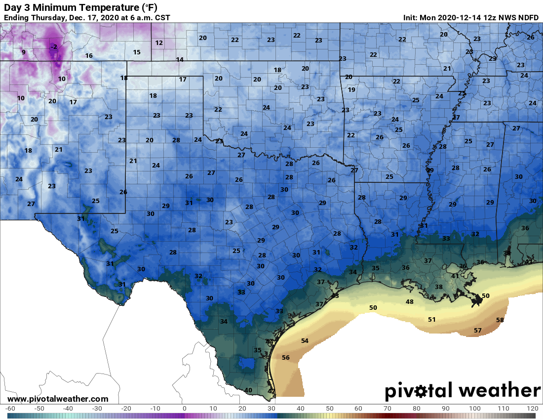
Wednesday and Thursday
The middle of the week will be cool and sunny in the wake of the front. We can expect highs in the 50s to go along with moderate north or northwest winds. Wednesday night will be the coldest of the week, most likely, with a light freeze possible for outlying areas.
Friday, Saturday, and Sunday
Heading into the weekend we should see some clouds mixing into the sky, as temperatures warm a little bit—perhaps into the low 60s? We may see some showers on Friday or Saturday ahead of the region’s next front. At this point they neither look all that strong or severe, but out confidence in this is far from absolute. The next front then pushes through either on Saturday or Saturday night, which likely would yield a cool and clear day on Sunday.
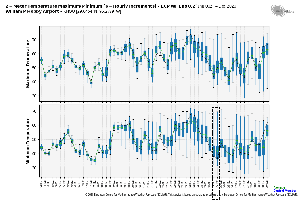
Christmas week
It’s hard to believe, but December 25th falls on the Friday of next week. So what kind of weather can we anticipate for Christmas Eve and Christmas Day? The models generally agree that next week will probably be at least a little warmer than this week with its highs in the 50s. The long range models suggest another fairly strong front will push through during the Christmas Eve time frame, just in time for the holiday. I would at this point label this as a strong “maybe,” and if the front does arrive it would make for a fairly cold Christmas. I’d even go so far as to say there’s maybe a 5 percent—that’s a 1-in-20 chance, friends—of some kind of wintry precipitation around that timeframe. But most likely it will just be rain of some sort, with the time and amount to be determined.
Brace for local a TV weather personalities overselling snow on Christmas day. Thanks, as always for your no nonsense forecasting Eric and Matt!
Brrrr!
There were reports on NextDoor of some rotation and potentially, a small tornado in the Seabrook/El Lago/Boondoggles area as the front came in yesterday. Have y’all heard anything about that?
I know there was a large tree blown down blocking 3 lanes of Nasa Road 1 near Boondoggles yesterday. No other damage that I know of.
I have one of the larger Christmas light displays in our neighborhood, and despite everything being fairly well secured, that wind yesterday showed all kinds of disrespect!!!
the winds yesterday were quite strong. I hope that it will warm up a bit…the general forecast for this fall and winter is above average temperature and below average precipitation for most of the US, so let’s hope that starts coming true.