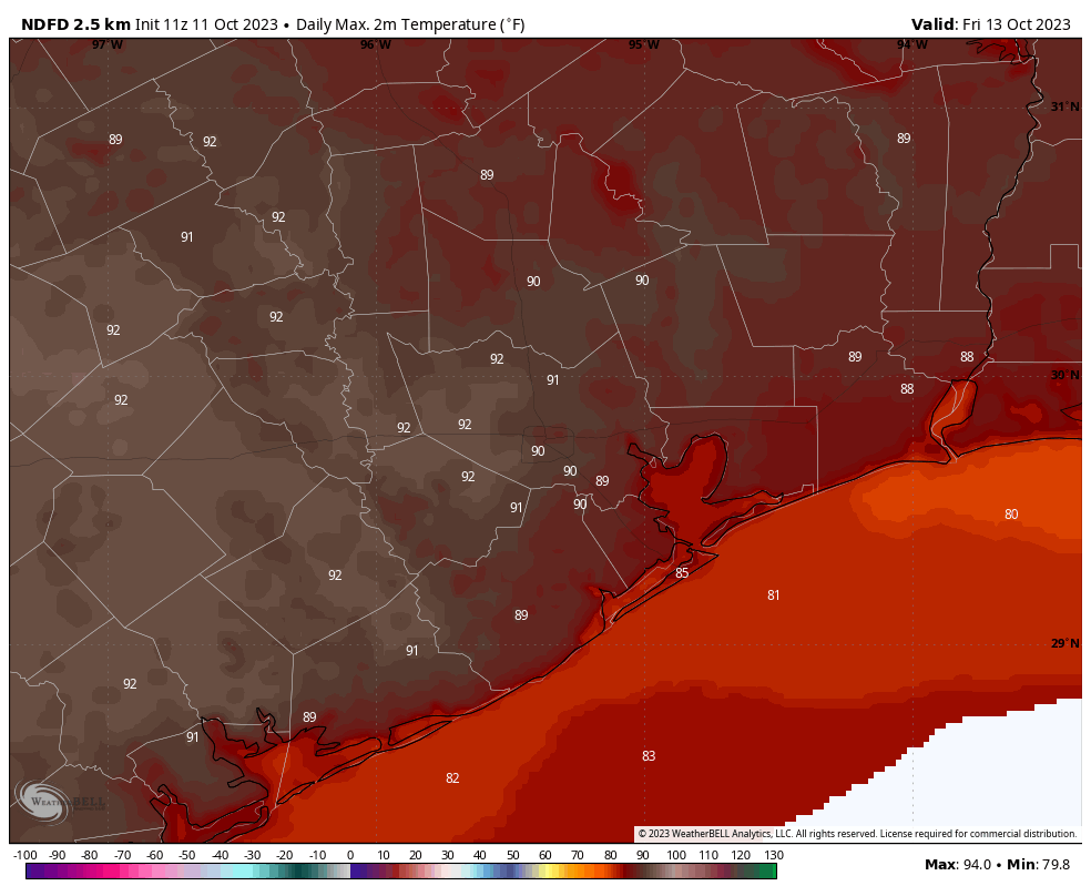
Good morning. Generally light rain is moving through the Houston region this morning in association with a low pressure system, and this should continue on-and-off through the morning hours. There are no flooding concerns. We’re still expecting temperatures to spike to around 90 degrees on Friday before a cool front cools us down for the weekend, bringing some wonderful fall-like weather into the area for awhile.
Wednesday
Skies will remain mostly cloudy today, even after the rainfall departs. This should help to limit high temperatures to the upper-70s for most locations. As mentioned above, the rain chances should end by around noon for most areas, with light easterly winds. A slightly drier air mass will move in behind the showers and this should allow temperatures to drop into the low 60s tonight.
Thursday
With partly to mostly sunny skies, we can expect high temperatures to reach the mid-80s on Thursday. Winds will be light, out of the southwest at 5 to 10 mph. Lows will only drop to around 70 degrees on Thursday night, however—so a bit sticky out.
Friday
Atmospheric conditions on Friday will favor a fairly pronounced flow of warmer air from the south, and this in concert with sunny skies should allow high temperatures to reach 90 degrees. This return to summer-like weather will be brief, however, after the passage of a front later on Friday. Rain chances are near zero with the front. Areas such as The Woodlands should start to see drier air arrive before midnight on Friday, with coastal areas seeing an influx of northerly winds and drier air by or before sunrise on Saturday. This should actually feel like a front in terms of wind and drier air arriving all at once.
Saturday
When you wake up on Saturday, temperatures for most of the area will be in the low- to mid-60s, with northerly winds at 10 to 15 mph, and higher gusts. Expect mostly sunny to sunny skies for the annular eclipse, which will occur shortly before noon. Highs will reach about 80 degrees during the afternoon hours. Lows on Saturday night will drop into the upper 50s.
Sunday
A banger of a day, with sunny skies, generally light northerly winds, and highs in the upper 70s. Expect another cool-ish night, with lows in the upper-50s for most of the metro area.
Next week
A nice northwesterly flow will establish itself for the early part of next week, allowing the cooler and drier weather to prevail through Tuesday or even Wednesday. We’re talking highs in the 70s and lows in the 50s. The second half of next week could see the return of some rain showers and highs in the low 80s. We shall see.


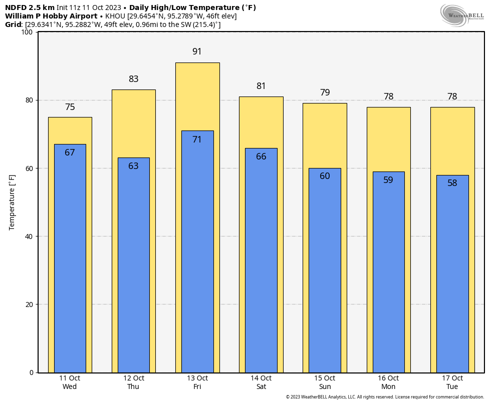
1 more 90 degree day the entire year than 2011 at Hobby Airport with this Friday reaching it, at least they’re ending right on schedule.
“October is the month of painted leaves. Their rich glow now flashes round the world.”
— Henry David Thoreau
Through the first 10 days of the “month of painted leaves” Houston (IAH) is actually .8 degrees below normal. That is a refreshing change after the summer from hell…
Glad this rain moved in deeper inland than previously forecasted. We need the rain even if its light. Go ‘stros!
Time for 🎃 🍞 & 🎃 🥞s…
🌬🍂🍂👻🍂🍂
A different pattern for sure. All the rain we’ve seen is coming from the Gulf. The two cold fronts – 2nd one on the way – being dry as a sun baked raisin.