As of 6:15am, a few showers are lingering near The Woodlands and College Station, but for the most part this system should be moving to the northeast, away from the Houston area. Some scattered showers are possible today, but for the most part this should be it for the rain through the weekend.
Wednesday
Today will be sort of a waiting game, as the showers clear the area, but a related cold front lags about 24 hours behind. Highs should get into the mid- to upper-60s this afternoon, and skies could become partly to even mostly sunny later. Lows for much of the night probably will stay in the mid-50s until the front arrives before sunrise on Thursday.
Thursday
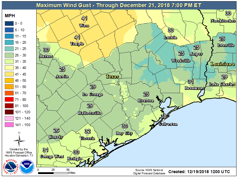
The front will blow in with purpose—its passage will likely be dry—and we’ll pretty quickly notice the cooler air and blustery conditions. Despite sunny skies, highs on Thursday may not reach 60 degrees, and it will be quite chilly with winds gusting above 20 to 25mph. Pack a windbreaker on your way out the door. Thursday night will probably be the coldest of the week, with lows in the mid-40s in the city, colder up north, and warmer along the coast.

Friday
Another sunny day, with highs likely around 60 degrees. The absence of a bracing northerly wind will make it feel nicer, however. Overnight lows may be a degree or two warmer than Thursday night, so still chilly.
Saturday
This should be a fine weekend day, with mostly sunny skies, and a high temperature of around 70 degrees.
Sunday and Monday
The forecast for the second half of the weekend is muddied by the timing of a weak cold front that may push all the way through Houston, or may stall along the coast. Regardless, it should be dry, as there won’t be much atmospheric moisture to work with. Depending on where you live, highs probably will range from about 60 degrees to 70 degrees these days, with the cooler highs found inland. In any case, the front won’t have much sticking power.

Christmas Day
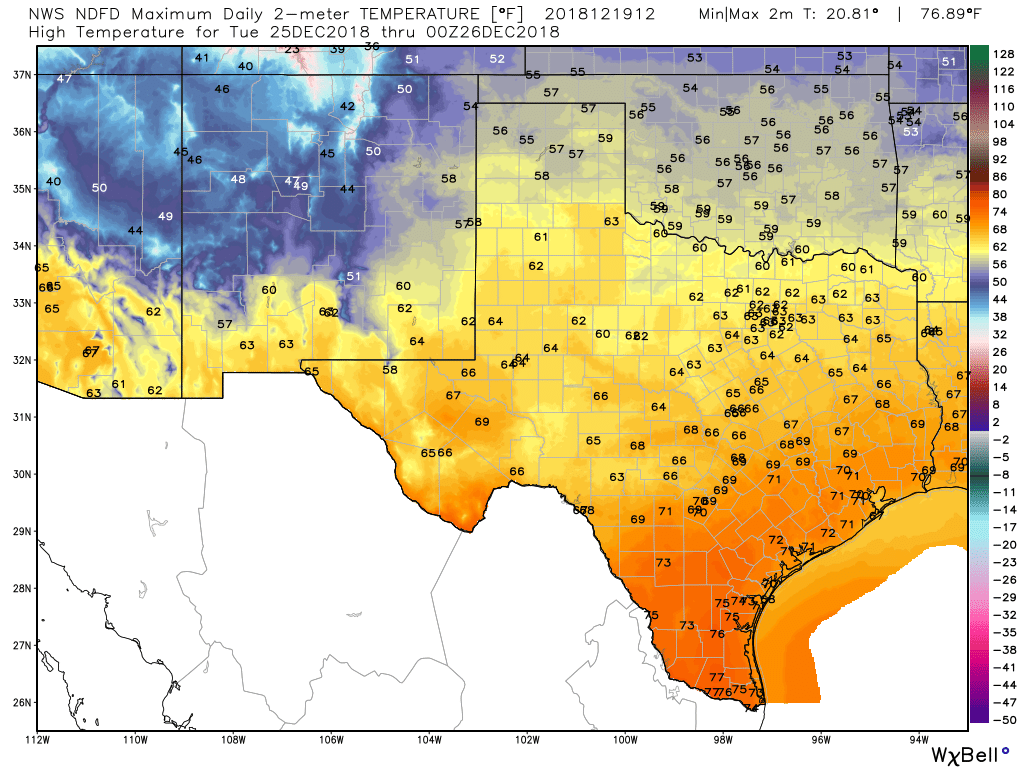
The forecast for Christmas Day looks a bit warmer than normal (the average high for Dec. 25th is 63 degrees). Right now the most likely temperature range is from the upper-60s to lower-70s. It should be a partly to mostly cloudy affair, with a chance of light rain (confidence is low in overall rain chances).
The next real front, for a “cold weather” feel, is unlikely to come before next Thursday or Friday. This is not ideal, I realize, and I’m stuffing Matt’s stocking with coal even as I write this.

This is the 10th year in a row I’ve received coal in my stocking. I need to do something about this.
Matt, with all the good work you do, you need a special gift in that stocking!
I realize you don’t have a crystal ball, but is a freeze likely in galleria area between December 22 and 30th? Wondering what to do with my delicate plants as I leave town.
Matt…take down your stocking…
Don’t worry, it’s so full of coal that it’s crashed down to the floor.
70s on Christmas? Ugh. But better than 84 and humid like a few years ago.
And of course the cool down comes when I am gone visiting family for New Year’s……
I’ll take it, better than rain and thunderstorms on the holiday… Merry Christmas you guys! Thank you again for all you do!!!!!
Ah, but the warmer temp allows for our Christmas dinner to be al fresco! When you are hosting 14 adults and 8 grandchildren in a 900 sq ft. home, 70 degrees is a blessing! Matt, you did just fine! 😉
I love warm Texas Christmases! Shopping in 70 degree weather just brings a smile to my face. I moved to Houston 15 years ago from Cleveland Ohio where it snows a lot. I don’t miss the snow—and warm weather in December makes me as happy now as it did when I first moved here. Thanks for all of your hard work and being the best weather service on the planet!!!
A nice winter white dusting on Christmas morning and 65 by 2pm on Christmas day is the ideal situation. And I’m thinking that is about a .02% chance of ever happening….
Do you have any insight on the possible polar vortex and maybe what impact it could possibly have on us? Any feedback would be much appreciated