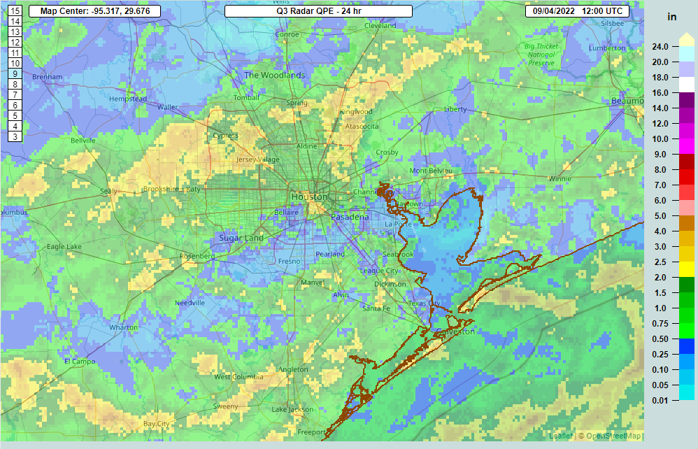
Good Sunday morning. About 60 to 70 percent of the area got a good dose of rainfall yesterday. Some places saw nearly 4 inches of rain on Saturday across Harris County.

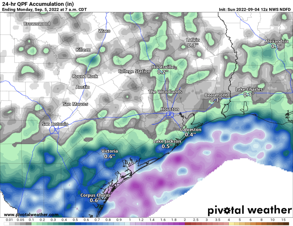
Back on Friday we mentioned that Sunday’s forecast was a little trickier in that the greater concentration of rain could end up farther south of Houston. Indeed, that’s what will end up happening today. We expect the heaviest rain to be offshore much of today, perhaps building back along the coast some as the day progresses. So, draw a line from Galveston to Angleton to Bay City, and points south of that line have the highest odds of meaningful rain today.

Inland areas won’t be 100 percent dry, but shower coverage may be less than it has been for a few days. Look for highs in the low to mid-80s south and mid to upper-80s north, perhaps near 90 degrees.
Labor Day
A similar pattern is expected for Monday, with the heaviest rain offshore or well south of Houston. Look for a bit more sun, a slight chance of showers, and highs in the mid to upper 80s on average.
The rest of next week looks fairly benign now, with only isolated to scattered rain chances each day.
Tropics
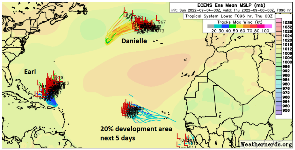
Just a quick update on the tropics today. We have Hurricane Danielle to the north and Tropical Storm Earl to the south in the open Atlantic. Neither are a threat to the Gulf or to land.

An area in the eastern Atlantic has about a 20 percent chance of developing over the next 5 days. That is also not a Gulf concern. We see nothing over the next 7 to 10 days that looks to be of concern for the Gulf. Good news!
Eric should be back posting on Tuesday, unless something changes between now and then. Otherwise, enjoy the rest of the holiday weekend!


Your website is really good
I hope that it dries out some this weekend, I need to get outside.
Finally a really good soaking downpour hit in Sweeny. My rain gauge picked up 3.4 inches. I haven’t seen heavy rain and water standing in my yard like this in almost a year.
Glad it’s being spread around!