As Eric mentioned yesterday, for some in the Houston area, rain has been missing for a good while. And it looks like the next couple days will extend that streak. By Sunday and next week, however, a few subtle changes will at least allow us to at least mention showers again. But it is unlikely that all of us will see rain.
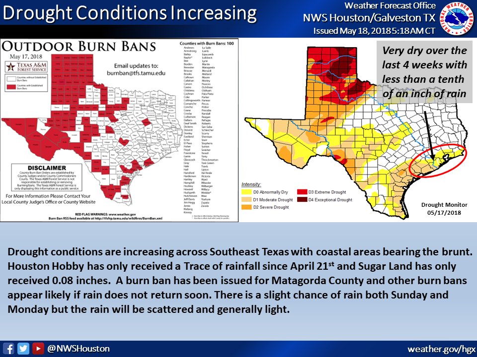
A quick side note here: I’ve seen some people mention how this is reminding them of 2011 again. We technically aren’t in drought yet. And at this point in 2011, the drought in Southeast Texas was orders of magnitude worse than it is now. So we have a long, long way to go before we’re at that level. Be aware that we have dry conditions, be smart and conscious about burn bans around Texas, and give some thought about conserving water where you can. But, no, this is not a 2011 redux as of mid-May 2018. We need some rain though.
Let’s get into the forecast details.
Today & Saturday
I don’t foresee much change in the overall weather pattern the next two days. Both today and tomorrow should be mainly sunny and hot. After hitting 96° yesterday, expect mid 90s this afternoon and lower 90s on Saturday afternoon. Nighttime lows tonight will drop into the lower 70s. Humidity should increase a little bit above where it has been for the last few days.
Sunday through Tuesday
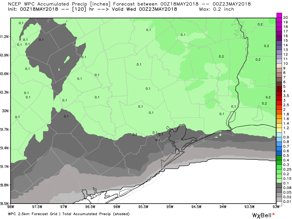
As onshore flow returns, moisture will come ashore also. Precipitable water (a good measure of how much moisture is available for thunderstorms) is around an inch right now, a little bit below average for this time of year. By Sunday that rises to around 1.5 inches, or around normal. We might be able to stretch it a little bit higher Monday and Tuesday, but for all intents and purposes, we’re just getting back to average here. That should mean that with daytime heating we will see at least a few hit or miss downpours develop each afternoon, especially Monday and Tuesday. But widespread soaking rain seems highly unlikely.
I don’t think everyone will see rain early next week. Hopefully most of us see a little something here, but I’m not overly optimistic.
All three days will see high temperatures around 90 degrees, give or take a couple degrees. Our evenings will be sultry, with lows in the mid 70s, but perhaps close to 80 degrees in Galveston.

Wednesday through Friday + Tropics
There’s a bit of uncertainty around the forecast for mid to late next week, but it pertains mainly to some finer details that we can’t pin down this far in advance. I think we’re looking at a mix of sun and clouds, some typical early summer-type heat (near 90, give or take) and about a 20% or less chance of rain each afternoon.
Some of this depends on what becomes of a potential tropical system in the eastern Gulf. Reiterating what Eric said yesterday, this system is *not* of concern to Texas, but it could have an indirect impact on how the weather plays out over the western Gulf next week, perhaps helping to make it a little hotter and drier once again. Or perhaps it could end up disorganized and far enough east that we just continue a typical early summer hot, humid, 20% or less chance of showers type of pattern.
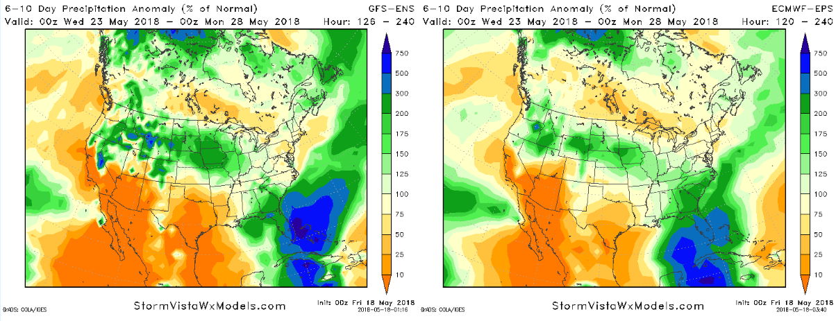
From the two maps above, which you can click to enlarge, you can see 6-10 day forecast rainfall as a percent of what is normal for that period. Both the GFS ensemble mean (left) and European ensemble mean (right) show Florida receiving about 300% of normal rainfall for the period between Tuesday night and Sunday afternoon. Texas, meanwhile is showing 50% or less of average. This means there is good weather model agreement on mostly wet weather in Florida and mostly dry weather in Texas. So whatever becomes of that system, it’s likely our drier than usual weather continues here in Houston.
We’ll have more on this Monday, but the key takeaway is that you don’t need to worry about direct impacts here.
As a closing note: Thanks to Eric for covering me the last few Fridays, as I have been visiting family, speaking at a weather conference, and busy with some work travel. It’s great to be back in the driver’s seat once again!